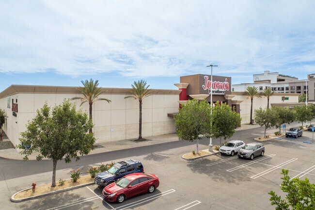
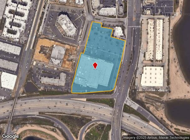
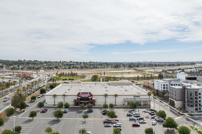
Property Record
1011 N Tustin Ave, Anaheim, CA 92807
Current Lease Availabilities
NEARBY LISTINGS FOR SALE OR LEASE
Property Detail
1011 N Tustin Ave
Anaheim-Santa Ana-Irvine, CA
Parcel Map 99-129
345-181-24
P BK 316 PG 7 PAR 2
Industrialgeneral
Orange
X
California
06059C0152J
2
2024
6.30 AC
2025
North/East Anaheim
011714
Orange County (California)
DEMOGRAPHICS near 1011 N Tustin Ave
1 Mile
3 Mile
5 Mile
2024 Total Population
7,105
142,180
419,464
2029 Population
6,973
140,246
413,711
Pop Growth 2024-2029
(1.86%)
(1.36%)
(1.37%)
Average Age
39
40
39
2024 Total Households
2,207
45,602
135,052
HH Growth 2024-2029
(1.99%)
(1.49%)
(1.47%)
Median Household Inc
$112,642
$107,400
$102,769
Avg Household Size
3.10
3.00
2.90
2024 Avg HH Vehicles
2.00
2.00
2.00
Median Home Value
$760,526
$790,749
$807,788
Median Year Built
1968
1973
1973
Nearby Places
- Restaurants
- Banks
- Shops
- Fitness
- Groceries
PUBLIC TRANSPORTATION
COMMUTER RAIL
Anaheim Canyon (Inland Empire-Orange County Line - Southern California Regional Rail Authority (Metrolink))
DRIVE
WALK
Distance
Anaheim Canyon (Inland Empire-Orange County Line - Southern California Regional Rail Authority (Metrolink))
1 min
6 min
0.2 mi
Anaheim (Orange County Line - Southern California Regional Rail Authority (Metrolink))
DRIVE
WALK
Distance
Anaheim (Orange County Line - Southern California Regional Rail Authority (Metrolink))
13 min
6.5 mi
AIRPORT
John Wayne/Orange County
DRIVE
WALK
Distance
John Wayne/Orange County
17 min
14.1 mi
Long Beach (Daugherty Field)
DRIVE
WALK
Distance
Long Beach (Daugherty Field)
29 min
26.4 mi
Ontario International
DRIVE
WALK
Distance
Ontario International
35 min
30.7 mi
Freight Ports
Port of Long Beach
DRIVE
WALK
Distance
Port of Long Beach
1 min
20.8 mi
Nearby Properties
Address
Land Use
TOTAL SIZE
Lot Size
Zoning
Address
Land Use
TOTAL SIZE
Lot Size
Zoning
26.08 AC
Address
Land Use
TOTAL SIZE
Lot Size
Zoning
Address
Land Use
TOTAL SIZE
Lot Size
Zoning
352,352 SF
12.98 AC
Address
Land Use
TOTAL SIZE
Lot Size
Zoning
10.12 AC
Address
Land Use
TOTAL SIZE
Lot Size
Zoning
Address
Land Use
TOTAL SIZE
Lot Size
Zoning
2.25 AC
Address
Land Use
TOTAL SIZE
Lot Size
Zoning
5.13 AC
Address
Land Use
TOTAL SIZE
Lot Size
Zoning
198,208 SF
11.62 AC
Address
Land Use
TOTAL SIZE
Lot Size
Zoning
1,404 SF
10.63 AC
Address
Land Use
TOTAL SIZE
Lot Size
Zoning
12.72 AC
Address
Land Use
TOTAL SIZE
Lot Size
Zoning
10.43 AC
Address
Land Use
TOTAL SIZE
Lot Size
Zoning
5.08 AC
Address
Land Use
TOTAL SIZE
Lot Size
Zoning
13.27 AC
Address
Land Use
TOTAL SIZE
Lot Size
Zoning
4,000 SF
4.11 AC
Address
Land Use
TOTAL SIZE
Lot Size
Zoning
19.38 AC
Address
Land Use
TOTAL SIZE
Lot Size
Zoning
232,305 SF
10.78 AC
Address
Land Use
TOTAL SIZE
Lot Size
Zoning
208,000 SF
17.03 AC
Address
Land Use
TOTAL SIZE
Lot Size
Zoning
17.84 AC
Address
Land Use
TOTAL SIZE
Lot Size
Zoning
40,000 SF
7.29 AC
Address
Land Use
TOTAL SIZE
Lot Size
Zoning
840 SF
24.22 AC
Address
Land Use
TOTAL SIZE
Lot Size
Zoning
0.66 AC
Address
Land Use
TOTAL SIZE
Lot Size
Zoning
6.47 AC
Address
Land Use
TOTAL SIZE
Lot Size
Zoning
12.20 AC
Address
Land Use
TOTAL SIZE
Lot Size
Zoning
9.84 AC
Address
Land Use
TOTAL SIZE
Lot Size
Zoning
Address
Land Use
TOTAL SIZE
Lot Size
Zoning
1.38 AC
Address
Land Use
TOTAL SIZE
Lot Size
Zoning
17.99 AC
Address
Land Use
TOTAL SIZE
Lot Size
Zoning
5.40 AC
Address
Land Use
TOTAL SIZE
Lot Size
Zoning
248,822 SF
9.72 AC
Address
Land Use
TOTAL SIZE
Lot Size
Zoning
The World's #1 Commercial Real Estate Marketplace
Connect with us
© 2025 CoStar Group
The information above has been obtained from sources believed reliable. While we do not doubt its accuracy we have not verified it and make no guarantee, warranty or representation about it. It is your responsibility to independently confirm its accuracy and completeness. Any projections, opinions, assumptions, or estimates used are for example only and do not represent the current or future performance of the property. The value of this transaction to you depends on tax and other factors which should be evaluated by your tax, financial, and legal advisors. You and your advisors should conduct a careful, independent investigation of the property to determine to your satisfaction the suitability of the property for your needs.