Property Record
1011 Old Airport Rd, Monett, MO 65708

Property Detail
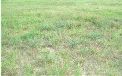
1011 Old Airport Rd
18-9.0-29-004-004-001.000
BEG 1241.85'S OF THE NE COR E1/2 SE, THEN S600' W659.51' N600' E TO POB
Policefirecivildefense
LAWRENCE
2024
Missouri
2025
9.08 AC
470401
Missouri South Area
43,706 SF
Other Market Areas
NEARBY LISTINGS FOR SALE OR LEASE
-
-
View all Monett listings for sale on LoopNet.com
DEMOGRAPHICS near 1011 Old Airport Rd
1 mile
3 mile
5 mile
2025 Total Population
2,150
10,637
12,471
2030 Population
2,168
10,718
12,591
Pop Growth 2025-2030
+ 0.84%
+ 0.76%
+ 0.96%
Average Age
37
37
38
2025 Total Households
781
3,922
4,589
HH Growth 2025-2030
+ 0.77%
+ 0.54%
+ 0.72%
Median Household Inc
$40,083
$48,051
$49,707
Avg Household Size
2.70
2.60
2.60
2025 Avg HH Vehicles
2.00
2.00
2.00
Median Home Value
$162,553
$166,771
$175,019
Median Year Built
1976
1973
1974
Nearby Places
Map Layers
Map Styles
 Street
 Aerial
Layers
 Traffic
 Biking
Places
Listings with unknown addresses are not visible on the map
- Restaurants
- Banks
- Shops
- Fitness
- Groceries
Nearby Properties
Address
Land Use
TOTAL SIZE
Lot Size
Zoning
Address
Land Use
TOTAL SIZE
Lot Size
Zoning
6,000 SF
11.60 AC
Address
Land Use
TOTAL SIZE
Lot Size
Zoning
5.43 AC
Address
Land Use
TOTAL SIZE
Lot Size
Zoning
8,648 SF
0.56 AC
Address
Land Use
TOTAL SIZE
Lot Size
Zoning
32,840 SF
1.37 AC
Address
Land Use
TOTAL SIZE
Lot Size
Zoning
7,552 SF
1.37 AC
Address
Land Use
TOTAL SIZE
Lot Size
Zoning
10,892 SF
19.60 AC
Address
Land Use
TOTAL SIZE
Lot Size
Zoning
11,400 SF
9 AC
Address
Land Use
TOTAL SIZE
Lot Size
Zoning
8,221 SF
2.50 AC
Address
Land Use
TOTAL SIZE
Lot Size
Zoning
9,136 SF
0.64 AC
Address
Land Use
TOTAL SIZE
Lot Size
Zoning
16,859 SF
1.80 AC
Address
Land Use
TOTAL SIZE
Lot Size
Zoning
55,862 SF
3.10 AC
Address
Land Use
TOTAL SIZE
Lot Size
Zoning
6,292 SF
1.20 AC
Address
Land Use
TOTAL SIZE
Lot Size
Zoning
43,800 SF
2.83 AC
Address
Land Use
TOTAL SIZE
Lot Size
Zoning
75,789 SF
5.50 AC
Address
Land Use
TOTAL SIZE
Lot Size
Zoning
16,809 SF
1.50 AC
The World's #1 Commercial Real Estate Marketplace
Connect with us
© 2026 CoStar Group
The information above has been obtained from sources believed reliable. While we do not doubt its accuracy we have not verified it and make no guarantee, warranty or representation about it. It is your responsibility to independently confirm its accuracy and completeness. Any projections, opinions, assumptions, or estimates used are for example only and do not represent the current or future performance of the property. The value of this transaction to you depends on tax and other factors which should be evaluated by your tax, financial, and legal advisors. You and your advisors should conduct a careful, independent investigation of the property to determine to your satisfaction the suitability of the property for your needs.