Property Record
1011 River Line Dr, Howell, MI 48843

Property Detail
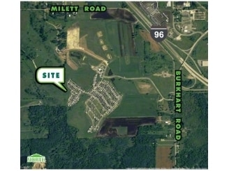
1011 River Line Dr
06-32-100-003
SEC 29 T3N R4E COMM NW COR SEC 32 TH N 89^ 18' 21" E 98.65 FT FOR POB AND ALSO KNOWN AS TRAVERSE PT A TH N 89^ 18' 21" E
Commercialnec
Livingston
MHP
Michigan
AE The base floodplain where base flood elevations are provided. AE Zones are now used on new format FIRMs instead of A1-A30 Zones.
128.76 AC
2025
Livingston County
2025
Detroit
724001
Detroit-Warren-Dearborn, MI
6,837 SF
NEARBY LISTINGS FOR SALE OR LEASE
DEMOGRAPHICS near 1011 River Line Dr
1 mile
3 mile
5 mile
2025 Total Population
1,386
7,231
33,471
2030 Population
1,416
7,329
33,914
Pop Growth 2025-2030
+ 2.16%
+ 1.36%
+ 1.32%
Average Age
44
43
42
2025 Total Households
561
2,804
13,236
HH Growth 2025-2030
+ 2.32%
+ 1.39%
+ 1.26%
Median Household Inc
$78,968
$87,186
$86,589
Avg Household Size
2.40
2.50
2.50
2025 Avg HH Vehicles
2.00
2.00
2.00
Median Home Value
$201,515
$280,858
$278,132
Median Year Built
2001
1995
1989
Nearby Places
Map Layers
Map Styles
 Street
 Aerial
Layers
 Traffic
 Biking
Places
Listings with unknown addresses are not visible on the map
- Restaurants
- Banks
- Shops
- Fitness
- Groceries
PUBLIC TRANSPORTATION
AIRPORT
Bishop International
Drive
Walk
Distance
Bishop International
62 min
39.5 mi
Freight Ports
Port of Toledo
Drive
Walk
Distance
Port of Toledo
112 min
92.4 mi
Nearby Properties
Address
Land Use
TOTAL SIZE
Lot Size
Zoning
Address
Land Use
TOTAL SIZE
Lot Size
Zoning
767,161 SF
127.33 AC
I-1
Address
Land Use
TOTAL SIZE
Lot Size
Zoning
331,100 SF
41.10 AC
RSC
Address
Land Use
TOTAL SIZE
Lot Size
Zoning
89,443 SF
10.45 AC
R-M
Address
Land Use
TOTAL SIZE
Lot Size
Zoning
102,971 SF
11.95 AC
I-1
Address
Land Use
TOTAL SIZE
Lot Size
Zoning
171,564 SF
30.98 AC
O-1
Address
Land Use
TOTAL SIZE
Lot Size
Zoning
321,167 SF
27.01 AC
IFZ
Address
Land Use
TOTAL SIZE
Lot Size
Zoning
145,366 SF
13.60 AC
R-M
Address
Land Use
TOTAL SIZE
Lot Size
Zoning
37.65 AC
MFR
Address
Land Use
TOTAL SIZE
Lot Size
Zoning
38.64 AC
R&D
Address
Land Use
TOTAL SIZE
Lot Size
Zoning
24,644 SF
160 AC
R&D
Address
Land Use
TOTAL SIZE
Lot Size
Zoning
152,606 SF
16 AC
R-M
Address
Land Use
TOTAL SIZE
Lot Size
Zoning
16.65 AC
MFR
Address
Land Use
TOTAL SIZE
Lot Size
Zoning
106,170 SF
6.68 AC
I
Address
Land Use
TOTAL SIZE
Lot Size
Zoning
119,260 SF
7.10 AC
IFZ
Address
Land Use
TOTAL SIZE
Lot Size
Zoning
154,040 SF
13.70 AC
I
Address
Land Use
TOTAL SIZE
Lot Size
Zoning
112,419 SF
9.31 AC
I
Address
Land Use
TOTAL SIZE
Lot Size
Zoning
107,867 SF
26.53 AC
AR
Address
Land Use
TOTAL SIZE
Lot Size
Zoning
119,436 SF
12.20 AC
I-1
Address
Land Use
TOTAL SIZE
Lot Size
Zoning
128,437 SF
8.55 AC
IFZ
Address
Land Use
TOTAL SIZE
Lot Size
Zoning
122,040 SF
9.81 AC
I
Address
Land Use
TOTAL SIZE
Lot Size
Zoning
22,660 SF
4.80 AC
IFZ
Address
Land Use
TOTAL SIZE
Lot Size
Zoning
81.26 AC
MHP
Address
Land Use
TOTAL SIZE
Lot Size
Zoning
55,100 SF
5 AC
NSC
Address
Land Use
TOTAL SIZE
Lot Size
Zoning
56,205 SF
3.68 AC
RSC
Address
Land Use
TOTAL SIZE
Lot Size
Zoning
54,662 SF
5.65 AC
RSC
Address
Land Use
TOTAL SIZE
Lot Size
Zoning
53,448 SF
5.16 AC
IFZ
Address
Land Use
TOTAL SIZE
Lot Size
Zoning
13.92 AC
IFZ
Address
Land Use
TOTAL SIZE
Lot Size
Zoning
50,496 SF
5.53 AC
R-M
Address
Land Use
TOTAL SIZE
Lot Size
Zoning
70,725 SF
125.03 AC
I-1
The World's #1 Commercial Real Estate Marketplace
Connect with us
© 2026 CoStar Group
The information above has been obtained from sources believed reliable. While we do not doubt its accuracy we have not verified it and make no guarantee, warranty or representation about it. It is your responsibility to independently confirm its accuracy and completeness. Any projections, opinions, assumptions, or estimates used are for example only and do not represent the current or future performance of the property. The value of this transaction to you depends on tax and other factors which should be evaluated by your tax, financial, and legal advisors. You and your advisors should conduct a careful, independent investigation of the property to determine to your satisfaction the suitability of the property for your needs.