Property Record
1011 S Sumter Blvd, North Port, FL 34287
NEARBY LISTINGS FOR SALE OR LEASE
Property Detail
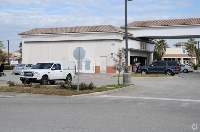
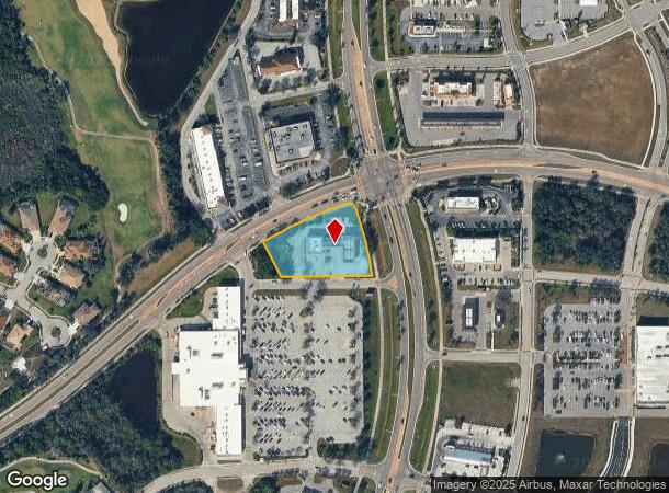
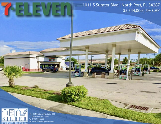
1011 S Sumter Blvd
North Port-Sarasota-Bradenton, FL
Heron Creek Towne Centre
0977-03-0010
PARCEL A, LESS R/W FOR PRICE BLVD AS DESC IN ORI 2013113895, HERON CREEK TOWNE CENTRE, CONTAINING 1.2 C-AC M/L
Storebuilding
Sarasota
AE
Florida
12115C0379F
a
2024
1.28 AC
2025
Sarasota Outlying
002737
Tampa/St Petersburg
3,000 SF
DEMOGRAPHICS near 1011 S Sumter Blvd
1 Mile
3 Mile
5 Mile
2024 Total Population
4,402
45,502
75,564
2029 Population
4,999
51,947
86,967
Pop Growth 2024-2029
+ 13.56%
+ 14.16%
+ 15.09%
Average Age
46
44
46
2024 Total Households
1,731
17,687
30,523
HH Growth 2024-2029
+ 13.52%
+ 14.17%
+ 15.13%
Median Household Inc
$77,254
$65,002
$65,148
Avg Household Size
2.50
2.50
2.40
2024 Avg HH Vehicles
2.00
2.00
2.00
Median Home Value
$253,748
$233,030
$235,937
Median Year Built
2001
2000
2001
Nearby Places
Map Layers
Map Styles
 Street
 Aerial
- Restaurants
- Banks
- Shops
- Fitness
- Groceries
PUBLIC TRANSPORTATION
AIRPORT
Punta Gorda
DRIVE
WALK
Distance
Punta Gorda
31 min
23.6 mi
Freight Ports
Port Manatee
DRIVE
WALK
Distance
Port Manatee
67 min
54.6 mi
SALE & LEASE HISTORY
LISTING DATE
SALE/LEASE

Sep 25, 2024
For Sale
Oct 24, 2022
For Sale
Dec 08, 2021
For Sale
Aug 17, 2021
For Sale
Nearby Properties
Address
Land Use
TOTAL SIZE
Lot Size
Zoning
Address
Land Use
TOTAL SIZE
Lot Size
Zoning
548,781 SF
196.98 AC
GU
Address
Land Use
TOTAL SIZE
Lot Size
Zoning
218,356 SF
17.14 AC
AC2
Address
Land Use
TOTAL SIZE
Lot Size
Zoning
267,412 SF
23.26 AC
AC1
Address
Land Use
TOTAL SIZE
Lot Size
Zoning
146,932 SF
39.48 AC
AC2
Address
Land Use
TOTAL SIZE
Lot Size
Zoning
302,632 SF
15.71 AC
AC2
Address
Land Use
TOTAL SIZE
Lot Size
Zoning
145,713 SF
30.50 AC
GU
Address
Land Use
TOTAL SIZE
Lot Size
Zoning
205,624 SF
21.37 AC
AC1
Address
Land Use
TOTAL SIZE
Lot Size
Zoning
9,511 SF
40.53 AC
PD
Address
Land Use
TOTAL SIZE
Lot Size
Zoning
114,985 SF
29.77 AC
GU
Address
Land Use
TOTAL SIZE
Lot Size
Zoning
103,327 SF
47.54 AC
GU
Address
Land Use
TOTAL SIZE
Lot Size
Zoning
79,944 SF
15.64 AC
AC1
Address
Land Use
TOTAL SIZE
Lot Size
Zoning
196,163 SF
15.60 AC
AC1
Address
Land Use
TOTAL SIZE
Lot Size
Zoning
142,364 SF
13.87 AC
AC1
Address
Land Use
TOTAL SIZE
Lot Size
Zoning
40,161 SF
40 AC
GU
Address
Land Use
TOTAL SIZE
Lot Size
Zoning
65,103 SF
10.16 AC
AC2
Address
Land Use
TOTAL SIZE
Lot Size
Zoning
18.49 AC
PCDN
Address
Land Use
TOTAL SIZE
Lot Size
Zoning
85,529 SF
11.41 AC
AC1
Address
Land Use
TOTAL SIZE
Lot Size
Zoning
105,046 SF
12.69 AC
AC1
Address
Land Use
TOTAL SIZE
Lot Size
Zoning
136,260 SF
8.44 AC
AC5
Address
Land Use
TOTAL SIZE
Lot Size
Zoning
115,678 SF
8.58 AC
R3
Address
Land Use
TOTAL SIZE
Lot Size
Zoning
124,047 SF
9.10 AC
AC5
Address
Land Use
TOTAL SIZE
Lot Size
Zoning
42,923 SF
403.06 AC
R1
Address
Land Use
TOTAL SIZE
Lot Size
Zoning
63,016 SF
2.56 AC
AC1
Address
Land Use
TOTAL SIZE
Lot Size
Zoning
43,387 SF
5.09 AC
AC2
Address
Land Use
TOTAL SIZE
Lot Size
Zoning
22.07 AC
PD
Address
Land Use
TOTAL SIZE
Lot Size
Zoning
289,861 SF
27.47 AC
AC2
Address
Land Use
TOTAL SIZE
Lot Size
Zoning
19,816 SF
2.70 AC
AC2
Address
Land Use
TOTAL SIZE
Lot Size
Zoning
17.48 AC
AC1
Address
Land Use
TOTAL SIZE
Lot Size
Zoning
10,721 SF
3 AC
PD
Address
Land Use
TOTAL SIZE
Lot Size
Zoning
29,890 SF
7.78 AC
R3
The World's #1 Commercial Real Estate Marketplace
Connect with us
© 2026 CoStar Group
The information above has been obtained from sources believed reliable. While we do not doubt its accuracy we have not verified it and make no guarantee, warranty or representation about it. It is your responsibility to independently confirm its accuracy and completeness. Any projections, opinions, assumptions, or estimates used are for example only and do not represent the current or future performance of the property. The value of this transaction to you depends on tax and other factors which should be evaluated by your tax, financial, and legal advisors. You and your advisors should conduct a careful, independent investigation of the property to determine to your satisfaction the suitability of the property for your needs.