Property Record
1011 Short St, Eau Claire, WI 54701


Save to a Folder
{{folder.Name}}
{{folder.ListingIds.length}} Properties
{{folder.ListingIds.length}} Property
Create a New Folder
Property Detail
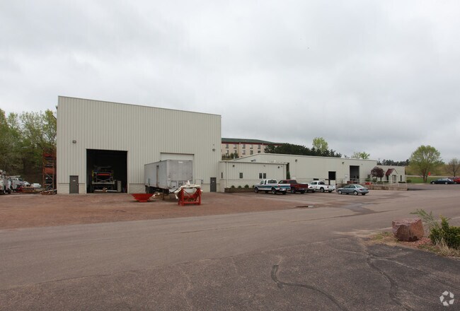
1011 Short St
15-1074-C
LOT 6 CSM 3772 REC V 22 P 92 DOC 1234399 LOC IN GOV LOT 8 SEC 25-27-10 & SW1/4 OF SW1/4 SEC 30-27-9 BEG 2023
Lightindustrial
EAU CLAIRE
I2
Wisconsin
AE The base floodplain where base flood elevations are provided. AE Zones are now used on new format FIRMs instead of A1-A30 Zones.
6
2025
7.53 AC
2025
Eau Claire/Menomonie
000900
Other Market Areas
20,070 SF
Eau Claire, WI
NEARBY LISTINGS FOR SALE OR LEASE
-
-
View all Eau Claire listings for sale on LoopNet.com
DEMOGRAPHICS near 1011 Short St
1 mile
3 mile
5 mile
2025 Total Population
3,354
42,034
77,852
2030 Population
3,434
42,972
79,994
Pop Growth 2025-2030
+ 2.39%
+ 2.23%
+ 2.75%
Average Age
37
36
38
2025 Total Households
1,593
16,842
32,313
HH Growth 2025-2030
+ 2.70%
+ 2.46%
+ 2.91%
Median Household Inc
$57,121
$65,823
$70,401
Avg Household Size
2.10
2.20
2.20
2025 Avg HH Vehicles
1.00
2.00
2.00
Median Home Value
$298,076
$256,910
$257,073
Median Year Built
1987
1970
1977
Nearby Places
Map Layers
Map Styles
 Street
 Aerial
Layers
 Traffic
 Biking
Places
Listings with unknown addresses are not visible on the map
- Restaurants
- Banks
- Shops
- Fitness
- Groceries
Nearby Properties
Address
Land Use
TOTAL SIZE
Lot Size
Zoning
Address
Land Use
TOTAL SIZE
Lot Size
Zoning
203,723 SF
Address
Land Use
TOTAL SIZE
Lot Size
Zoning
97,194 SF
7.39 AC
C3H
Address
Land Use
TOTAL SIZE
Lot Size
Zoning
361,759 SF
8.46 AC
Address
Land Use
TOTAL SIZE
Lot Size
Zoning
206,042 SF
5.59 AC
Address
Land Use
TOTAL SIZE
Lot Size
Zoning
0.78 AC
Address
Land Use
TOTAL SIZE
Lot Size
Zoning
1.36 AC
CBD
Address
Land Use
TOTAL SIZE
Lot Size
Zoning
114,683 SF
5.47 AC
C3H
Address
Land Use
TOTAL SIZE
Lot Size
Zoning
81,260 SF
2.32 AC
R4
Address
Land Use
TOTAL SIZE
Lot Size
Zoning
199,534 SF
7.23 AC
Address
Land Use
TOTAL SIZE
Lot Size
Zoning
1.05 AC
P
Address
Land Use
TOTAL SIZE
Lot Size
Zoning
105,434 SF
1.55 AC
CBD
Address
Land Use
TOTAL SIZE
Lot Size
Zoning
65,378 SF
1.83 AC
Address
Land Use
TOTAL SIZE
Lot Size
Zoning
114,100 SF
2.64 AC
Address
Land Use
TOTAL SIZE
Lot Size
Zoning
68,024 SF
0.80 AC
CBD
Address
Land Use
TOTAL SIZE
Lot Size
Zoning
Address
Land Use
TOTAL SIZE
Lot Size
Zoning
Address
Land Use
TOTAL SIZE
Lot Size
Zoning
88,350 SF
0.40 AC
Address
Land Use
TOTAL SIZE
Lot Size
Zoning
66,497 SF
0.81 AC
CBDP
Address
Land Use
TOTAL SIZE
Lot Size
Zoning
7,084 SF
26.73 AC
I2P
Address
Land Use
TOTAL SIZE
Lot Size
Zoning
70,965 SF
0.78 AC
CBD
Address
Land Use
TOTAL SIZE
Lot Size
Zoning
Address
Land Use
TOTAL SIZE
Lot Size
Zoning
73,414 SF
2.46 AC
C3P
Address
Land Use
TOTAL SIZE
Lot Size
Zoning
60,473 SF
1.83 AC
Address
Land Use
TOTAL SIZE
Lot Size
Zoning
77,311 SF
3.39 AC
C3H
Address
Land Use
TOTAL SIZE
Lot Size
Zoning
5,735 SF
6.94 AC
Address
Land Use
TOTAL SIZE
Lot Size
Zoning
43,156 SF
2.17 AC
C3P
Address
Land Use
TOTAL SIZE
Lot Size
Zoning
89,448 SF
13.47 AC
C3P
Address
Land Use
TOTAL SIZE
Lot Size
Zoning
54,420 SF
2.30 AC
CBDP
Address
Land Use
TOTAL SIZE
Lot Size
Zoning
61,710 SF
7.66 AC
C3P
Address
Land Use
TOTAL SIZE
Lot Size
Zoning
0.89 AC
The World's #1 Commercial Real Estate Marketplace
Connect with us
© 2026 CoStar Group
The information above has been obtained from sources believed reliable. While we do not doubt its accuracy we have not verified it and make no guarantee, warranty or representation about it. It is your responsibility to independently confirm its accuracy and completeness. Any projections, opinions, assumptions, or estimates used are for example only and do not represent the current or future performance of the property. The value of this transaction to you depends on tax and other factors which should be evaluated by your tax, financial, and legal advisors. You and your advisors should conduct a careful, independent investigation of the property to determine to your satisfaction the suitability of the property for your needs.