Property Record
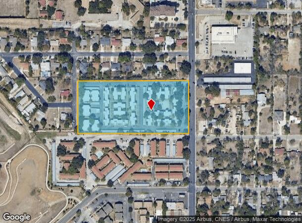
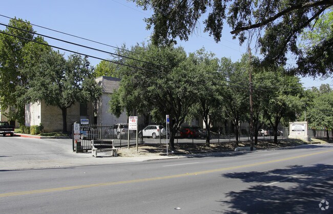
1011 Vance Jackson Rd, San Antonio, TX 78201

NEARBY LISTINGS FOR SALE OR LEASE
Property Detail
1011 Vance Jackson Rd
San Antonio-New Braunfels, TX
Block 10356
10356-005-0231
NCB 10356 BLK 5 LOT 23 & 24
Multifamilydwelling
Bexar
X
Texas
48029C0381H
231
2024
6.19 AC
2025
Maverick
180201
San Antonio
116,302 SF
DEMOGRAPHICS near 1011 Vance Jackson Rd
1 Mile
3 Mile
5 Mile
2024 Total Population
18,807
145,747
402,060
2029 Population
19,974
154,285
427,837
Pop Growth 2024-2029
+ 6.21%
+ 5.86%
+ 6.41%
Average Age
40
39
38
2024 Total Households
7,612
57,513
161,847
HH Growth 2024-2029
+ 6.56%
+ 6.13%
+ 6.82%
Median Household Inc
$36,121
$43,898
$46,324
Avg Household Size
2.40
2.40
2.40
2024 Avg HH Vehicles
2.00
2.00
2.00
Median Home Value
$160,674
$171,165
$181,336
Median Year Built
1963
1961
1971
Nearby Places
Map Layers
Map Styles
 Street
 Aerial
- Restaurants
- Banks
- Shops
- Fitness
- Groceries
PUBLIC TRANSPORTATION
COMMUTER RAIL
San Antonio Amtrak Station (Sunset Limited - Amtrak, Texas Eagle - Amtrak)
DRIVE
WALK
Distance
San Antonio Amtrak Station (Sunset Limited - Amtrak, Texas Eagle - Amtrak)
12 min
7.1 mi
AIRPORT
San Antonio International
DRIVE
WALK
Distance
San Antonio International
11 min
6.2 mi
Freight Ports
Calhoun Port
DRIVE
WALK
Distance
Calhoun Port
189 min
154.6 mi
Nearby Properties
Address
Land Use
TOTAL SIZE
Lot Size
Zoning
Address
Land Use
TOTAL SIZE
Lot Size
Zoning
1,414,945 SF
16.77 AC
Address
Land Use
TOTAL SIZE
Lot Size
Zoning
429,561 SF
25.70 AC
Address
Land Use
TOTAL SIZE
Lot Size
Zoning
97.47 AC
Address
Land Use
TOTAL SIZE
Lot Size
Zoning
278,352 SF
10 AC
Address
Land Use
TOTAL SIZE
Lot Size
Zoning
482,412 SF
22.97 AC
Address
Land Use
TOTAL SIZE
Lot Size
Zoning
506,058 SF
25.23 AC
Address
Land Use
TOTAL SIZE
Lot Size
Zoning
356,368 SF
18.58 AC
Address
Land Use
TOTAL SIZE
Lot Size
Zoning
122,292 SF
12.83 AC
Address
Land Use
TOTAL SIZE
Lot Size
Zoning
293,420 SF
9.24 AC
Address
Land Use
TOTAL SIZE
Lot Size
Zoning
256,678 SF
4.42 AC
Address
Land Use
TOTAL SIZE
Lot Size
Zoning
138,674 SF
11.14 AC
Address
Land Use
TOTAL SIZE
Lot Size
Zoning
207,445 SF
9.55 AC
Address
Land Use
TOTAL SIZE
Lot Size
Zoning
Address
Land Use
TOTAL SIZE
Lot Size
Zoning
97,800 SF
0.85 AC
Address
Land Use
TOTAL SIZE
Lot Size
Zoning
279,112 SF
10.62 AC
Address
Land Use
TOTAL SIZE
Lot Size
Zoning
166,170 SF
25.56 AC
Address
Land Use
TOTAL SIZE
Lot Size
Zoning
184,262 SF
6.13 AC
Address
Land Use
TOTAL SIZE
Lot Size
Zoning
181,290 SF
5.57 AC
Address
Land Use
TOTAL SIZE
Lot Size
Zoning
217,700 SF
11.90 AC
Address
Land Use
TOTAL SIZE
Lot Size
Zoning
134,802 SF
8.02 AC
Address
Land Use
TOTAL SIZE
Lot Size
Zoning
195,411 SF
5.15 AC
Address
Land Use
TOTAL SIZE
Lot Size
Zoning
175,347 SF
4.71 AC
Address
Land Use
TOTAL SIZE
Lot Size
Zoning
Address
Land Use
TOTAL SIZE
Lot Size
Zoning
97,280 SF
3 AC
Address
Land Use
TOTAL SIZE
Lot Size
Zoning
75,169 SF
17.44 AC
Address
Land Use
TOTAL SIZE
Lot Size
Zoning
168,619 SF
8.38 AC
Address
Land Use
TOTAL SIZE
Lot Size
Zoning
173,363 SF
10.29 AC
Address
Land Use
TOTAL SIZE
Lot Size
Zoning
286,747 SF
12.53 AC
Address
Land Use
TOTAL SIZE
Lot Size
Zoning
160,152 SF
4.18 AC
Address
Land Use
TOTAL SIZE
Lot Size
Zoning
99,800 SF
7.84 AC
The World's #1 Commercial Real Estate Marketplace
Connect with us
© 2025 CoStar Group
The information above has been obtained from sources believed reliable. While we do not doubt its accuracy we have not verified it and make no guarantee, warranty or representation about it. It is your responsibility to independently confirm its accuracy and completeness. Any projections, opinions, assumptions, or estimates used are for example only and do not represent the current or future performance of the property. The value of this transaction to you depends on tax and other factors which should be evaluated by your tax, financial, and legal advisors. You and your advisors should conduct a careful, independent investigation of the property to determine to your satisfaction the suitability of the property for your needs.