Property Record
10110 Us Highway 2 E, Coram, MT 59913
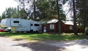

Property Detail
10110 Us Highway 2 E
Kalispell, MT
TRIGON SUB AMD PORTION, S29, T31 N, R19 W, LOT C, ASSR# 0000144180
07-4295-29-4-07-01-0000
FLATHEAD
Policefirecivildefense
Montana
B and X Area of moderate flood hazard, usually the area between the limits of the 100-year and 500-year floods.
c
0
0.97 AC
2025
Glacier Country
000102
Other Market Areas
6,144 SF
NEARBY LISTINGS FOR SALE OR LEASE
-
-
View all Coram listings for sale on LoopNet.com
DEMOGRAPHICS near 10110 Us Highway 2 E
1 mile
3 mile
5 mile
2025 Total Population
180
1,377
1,721
2030 Population
177
1,353
1,703
Pop Growth 2025-2030
(1.67%)
(1.74%)
(1.05%)
Average Age
46
46
46
2025 Total Households
80
606
746
HH Growth 2025-2030
(2.50%)
(1.82%)
(1.34%)
Median Household Inc
$59,545
$60,689
$62,812
Avg Household Size
2.20
2.20
2.20
2025 Avg HH Vehicles
2.00
2.00
2.00
Median Home Value
$562,500
$561,594
$588,353
Median Year Built
1981
1981
1982
Nearby Places
Map Layers
Map Styles
 Street
 Aerial
Layers
 Traffic
 Biking
Places
Listings with unknown addresses are not visible on the map
- Restaurants
- Banks
- Shops
- Fitness
- Groceries
PUBLIC TRANSPORTATION
COMMUTER RAIL
West Glacier Amtrak (Empire Builder - Amtrak)
Drive
Walk
Distance
West Glacier Amtrak (Empire Builder - Amtrak)
8 min
7.0 mi
AIRPORT
Glacier Park International
Drive
Walk
Distance
Glacier Park International
23 min
17.1 mi
Freight Ports
Port of Everett
Drive
Walk
Distance
Port of Everett
660 min
570.0 mi
Nearby Properties
Address
Land Use
TOTAL SIZE
Lot Size
Zoning
Address
Land Use
TOTAL SIZE
Lot Size
Zoning
Address
Land Use
TOTAL SIZE
Lot Size
Zoning
13,332 SF
0.53 AC
Address
Land Use
TOTAL SIZE
Lot Size
Zoning
8,372 SF
3.40 AC
1
Address
Land Use
TOTAL SIZE
Lot Size
Zoning
360 SF
24.36 AC
Address
Land Use
TOTAL SIZE
Lot Size
Zoning
320 SF
16.69 AC
Address
Land Use
TOTAL SIZE
Lot Size
Zoning
2,304 SF
19.04 AC
Address
Land Use
TOTAL SIZE
Lot Size
Zoning
4,328 SF
6.57 AC
Address
Land Use
TOTAL SIZE
Lot Size
Zoning
720 SF
8.28 AC
Address
Land Use
TOTAL SIZE
Lot Size
Zoning
6,394 SF
8.79 AC
Address
Land Use
TOTAL SIZE
Lot Size
Zoning
1,792 SF
10.21 AC
Address
Land Use
TOTAL SIZE
Lot Size
Zoning
1,518 SF
2 AC
Address
Land Use
TOTAL SIZE
Lot Size
Zoning
3,080 SF
5.20 AC
Address
Land Use
TOTAL SIZE
Lot Size
Zoning
672 SF
10 AC
Address
Land Use
TOTAL SIZE
Lot Size
Zoning
Address
Land Use
TOTAL SIZE
Lot Size
Zoning
12,448 SF
0.59 AC
Address
Land Use
TOTAL SIZE
Lot Size
Zoning
1,848 SF
20 AC
Address
Land Use
TOTAL SIZE
Lot Size
Zoning
2,160 SF
1.28 AC
Address
Land Use
TOTAL SIZE
Lot Size
Zoning
3,240 SF
1.07 AC
Address
Land Use
TOTAL SIZE
Lot Size
Zoning
6,332 SF
0.18 AC
Address
Land Use
TOTAL SIZE
Lot Size
Zoning
2,880 SF
2.20 AC
Address
Land Use
TOTAL SIZE
Lot Size
Zoning
3,640 SF
0.34 AC
Address
Land Use
TOTAL SIZE
Lot Size
Zoning
6,796 SF
0.52 AC
Address
Land Use
TOTAL SIZE
Lot Size
Zoning
3,648 SF
1 AC
Address
Land Use
TOTAL SIZE
Lot Size
Zoning
1,216 SF
0.50 AC
Address
Land Use
TOTAL SIZE
Lot Size
Zoning
672 SF
2 AC
Address
Land Use
TOTAL SIZE
Lot Size
Zoning
1,564 SF
2.44 AC
Address
Land Use
TOTAL SIZE
Lot Size
Zoning
4,492 SF
1.43 AC
Address
Land Use
TOTAL SIZE
Lot Size
Zoning
4,760 SF
3.24 AC
The World's #1 Commercial Real Estate Marketplace
Connect with us
© 2026 CoStar Group
The information above has been obtained from sources believed reliable. While we do not doubt its accuracy we have not verified it and make no guarantee, warranty or representation about it. It is your responsibility to independently confirm its accuracy and completeness. Any projections, opinions, assumptions, or estimates used are for example only and do not represent the current or future performance of the property. The value of this transaction to you depends on tax and other factors which should be evaluated by your tax, financial, and legal advisors. You and your advisors should conduct a careful, independent investigation of the property to determine to your satisfaction the suitability of the property for your needs.