Property Record
10111 N Il Route 47 St, Huntley, IL 60142

NEARBY LISTINGS FOR SALE OR LEASE
Property Detail
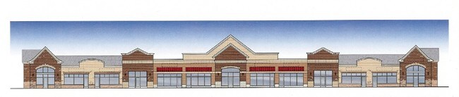
10111 N Il Route 47 St
Chicago-Naperville-Elgin, IL-IN-WI
Bakleys 18Th Addn
18-28-130-002
DOC 2023R0027879 LT 4 BAKLEYS 18TH ADDN WEST
Commercialnec
McHenry
X
Illinois
17089C0045H
4
2024
2 AC
2024
Far Northwest
871501
Chicago
DEMOGRAPHICS near 10111 N Il Route 47 St
1 Mile
3 Mile
5 Mile
2024 Total Population
7,923
41,388
87,041
2029 Population
8,013
41,468
87,088
Pop Growth 2024-2029
+ 1.14%
+ 0.19%
+ 0.05%
Average Age
36
41
42
2024 Total Households
2,488
14,287
31,586
HH Growth 2024-2029
+ 1.21%
+ 0.24%
+ 0.04%
Median Household Inc
$119,190
$105,035
$101,105
Avg Household Size
3.10
2.80
2.70
2024 Avg HH Vehicles
2.00
2.00
2.00
Median Home Value
$317,500
$285,664
$289,671
Median Year Built
2004
2002
1999
Nearby Places
Map Layers
Map Styles
 Street
 Aerial
- Restaurants
- Banks
- Shops
- Fitness
- Groceries
Nearby Properties
Address
Land Use
TOTAL SIZE
Lot Size
Zoning
Address
Land Use
TOTAL SIZE
Lot Size
Zoning
7.26 AC
Address
Land Use
TOTAL SIZE
Lot Size
Zoning
11.86 AC
Address
Land Use
TOTAL SIZE
Lot Size
Zoning
189,735 SF
21.85 AC
Address
Land Use
TOTAL SIZE
Lot Size
Zoning
3.50 AC
Address
Land Use
TOTAL SIZE
Lot Size
Zoning
Address
Land Use
TOTAL SIZE
Lot Size
Zoning
0.71 AC
Address
Land Use
TOTAL SIZE
Lot Size
Zoning
9.28 AC
Address
Land Use
TOTAL SIZE
Lot Size
Zoning
8.23 AC
Address
Land Use
TOTAL SIZE
Lot Size
Zoning
57,813 SF
4.11 AC
Address
Land Use
TOTAL SIZE
Lot Size
Zoning
Address
Land Use
TOTAL SIZE
Lot Size
Zoning
11.15 AC
Address
Land Use
TOTAL SIZE
Lot Size
Zoning
92,850 SF
5 AC
Address
Land Use
TOTAL SIZE
Lot Size
Zoning
24,700 SF
3.08 AC
Address
Land Use
TOTAL SIZE
Lot Size
Zoning
3,144 SF
4.81 AC
Address
Land Use
TOTAL SIZE
Lot Size
Zoning
85,500 SF
7 AC
Address
Land Use
TOTAL SIZE
Lot Size
Zoning
2.55 AC
Address
Land Use
TOTAL SIZE
Lot Size
Zoning
5.40 AC
Address
Land Use
TOTAL SIZE
Lot Size
Zoning
14,606 SF
2.14 AC
Address
Land Use
TOTAL SIZE
Lot Size
Zoning
0.27 AC
Address
Land Use
TOTAL SIZE
Lot Size
Zoning
24,157 SF
1.97 AC
Address
Land Use
TOTAL SIZE
Lot Size
Zoning
71,064 SF
7 AC
Address
Land Use
TOTAL SIZE
Lot Size
Zoning
65,235 SF
4.74 AC
Address
Land Use
TOTAL SIZE
Lot Size
Zoning
48,150 SF
3.42 AC
Address
Land Use
TOTAL SIZE
Lot Size
Zoning
9,440 SF
1.68 AC
Address
Land Use
TOTAL SIZE
Lot Size
Zoning
24,425 SF
4.20 AC
Address
Land Use
TOTAL SIZE
Lot Size
Zoning
22,100 SF
3 AC
Address
Land Use
TOTAL SIZE
Lot Size
Zoning
71,331 SF
8 AC
Address
Land Use
TOTAL SIZE
Lot Size
Zoning
Address
Land Use
TOTAL SIZE
Lot Size
Zoning
2.10 AC
Address
Land Use
TOTAL SIZE
Lot Size
Zoning
1.65 AC
The World's #1 Commercial Real Estate Marketplace
Connect with us
© 2026 CoStar Group
The information above has been obtained from sources believed reliable. While we do not doubt its accuracy we have not verified it and make no guarantee, warranty or representation about it. It is your responsibility to independently confirm its accuracy and completeness. Any projections, opinions, assumptions, or estimates used are for example only and do not represent the current or future performance of the property. The value of this transaction to you depends on tax and other factors which should be evaluated by your tax, financial, and legal advisors. You and your advisors should conduct a careful, independent investigation of the property to determine to your satisfaction the suitability of the property for your needs.