Property Record
10115 Ophir Rd, Newcastle, CA 95658
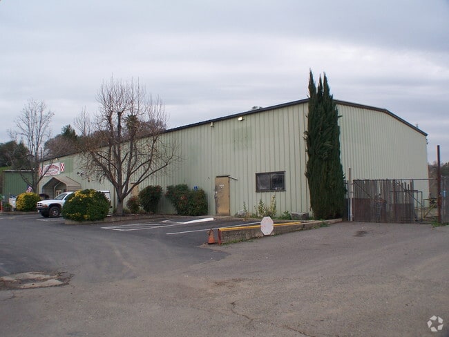


Property Detail
10115 Ophir Rd
040-200-055
PAR C PAR MOR 1 103
Warehouse
PLACER
INDC
California
B and X Area of moderate flood hazard, usually the area between the limits of the 100-year and 500-year floods.
2.80 AC
2024
Auburn/Newcastle
2025
Sacramento
020501
Sacramento-Roseville-Folsom, CA
14,240 SF
NEARBY LISTINGS FOR SALE OR LEASE
-
-
View all Newcastle listings for sale on LoopNet.com
DEMOGRAPHICS near 10115 Ophir Rd
1 mile
3 mile
5 mile
2025 Total Population
972
16,094
43,182
2030 Population
1,017
16,838
45,115
Pop Growth 2025-2030
+ 4.63%
+ 4.62%
+ 4.48%
Average Age
46
46
45
2025 Total Households
362
6,607
17,435
HH Growth 2025-2030
+ 4.70%
+ 4.63%
+ 4.52%
Median Household Inc
$135,539
$102,265
$92,481
Avg Household Size
2.60
2.40
2.40
2025 Avg HH Vehicles
3.00
2.00
2.00
Median Home Value
$780,386
$749,488
$714,053
Median Year Built
1981
1977
1979
Nearby Places
Map Layers
Map Styles
 Street
 Aerial
Layers
 Traffic
 Biking
Places
Listings with unknown addresses are not visible on the map
- Restaurants
- Banks
- Shops
- Fitness
- Groceries
PUBLIC TRANSPORTATION
COMMUTER RAIL
Auburn-Conheim (Capitol Corridor - Capitol Corridor Joint Powers Authority)
Drive
Walk
Distance
Auburn-Conheim (Capitol Corridor - Capitol Corridor Joint Powers Authority)
6 min
3.5 mi
Auburn Amtrak (Capitol Corridor - Amtrak)
Drive
Walk
Distance
Auburn Amtrak (Capitol Corridor - Amtrak)
6 min
3.6 mi
AIRPORT
Sacramento International
Drive
Walk
Distance
Sacramento International
47 min
37.5 mi
Freight Ports
Port of Stockton
Drive
Walk
Distance
Port of Stockton
90 min
77.7 mi
Nearby Properties
Address
Land Use
TOTAL SIZE
Lot Size
Zoning
Address
Land Use
TOTAL SIZE
Lot Size
Zoning
43,785 SF
3.80 AC
Address
Land Use
TOTAL SIZE
Lot Size
Zoning
55,721 SF
3.10 AC
Address
Land Use
TOTAL SIZE
Lot Size
Zoning
52,100 SF
2.30 AC
Address
Land Use
TOTAL SIZE
Lot Size
Zoning
49,023 SF
0.89 AC
Address
Land Use
TOTAL SIZE
Lot Size
Zoning
50,450 SF
2.60 AC
Address
Land Use
TOTAL SIZE
Lot Size
Zoning
44,800 SF
4.10 AC
Address
Land Use
TOTAL SIZE
Lot Size
Zoning
23,426 SF
2.40 AC
Address
Land Use
TOTAL SIZE
Lot Size
Zoning
63,378 SF
30.30 AC
Address
Land Use
TOTAL SIZE
Lot Size
Zoning
878 SF
0.28 AC
C2DC
Address
Land Use
TOTAL SIZE
Lot Size
Zoning
28,256 SF
2.80 AC
Address
Land Use
TOTAL SIZE
Lot Size
Zoning
20,710 SF
1.50 AC
Address
Land Use
TOTAL SIZE
Lot Size
Zoning
19,726 SF
1.21 AC
Address
Land Use
TOTAL SIZE
Lot Size
Zoning
18,980 SF
0.37 AC
Address
Land Use
TOTAL SIZE
Lot Size
Zoning
37,038 SF
2.80 AC
Address
Land Use
TOTAL SIZE
Lot Size
Zoning
186.30 AC
FBX
Address
Land Use
TOTAL SIZE
Lot Size
Zoning
18,932 SF
0.37 AC
Address
Land Use
TOTAL SIZE
Lot Size
Zoning
23,914 SF
1.80 AC
Address
Land Use
TOTAL SIZE
Lot Size
Zoning
165.10 AC
FBX
Address
Land Use
TOTAL SIZE
Lot Size
Zoning
35,720 SF
2.80 AC
Address
Land Use
TOTAL SIZE
Lot Size
Zoning
23,430 SF
1.50 AC
Address
Land Use
TOTAL SIZE
Lot Size
Zoning
14,980 SF
0.31 AC
Address
Land Use
TOTAL SIZE
Lot Size
Zoning
17,424 SF
0.66 AC
Address
Land Use
TOTAL SIZE
Lot Size
Zoning
19,056 SF
0.91 AC
Address
Land Use
TOTAL SIZE
Lot Size
Zoning
2,736 SF
0.55 AC
HSDC
Address
Land Use
TOTAL SIZE
Lot Size
Zoning
21,928 SF
1.15 AC
Address
Land Use
TOTAL SIZE
Lot Size
Zoning
6,707 SF
0.68 AC
Address
Land Use
TOTAL SIZE
Lot Size
Zoning
36,432 SF
2.50 AC
Address
Land Use
TOTAL SIZE
Lot Size
Zoning
12,069 SF
0.26 AC
Address
Land Use
TOTAL SIZE
Lot Size
Zoning
15,827 SF
0.85 AC
The World's #1 Commercial Real Estate Marketplace
Connect with us
© 2026 CoStar Group
The information above has been obtained from sources believed reliable. While we do not doubt its accuracy we have not verified it and make no guarantee, warranty or representation about it. It is your responsibility to independently confirm its accuracy and completeness. Any projections, opinions, assumptions, or estimates used are for example only and do not represent the current or future performance of the property. The value of this transaction to you depends on tax and other factors which should be evaluated by your tax, financial, and legal advisors. You and your advisors should conduct a careful, independent investigation of the property to determine to your satisfaction the suitability of the property for your needs.