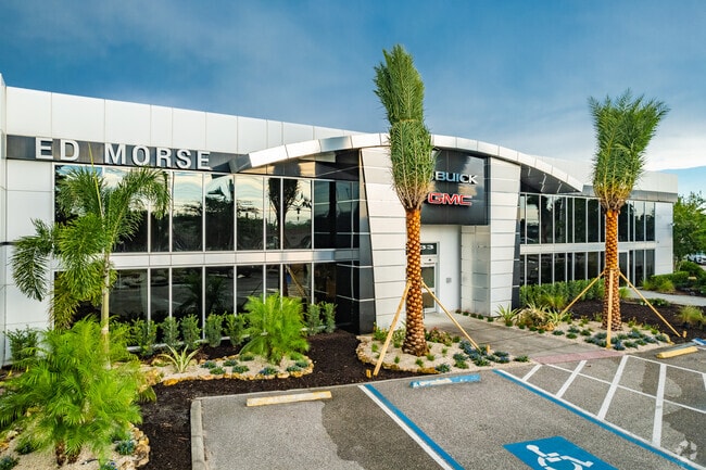
Property Record
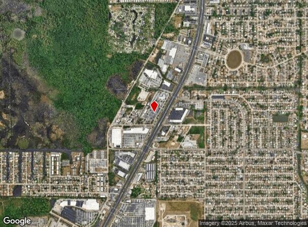
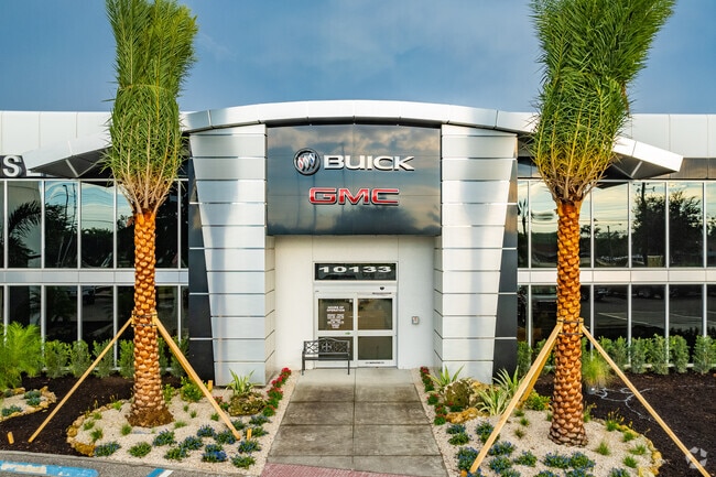
10115 Us Highway 19, Port Richey, FL 34668

NEARBY LISTINGS FOR SALE OR LEASE
Property Detail
10115 Us Highway 19
Tampa/St Petersburg
Crescent Park
Tampa-St. Petersburg-Clearwater, FL
PART OF S1/2 OF SE1/4 AND LOT 27 BLOCK 7 OF CRESCENT PARK PB 2 PG 51 ALL DESC AS COM AT SE COR OF SECTION 16 TH ALG EAST BDY N00DG 13 52E 1311.57 FT TO NORTH BDY OF S1/2 OF SE1/4 TH ALG NORTH BDY N89DG 43 46W 1023.58 FT TO WLY R/W LINE OF US HWY 19 F
16-25-16-0000-01300-0000
Pasco
Vehiclerentalsvehiclesales
Florida
2024
27
2026
7.48 AC
031014
Pasco County
29,884 SF
DEMOGRAPHICS near 10115 Us Highway 19
1 Mile
3 Mile
5 Mile
2024 Total Population
13,222
68,494
126,912
2029 Population
16,017
82,060
152,335
Pop Growth 2024-2029
+ 21.14%
+ 19.81%
+ 20.03%
Average Age
42
44
46
2024 Total Households
5,460
29,661
56,416
HH Growth 2024-2029
+ 21.36%
+ 19.82%
+ 20.07%
Median Household Inc
$46,614
$42,246
$45,439
Avg Household Size
2.40
2.30
2.20
2024 Avg HH Vehicles
1.00
1.00
2.00
Median Home Value
$132,747
$137,436
$164,902
Median Year Built
1976
1978
1980
Nearby Places
Map Layers
Map Styles
 Street
 Aerial
- Restaurants
- Banks
- Shops
- Fitness
- Groceries
PUBLIC TRANSPORTATION
AIRPORT
St Pete-Clearwater International
DRIVE
WALK
Distance
St Pete-Clearwater International
58 min
34.1 mi
Tampa International
DRIVE
WALK
Distance
Tampa International
56 min
36.9 mi
Freight Ports
Port of Tampa Bay
DRIVE
WALK
Distance
Port of Tampa Bay
68 min
42.4 mi
Nearby Properties
Address
Land Use
TOTAL SIZE
Lot Size
Zoning
Address
Land Use
TOTAL SIZE
Lot Size
Zoning
395,386 SF
35.63 AC
C2
Address
Land Use
TOTAL SIZE
Lot Size
Zoning
799,241 SF
88.92 AC
PUD
Address
Land Use
TOTAL SIZE
Lot Size
Zoning
218,736 SF
39.17 AC
R1
Address
Land Use
TOTAL SIZE
Lot Size
Zoning
351,012 SF
23.51 AC
MF2
Address
Land Use
TOTAL SIZE
Lot Size
Zoning
220,843 SF
35.13 AC
C2
Address
Land Use
TOTAL SIZE
Lot Size
Zoning
141,740 SF
22.84 AC
PO1
Address
Land Use
TOTAL SIZE
Lot Size
Zoning
124,316 SF
22.91 AC
MF1
Address
Land Use
TOTAL SIZE
Lot Size
Zoning
122,037 SF
13.83 AC
MF1
Address
Land Use
TOTAL SIZE
Lot Size
Zoning
121,284 SF
10.25 AC
MF1
Address
Land Use
TOTAL SIZE
Lot Size
Zoning
220,045 SF
22.67 AC
C2
Address
Land Use
TOTAL SIZE
Lot Size
Zoning
124,470 SF
5.09 AC
C2
Address
Land Use
TOTAL SIZE
Lot Size
Zoning
309,759 SF
65.19 AC
AC
Address
Land Use
TOTAL SIZE
Lot Size
Zoning
183,139 SF
19.66 AC
C2
Address
Land Use
TOTAL SIZE
Lot Size
Zoning
217,350 SF
11.20 AC
PUD
Address
Land Use
TOTAL SIZE
Lot Size
Zoning
76,160 SF
6.74 AC
MPUD
Address
Land Use
TOTAL SIZE
Lot Size
Zoning
189,166 SF
18.19 AC
C2
Address
Land Use
TOTAL SIZE
Lot Size
Zoning
217,758 SF
34.95 AC
C2
Address
Land Use
TOTAL SIZE
Lot Size
Zoning
220,024 SF
25.72 AC
C1
Address
Land Use
TOTAL SIZE
Lot Size
Zoning
190,794 SF
10.88 AC
C2
Address
Land Use
TOTAL SIZE
Lot Size
Zoning
86,570 SF
8.06 AC
MF1
Address
Land Use
TOTAL SIZE
Lot Size
Zoning
111,060 SF
9.31 AC
C3
Address
Land Use
TOTAL SIZE
Lot Size
Zoning
137,157 SF
18.59 AC
C2
Address
Land Use
TOTAL SIZE
Lot Size
Zoning
42,059 SF
9.16 AC
C3
Address
Land Use
TOTAL SIZE
Lot Size
Zoning
84,225 SF
5.21 AC
C2
Address
Land Use
TOTAL SIZE
Lot Size
Zoning
85,003 SF
25 AC
R4
Address
Land Use
TOTAL SIZE
Lot Size
Zoning
91,670 SF
3.51 AC
C2
Address
Land Use
TOTAL SIZE
Lot Size
Zoning
81,839 SF
3.33 AC
C2
Address
Land Use
TOTAL SIZE
Lot Size
Zoning
117,549 SF
8.07 AC
C2
Address
Land Use
TOTAL SIZE
Lot Size
Zoning
90,113 SF
8.22 AC
C2
Address
Land Use
TOTAL SIZE
Lot Size
Zoning
83,363 SF
5.97 AC
C2
The World's #1 Commercial Real Estate Marketplace
Connect with us
© 2026 CoStar Group
The information above has been obtained from sources believed reliable. While we do not doubt its accuracy we have not verified it and make no guarantee, warranty or representation about it. It is your responsibility to independently confirm its accuracy and completeness. Any projections, opinions, assumptions, or estimates used are for example only and do not represent the current or future performance of the property. The value of this transaction to you depends on tax and other factors which should be evaluated by your tax, financial, and legal advisors. You and your advisors should conduct a careful, independent investigation of the property to determine to your satisfaction the suitability of the property for your needs.