Property Record
1012 6Th St, Maysville, OK 73057


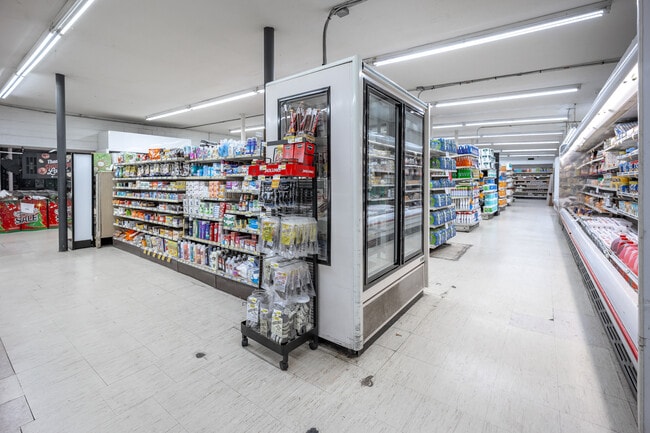
This Property Is For Sale
NEARBY LISTINGS FOR SALE OR LEASE
-
-
View all Maysville listings for sale on LoopNet.com
Property Detail
1012 6Th St
0535-00-000-002-0-002-00
Julia Mays Addition
Supermarket
JULIA MAYS ADD MAYS W/2 LOT 2 & ALL LTS 3 & 4 QCD 1852-290 QCD 1658-422 QCD 1512-139 & 142 SUPER C MART
X
Garvin
40049C0060D
Oklahoma
2025
2-4
2025
0.58 AC
681600
Oklahoma East Area
5,572 SF
Other Market Areas
DEMOGRAPHICS near 1012 6Th St
1 mile
3 mile
5 mile
2024 Total Population
871
1,143
1,644
2029 Population
826
1,096
1,618
Pop Growth 2024-2029
(5.17%)
(4.11%)
(1.58%)
Average Age
42
42
42
2024 Total Households
359
468
664
HH Growth 2024-2029
(5.01%)
(4.06%)
(1.81%)
Median Household Inc
$55,576
$56,483
$58,333
Avg Household Size
2.40
2.40
2.50
2024 Avg HH Vehicles
2.00
2.00
2.00
Median Home Value
$153,333
$161,504
$176,128
Median Year Built
1971
1972
1973
Nearby Places
Map Layers
Map Styles
 Street
 Aerial
Transit
 Traffic
 Biking
Places
Listings with unknown addresses are not visible on the map
- Restaurants
- Banks
- Shops
- Fitness
- Groceries
Nearby Properties
Address
Land Use
TOTAL SIZE
Lot Size
Zoning
Address
Land Use
TOTAL SIZE
Lot Size
Zoning
8,344 SF
1.88 AC
Address
Land Use
TOTAL SIZE
Lot Size
Zoning
2,148 SF
150 AC
TM
Address
Land Use
TOTAL SIZE
Lot Size
Zoning
4,072 SF
354 AC
TM
Address
Land Use
TOTAL SIZE
Lot Size
Zoning
3,300 SF
10.33 AC
Address
Land Use
TOTAL SIZE
Lot Size
Zoning
2,982 SF
0.63 AC
C1
Address
Land Use
TOTAL SIZE
Lot Size
Zoning
2,340 SF
8.60 AC
R1
Address
Land Use
TOTAL SIZE
Lot Size
Zoning
2,720 SF
70 AC
TM
Address
Land Use
TOTAL SIZE
Lot Size
Zoning
2,847 SF
0.48 AC
Address
Land Use
TOTAL SIZE
Lot Size
Zoning
3,140 SF
0.23 AC
C1
Address
Land Use
TOTAL SIZE
Lot Size
Zoning
2,376 SF
1 AC
R1
Address
Land Use
TOTAL SIZE
Lot Size
Zoning
1,400 SF
4.55 AC
C1
Address
Land Use
TOTAL SIZE
Lot Size
Zoning
2,700 SF
1.03 AC
C1
Address
Land Use
TOTAL SIZE
Lot Size
Zoning
2,148 SF
11.11 AC
TM
Address
Land Use
TOTAL SIZE
Lot Size
Zoning
2,046 SF
2 AC
R1
Address
Land Use
TOTAL SIZE
Lot Size
Zoning
3,240 SF
21.41 AC
IP
Address
Land Use
TOTAL SIZE
Lot Size
Zoning
2,720 SF
40 AC
TM
Address
Land Use
TOTAL SIZE
Lot Size
Zoning
1,212 SF
10 AC
Address
Land Use
TOTAL SIZE
Lot Size
Zoning
2,496 SF
90 AC
TM
Address
Land Use
TOTAL SIZE
Lot Size
Zoning
2,336 SF
5.13 AC
NP
Address
Land Use
TOTAL SIZE
Lot Size
Zoning
2,431 SF
10 AC
TM
Address
Land Use
TOTAL SIZE
Lot Size
Zoning
1,720 SF
95 AC
Address
Land Use
TOTAL SIZE
Lot Size
Zoning
3,312 SF
163.02 AC
Address
Land Use
TOTAL SIZE
Lot Size
Zoning
2,807 SF
66.88 AC
NP
Address
Land Use
TOTAL SIZE
Lot Size
Zoning
1,960 SF
0.48 AC
R1
Address
Land Use
TOTAL SIZE
Lot Size
Zoning
2,000 SF
0.29 AC
R1
Address
Land Use
TOTAL SIZE
Lot Size
Zoning
2,632 SF
2.86 AC
R1
Address
Land Use
TOTAL SIZE
Lot Size
Zoning
2,084 SF
10 AC
IP
Address
Land Use
TOTAL SIZE
Lot Size
Zoning
2,626 SF
4.61 AC
Address
Land Use
TOTAL SIZE
Lot Size
Zoning
3,600 SF
4.21 AC
R1
Address
Land Use
TOTAL SIZE
Lot Size
Zoning
2,677 SF
0.16 AC
C1
The World's #1 Commercial Real Estate Marketplace
Connect with us
© 2026 CoStar Group
The information above has been obtained from sources believed reliable. While we do not doubt its accuracy we have not verified it and make no guarantee, warranty or representation about it. It is your responsibility to independently confirm its accuracy and completeness. Any projections, opinions, assumptions, or estimates used are for example only and do not represent the current or future performance of the property. The value of this transaction to you depends on tax and other factors which should be evaluated by your tax, financial, and legal advisors. You and your advisors should conduct a careful, independent investigation of the property to determine to your satisfaction the suitability of the property for your needs.