Property Record
1012 E 1750 S, Vernal, UT 84078
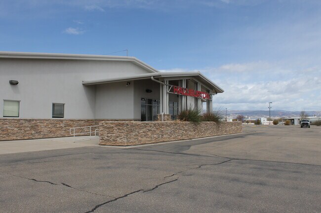

Property Detail
1012 E 1750 S
05-110-0024
BEG AT THE NE COR OF LOT 2 OF THE MONTGOMERY SUB (AMENDED), SD PT BEING LOC ON THE N LN OF THE SE/4 OF SEC 36, T4S, R21E, SLM
Industrialgeneral
UINTAH
B and X Area of moderate flood hazard, usually the area between the limits of the 100-year and 500-year floods.
Utah
2025
10 AC
2025
Utah North Area
968403
Other Market Areas
11,000 SF
Vernal, UT
NEARBY LISTINGS FOR SALE OR LEASE
-
-
View all Vernal listings for sale on LoopNet.com
DEMOGRAPHICS near 1012 E 1750 S
1 mile
3 mile
5 mile
2025 Total Population
1,215
15,914
28,181
2030 Population
1,311
17,246
30,356
Pop Growth 2025-2030
+ 7.90%
+ 8.37%
+ 7.72%
Average Age
37
34
34
2025 Total Households
386
5,687
9,735
HH Growth 2025-2030
+ 7.51%
+ 8.33%
+ 7.64%
Median Household Inc
$89,887
$67,448
$70,966
Avg Household Size
3.10
2.80
2.90
2025 Avg HH Vehicles
3.00
2.00
2.00
Median Home Value
$380,952
$294,437
$326,225
Median Year Built
1998
1990
1992
Nearby Places
Map Layers
Map Styles
 Street
 Aerial
Layers
 Traffic
 Biking
Places
Listings with unknown addresses are not visible on the map
- Restaurants
- Banks
- Shops
- Fitness
- Groceries
SALE & LEASE HISTORY
LISTING DATE
SALE/LEASE

May 22, 2020
For Sale
Nearby Properties
Address
Land Use
TOTAL SIZE
Lot Size
Zoning
Address
Land Use
TOTAL SIZE
Lot Size
Zoning
115,697 SF
4.23 AC
Address
Land Use
TOTAL SIZE
Lot Size
Zoning
13.52 AC
Address
Land Use
TOTAL SIZE
Lot Size
Zoning
186,357 SF
10.19 AC
Address
Land Use
TOTAL SIZE
Lot Size
Zoning
10,000 SF
30 AC
Address
Land Use
TOTAL SIZE
Lot Size
Zoning
5.16 AC
Address
Land Use
TOTAL SIZE
Lot Size
Zoning
1.87 AC
Address
Land Use
TOTAL SIZE
Lot Size
Zoning
Address
Land Use
TOTAL SIZE
Lot Size
Zoning
72,730 SF
1.70 AC
Address
Land Use
TOTAL SIZE
Lot Size
Zoning
Address
Land Use
TOTAL SIZE
Lot Size
Zoning
6.66 AC
Address
Land Use
TOTAL SIZE
Lot Size
Zoning
45,183 SF
2 AC
Address
Land Use
TOTAL SIZE
Lot Size
Zoning
3.07 AC
Address
Land Use
TOTAL SIZE
Lot Size
Zoning
2.86 AC
Address
Land Use
TOTAL SIZE
Lot Size
Zoning
3.70 AC
Address
Land Use
TOTAL SIZE
Lot Size
Zoning
34,089 SF
1.06 AC
Address
Land Use
TOTAL SIZE
Lot Size
Zoning
Address
Land Use
TOTAL SIZE
Lot Size
Zoning
42,946 SF
3.94 AC
Address
Land Use
TOTAL SIZE
Lot Size
Zoning
Address
Land Use
TOTAL SIZE
Lot Size
Zoning
Address
Land Use
TOTAL SIZE
Lot Size
Zoning
3.15 AC
Address
Land Use
TOTAL SIZE
Lot Size
Zoning
Address
Land Use
TOTAL SIZE
Lot Size
Zoning
1.40 AC
Address
Land Use
TOTAL SIZE
Lot Size
Zoning
19.36 AC
Address
Land Use
TOTAL SIZE
Lot Size
Zoning
44,235 SF
3.94 AC
Address
Land Use
TOTAL SIZE
Lot Size
Zoning
3.03 AC
Address
Land Use
TOTAL SIZE
Lot Size
Zoning
14,599 SF
16.17 AC
Address
Land Use
TOTAL SIZE
Lot Size
Zoning
2,027 SF
1.37 AC
Address
Land Use
TOTAL SIZE
Lot Size
Zoning
4.99 AC
Address
Land Use
TOTAL SIZE
Lot Size
Zoning
37,156 SF
2.71 AC
Address
Land Use
TOTAL SIZE
Lot Size
Zoning
13,696 SF
2.01 AC
The World's #1 Commercial Real Estate Marketplace
Connect with us
© 2026 CoStar Group
The information above has been obtained from sources believed reliable. While we do not doubt its accuracy we have not verified it and make no guarantee, warranty or representation about it. It is your responsibility to independently confirm its accuracy and completeness. Any projections, opinions, assumptions, or estimates used are for example only and do not represent the current or future performance of the property. The value of this transaction to you depends on tax and other factors which should be evaluated by your tax, financial, and legal advisors. You and your advisors should conduct a careful, independent investigation of the property to determine to your satisfaction the suitability of the property for your needs.