Property Record
1012 E Wabash St, O Fallon, MO 63366


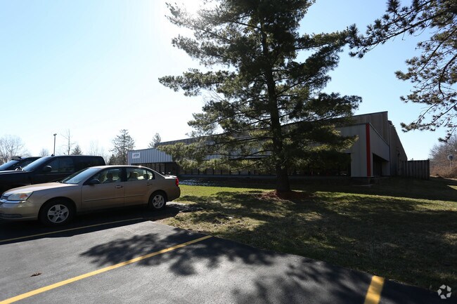
Property Detail
1012 E Wabash St
St. Louis, MO-IL
CONSOLIDATION PLAT PT OF LOT A
2-0056-C736-00-0001.0000000
Saint Charles
Commercialnec
Missouri
B and X Area of moderate flood hazard, usually the area between the limits of the 100-year and 500-year floods.
a
2024
16.09 AC
2025
St Charles County
311602
St. Louis
98,696 SF
NEARBY LISTINGS FOR SALE OR LEASE
DEMOGRAPHICS near 1012 E Wabash St
1 mile
3 mile
5 mile
2025 Total Population
7,237
62,829
136,421
2030 Population
7,456
64,662
140,887
Pop Growth 2025-2030
+ 3.03%
+ 2.92%
+ 3.27%
Average Age
41
41
41
2025 Total Households
2,714
24,020
51,101
HH Growth 2025-2030
+ 3.17%
+ 3.07%
+ 3.44%
Median Household Inc
$89,955
$95,833
$99,225
Avg Household Size
2.60
2.60
2.60
2025 Avg HH Vehicles
2.00
2.00
2.00
Median Home Value
$260,480
$289,342
$309,846
Median Year Built
1994
1994
1995
Nearby Places
Map Layers
Map Styles
 Street
 Aerial
Layers
 Traffic
 Biking
Places
Listings with unknown addresses are not visible on the map
- Restaurants
- Banks
- Shops
- Fitness
- Groceries
PUBLIC TRANSPORTATION
AIRPORT
St Louis Lambert International
Drive
Walk
Distance
St Louis Lambert International
30 min
21.1 mi
Freight Ports
Port Milwaukee
Drive
Walk
Distance
Port Milwaukee
450 min
394.2 mi
Nearby Properties
Address
Land Use
TOTAL SIZE
Lot Size
Zoning
Address
Land Use
TOTAL SIZE
Lot Size
Zoning
189,054 SF
24.92 AC
AA1
Address
Land Use
TOTAL SIZE
Lot Size
Zoning
71,908 SF
8.72 AC
Address
Land Use
TOTAL SIZE
Lot Size
Zoning
143,897 SF
7.17 AC
Address
Land Use
TOTAL SIZE
Lot Size
Zoning
28,215 SF
8.58 AC
AB6
Address
Land Use
TOTAL SIZE
Lot Size
Zoning
254,435 SF
16.57 AC
Address
Land Use
TOTAL SIZE
Lot Size
Zoning
342,840 SF
58.93 AC
AB6
Address
Land Use
TOTAL SIZE
Lot Size
Zoning
235,876 SF
11.35 AC
Address
Land Use
TOTAL SIZE
Lot Size
Zoning
46,388 SF
10.76 AC
Address
Land Use
TOTAL SIZE
Lot Size
Zoning
75.10 AC
AC7
Address
Land Use
TOTAL SIZE
Lot Size
Zoning
46,980 SF
4.15 AC
AF0
Address
Land Use
TOTAL SIZE
Lot Size
Zoning
513,174 SF
19.75 AC
AB6
Address
Land Use
TOTAL SIZE
Lot Size
Zoning
399,520 SF
16.98 AC
AB3
Address
Land Use
TOTAL SIZE
Lot Size
Zoning
591,516 SF
28.79 AC
AB2
Address
Land Use
TOTAL SIZE
Lot Size
Zoning
32.19 AC
AA1
Address
Land Use
TOTAL SIZE
Lot Size
Zoning
104,807 SF
9.34 AC
AB6
Address
Land Use
TOTAL SIZE
Lot Size
Zoning
36,438 SF
2.08 AC
AC4
Address
Land Use
TOTAL SIZE
Lot Size
Zoning
429,473 SF
82.18 AC
Address
Land Use
TOTAL SIZE
Lot Size
Zoning
167,090 SF
19.85 AC
Address
Land Use
TOTAL SIZE
Lot Size
Zoning
562,434 SF
40.73 AC
AB3
Address
Land Use
TOTAL SIZE
Lot Size
Zoning
53,636 SF
Address
Land Use
TOTAL SIZE
Lot Size
Zoning
201,531 SF
22.28 AC
Address
Land Use
TOTAL SIZE
Lot Size
Zoning
249,889 SF
26.95 AC
Address
Land Use
TOTAL SIZE
Lot Size
Zoning
197,791 SF
18.58 AC
Address
Land Use
TOTAL SIZE
Lot Size
Zoning
261,016 SF
15.27 AC
Address
Land Use
TOTAL SIZE
Lot Size
Zoning
40,952 SF
4.33 AC
Address
Land Use
TOTAL SIZE
Lot Size
Zoning
47.95 AC
AF0
Address
Land Use
TOTAL SIZE
Lot Size
Zoning
5,548 SF
68.46 AC
Address
Land Use
TOTAL SIZE
Lot Size
Zoning
129,472 SF
22 AC
AC2
Address
Land Use
TOTAL SIZE
Lot Size
Zoning
113,099 SF
12.12 AC
Address
Land Use
TOTAL SIZE
Lot Size
Zoning
147,526 SF
7.51 AC
AE8
The World's #1 Commercial Real Estate Marketplace
Connect with us
© 2026 CoStar Group
The information above has been obtained from sources believed reliable. While we do not doubt its accuracy we have not verified it and make no guarantee, warranty or representation about it. It is your responsibility to independently confirm its accuracy and completeness. Any projections, opinions, assumptions, or estimates used are for example only and do not represent the current or future performance of the property. The value of this transaction to you depends on tax and other factors which should be evaluated by your tax, financial, and legal advisors. You and your advisors should conduct a careful, independent investigation of the property to determine to your satisfaction the suitability of the property for your needs.