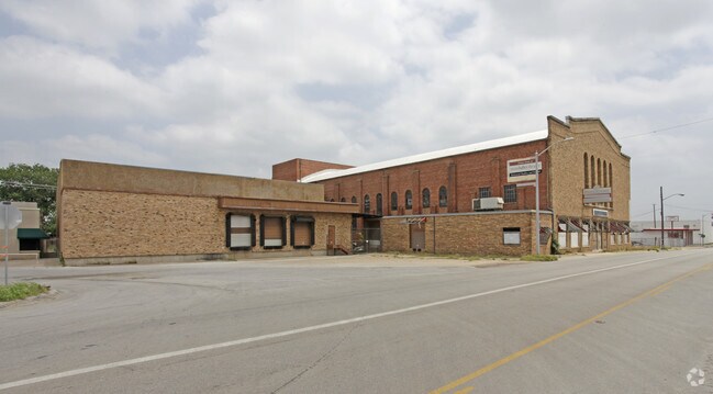
Property Record
1012 N Main St, Fort Worth, TX 76164


NEARBY LISTINGS FOR SALE OR LEASE
Property Detail
1012 N Main St
Dallas-Fort Worth-Arlington, TX
North Fort Worth
01898434
NORTH FORT WORTH BLOCK 44 LOT 4 THRU 9 & 16 THRU 21
Commercialnec
Tarrant
X
Texas
48439C0190L
4-
0
1.26 AC
2025
N Central Ft Worth
100900
Dallas/Ft Worth
34,891 SF
DEMOGRAPHICS near 1012 N Main St
1 Mile
3 Mile
5 Mile
2024 Total Population
7,554
105,136
247,626
2029 Population
8,139
112,302
263,598
Pop Growth 2024-2029
+ 7.74%
+ 6.82%
+ 6.45%
Average Age
38
37
36
2024 Total Households
2,931
38,819
88,031
HH Growth 2024-2029
+ 8.84%
+ 7.48%
+ 6.93%
Median Household Inc
$49,824
$58,195
$55,756
Avg Household Size
2.40
2.50
2.60
2024 Avg HH Vehicles
2.00
2.00
2.00
Median Home Value
$112,382
$182,718
$199,663
Median Year Built
1974
1975
1966
Nearby Places
Map Layers
Map Styles
 Street
 Aerial
- Restaurants
- Banks
- Shops
- Fitness
- Groceries
PUBLIC TRANSPORTATION
COMMUTER RAIL
DRIVE
WALK
Distance
5 min
2.1 mi
Fort Worth Intermodal Transportation Center (ITC) (Trinity Railway Express - Dallas Area Rapid Transit (DART))
DRIVE
WALK
Distance
Fort Worth Intermodal Transportation Center (ITC) (Trinity Railway Express - Dallas Area Rapid Transit (DART))
5 min
2.1 mi
AIRPORT
Dallas-Fort Worth International
DRIVE
WALK
Distance
Dallas-Fort Worth International
35 min
25.8 mi
Dallas Love Field
DRIVE
WALK
Distance
Dallas Love Field
46 min
34.5 mi
Nearby Properties
Address
Land Use
TOTAL SIZE
Lot Size
Zoning
Address
Land Use
TOTAL SIZE
Lot Size
Zoning
802,865 SF
17.38 AC
Address
Land Use
TOTAL SIZE
Lot Size
Zoning
1,135,360 SF
7.30 AC
Address
Land Use
TOTAL SIZE
Lot Size
Zoning
2,168,050 SF
16.28 AC
Address
Land Use
TOTAL SIZE
Lot Size
Zoning
1,545,212 SF
8.90 AC
Address
Land Use
TOTAL SIZE
Lot Size
Zoning
133,700 SF
6.29 AC
Address
Land Use
TOTAL SIZE
Lot Size
Zoning
738,487 SF
2.11 AC
Address
Land Use
TOTAL SIZE
Lot Size
Zoning
1,009,233 SF
0.92 AC
Address
Land Use
TOTAL SIZE
Lot Size
Zoning
616,686 SF
2.82 AC
Address
Land Use
TOTAL SIZE
Lot Size
Zoning
773,033 SF
2.11 AC
Address
Land Use
TOTAL SIZE
Lot Size
Zoning
1,281,000 SF
1.15 AC
Address
Land Use
TOTAL SIZE
Lot Size
Zoning
551,198 SF
3.12 AC
Address
Land Use
TOTAL SIZE
Lot Size
Zoning
508,378 SF
6.02 AC
Address
Land Use
TOTAL SIZE
Lot Size
Zoning
650,744 SF
15.68 AC
Address
Land Use
TOTAL SIZE
Lot Size
Zoning
884,928 SF
1.01 AC
Address
Land Use
TOTAL SIZE
Lot Size
Zoning
205,807 SF
3.19 AC
Address
Land Use
TOTAL SIZE
Lot Size
Zoning
1,024,627 SF
0.83 AC
Address
Land Use
TOTAL SIZE
Lot Size
Zoning
764,691 SF
0.92 AC
Address
Land Use
TOTAL SIZE
Lot Size
Zoning
914,300 SF
3.46 AC
Address
Land Use
TOTAL SIZE
Lot Size
Zoning
774,327 SF
11.86 AC
Address
Land Use
TOTAL SIZE
Lot Size
Zoning
1,719,136 SF
18.18 AC
Address
Land Use
TOTAL SIZE
Lot Size
Zoning
537,395 SF
2.82 AC
Address
Land Use
TOTAL SIZE
Lot Size
Zoning
788,621 SF
6.39 AC
Address
Land Use
TOTAL SIZE
Lot Size
Zoning
498,381 SF
5.26 AC
Address
Land Use
TOTAL SIZE
Lot Size
Zoning
750,215 SF
0.69 AC
Address
Land Use
TOTAL SIZE
Lot Size
Zoning
765,141 SF
56.28 AC
Address
Land Use
TOTAL SIZE
Lot Size
Zoning
336,310 SF
2.85 AC
Address
Land Use
TOTAL SIZE
Lot Size
Zoning
487,426 SF
4.18 AC
Address
Land Use
TOTAL SIZE
Lot Size
Zoning
386,125 SF
3.54 AC
Address
Land Use
TOTAL SIZE
Lot Size
Zoning
419,815 SF
10.26 AC
Address
Land Use
TOTAL SIZE
Lot Size
Zoning
581,601 SF
3.77 AC
The World's #1 Commercial Real Estate Marketplace
Connect with us
© 2026 CoStar Group
The information above has been obtained from sources believed reliable. While we do not doubt its accuracy we have not verified it and make no guarantee, warranty or representation about it. It is your responsibility to independently confirm its accuracy and completeness. Any projections, opinions, assumptions, or estimates used are for example only and do not represent the current or future performance of the property. The value of this transaction to you depends on tax and other factors which should be evaluated by your tax, financial, and legal advisors. You and your advisors should conduct a careful, independent investigation of the property to determine to your satisfaction the suitability of the property for your needs.