Property Record
1012 Sharp Cir, North Las Vegas, NV 89030

NEARBY LISTINGS FOR SALE OR LEASE
Property Detail
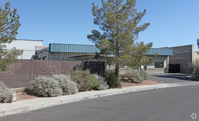
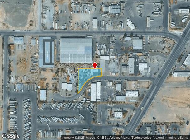
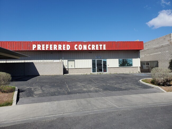
1012 Sharp Cir
Las Vegas-Henderson-Paradise, NV
Losee Indst Park Sub
139-11-413-014
LOSEE INDST PARK SUB PLAT BOOK 33 PAGE 3 LOT 14 BLOCK 1
Commercialnec
Clark
X
Nevada
32003C2160F
14
2026
0.70 AC
2025
North Las Vegas
003626
Las Vegas
3,200 SF
DEMOGRAPHICS near 1012 Sharp Cir
1 Mile
3 Mile
5 Mile
2024 Total Population
10,151
173,097
466,336
2029 Population
10,832
185,507
500,192
Pop Growth 2024-2029
+ 6.71%
+ 7.17%
+ 7.26%
Average Age
32
35
35
2024 Total Households
2,817
51,358
150,878
HH Growth 2024-2029
+ 6.64%
+ 7.27%
+ 7.27%
Median Household Inc
$41,845
$48,927
$48,273
Avg Household Size
3.40
3.20
3.00
2024 Avg HH Vehicles
2.00
2.00
2.00
Median Home Value
$239,893
$260,902
$284,651
Median Year Built
1975
1991
1993
Nearby Places
Map Layers
Map Styles
 Street
 Aerial
- Restaurants
- Banks
- Shops
- Fitness
- Groceries
PUBLIC TRANSPORTATION
AIRPORT
Harry Reid International
DRIVE
WALK
Distance
Harry Reid International
20 min
12.1 mi
Boulder City Municipal
DRIVE
WALK
Distance
Boulder City Municipal
40 min
28.6 mi
SALE & LEASE HISTORY
LISTING DATE
SALE/LEASE

Oct 05, 2020
For Lease
Mar 03, 2020
For Sale
Apr 12, 2021
For Lease
Nearby Properties
Address
Land Use
TOTAL SIZE
Lot Size
Zoning
Address
Land Use
TOTAL SIZE
Lot Size
Zoning
1,767,948 SF
142.04 AC
Address
Land Use
TOTAL SIZE
Lot Size
Zoning
252,005 SF
27.94 AC
C3
Address
Land Use
TOTAL SIZE
Lot Size
Zoning
724,845 SF
37.33 AC
M2
Address
Land Use
TOTAL SIZE
Lot Size
Zoning
9,738 SF
20.40 AC
Address
Land Use
TOTAL SIZE
Lot Size
Zoning
51.45 AC
R1
Address
Land Use
TOTAL SIZE
Lot Size
Zoning
747,196 SF
40.03 AC
Address
Land Use
TOTAL SIZE
Lot Size
Zoning
681,792 SF
29.65 AC
Address
Land Use
TOTAL SIZE
Lot Size
Zoning
696,064 SF
29.08 AC
Address
Land Use
TOTAL SIZE
Lot Size
Zoning
324 SF
8.74 AC
R1
Address
Land Use
TOTAL SIZE
Lot Size
Zoning
602,609 SF
27.33 AC
M2
Address
Land Use
TOTAL SIZE
Lot Size
Zoning
617,670 SF
27.90 AC
M2
Address
Land Use
TOTAL SIZE
Lot Size
Zoning
7,724 SF
108.84 AC
R1
Address
Land Use
TOTAL SIZE
Lot Size
Zoning
3,735 SF
17.69 AC
R3
Address
Land Use
TOTAL SIZE
Lot Size
Zoning
1,608 SF
30.32 AC
RAPSP
Address
Land Use
TOTAL SIZE
Lot Size
Zoning
35.49 AC
RE
Address
Land Use
TOTAL SIZE
Lot Size
Zoning
191,879 SF
12 AC
RACHE
Address
Land Use
TOTAL SIZE
Lot Size
Zoning
546,249 SF
28.58 AC
Address
Land Use
TOTAL SIZE
Lot Size
Zoning
390,851 SF
48.43 AC
PUD
Address
Land Use
TOTAL SIZE
Lot Size
Zoning
504,501 SF
23.08 AC
M2
Address
Land Use
TOTAL SIZE
Lot Size
Zoning
513,240 SF
24.86 AC
M2
Address
Land Use
TOTAL SIZE
Lot Size
Zoning
22.77 AC
CV
Address
Land Use
TOTAL SIZE
Lot Size
Zoning
355,910 SF
18.87 AC
M2
Address
Land Use
TOTAL SIZE
Lot Size
Zoning
378,212 SF
6.38 AC
Address
Land Use
TOTAL SIZE
Lot Size
Zoning
612,680 SF
25.48 AC
M2
Address
Land Use
TOTAL SIZE
Lot Size
Zoning
371,648 SF
17.30 AC
Address
Land Use
TOTAL SIZE
Lot Size
Zoning
407,991 SF
26.52 AC
M2
Address
Land Use
TOTAL SIZE
Lot Size
Zoning
446,880 SF
23.84 AC
Address
Land Use
TOTAL SIZE
Lot Size
Zoning
445,206 SF
24.81 AC
M2
The World's #1 Commercial Real Estate Marketplace
Connect with us
© 2025 CoStar Group
The information above has been obtained from sources believed reliable. While we do not doubt its accuracy we have not verified it and make no guarantee, warranty or representation about it. It is your responsibility to independently confirm its accuracy and completeness. Any projections, opinions, assumptions, or estimates used are for example only and do not represent the current or future performance of the property. The value of this transaction to you depends on tax and other factors which should be evaluated by your tax, financial, and legal advisors. You and your advisors should conduct a careful, independent investigation of the property to determine to your satisfaction the suitability of the property for your needs.