Property Record
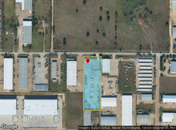
1012 W Harris Rd, Arlington, TX 76001

NEARBY LISTINGS FOR SALE OR LEASE
Property Detail
1012 W Harris Rd
Dallas-Fort Worth-Arlington, TX
Arlington South Industrial Pk
06697488
ARLINGTON SOUTH INDUSTRIAL PK BLOCK I LOT 15R
Commercialnec
Tarrant
X
Texas
48439C0345K
15r
2024
2.82 AC
2025
Arlington
111567
Dallas/Ft Worth
10,737 SF
DEMOGRAPHICS near 1012 W Harris Rd
1 Mile
3 Mile
5 Mile
2024 Total Population
12,428
117,931
245,464
2029 Population
13,059
123,574
258,228
Pop Growth 2024-2029
+ 5.08%
+ 4.79%
+ 5.20%
Average Age
36
37
37
2024 Total Households
3,660
37,786
81,962
HH Growth 2024-2029
+ 5.14%
+ 4.80%
+ 5.26%
Median Household Inc
$79,980
$92,391
$88,690
Avg Household Size
3.20
3.00
2.90
2024 Avg HH Vehicles
2.00
2.00
2.00
Median Home Value
$245,685
$270,447
$273,051
Median Year Built
1997
1997
1995
Nearby Places
Map Layers
Map Styles
 Street
 Aerial
- Restaurants
- Banks
- Shops
- Fitness
- Groceries
PUBLIC TRANSPORTATION
AIRPORT
Dallas-Fort Worth International
DRIVE
WALK
Distance
Dallas-Fort Worth International
37 min
24.5 mi
Dallas Love Field
DRIVE
WALK
Distance
Dallas Love Field
46 min
33.8 mi
Freight Ports
Port of Shreveport
DRIVE
WALK
Distance
Port of Shreveport
237 min
219.5 mi
Nearby Properties
Address
Land Use
TOTAL SIZE
Lot Size
Zoning
Address
Land Use
TOTAL SIZE
Lot Size
Zoning
348,951 SF
18.66 AC
Address
Land Use
TOTAL SIZE
Lot Size
Zoning
419,875 SF
108.14 AC
Address
Land Use
TOTAL SIZE
Lot Size
Zoning
160,000 SF
26.90 AC
Address
Land Use
TOTAL SIZE
Lot Size
Zoning
246,204 SF
15.16 AC
Address
Land Use
TOTAL SIZE
Lot Size
Zoning
258,908 SF
22.41 AC
Address
Land Use
TOTAL SIZE
Lot Size
Zoning
249,922 SF
17.26 AC
Address
Land Use
TOTAL SIZE
Lot Size
Zoning
255,134 SF
21.62 AC
Address
Land Use
TOTAL SIZE
Lot Size
Zoning
209,307 SF
15.34 AC
Address
Land Use
TOTAL SIZE
Lot Size
Zoning
208,630 SF
8.62 AC
Address
Land Use
TOTAL SIZE
Lot Size
Zoning
231,551 SF
25.69 AC
Address
Land Use
TOTAL SIZE
Lot Size
Zoning
171,820 SF
59.63 AC
Address
Land Use
TOTAL SIZE
Lot Size
Zoning
258,465 SF
8.99 AC
Address
Land Use
TOTAL SIZE
Lot Size
Zoning
177,384 SF
28.68 AC
Address
Land Use
TOTAL SIZE
Lot Size
Zoning
182,763 SF
10.54 AC
Address
Land Use
TOTAL SIZE
Lot Size
Zoning
165,842 SF
9.48 AC
Address
Land Use
TOTAL SIZE
Lot Size
Zoning
399,496 SF
23.29 AC
Address
Land Use
TOTAL SIZE
Lot Size
Zoning
157,094 SF
9.09 AC
Address
Land Use
TOTAL SIZE
Lot Size
Zoning
276,267 SF
16.10 AC
Address
Land Use
TOTAL SIZE
Lot Size
Zoning
427,622 SF
24.26 AC
Address
Land Use
TOTAL SIZE
Lot Size
Zoning
111,764 SF
10.34 AC
Address
Land Use
TOTAL SIZE
Lot Size
Zoning
160,000 SF
37.89 AC
Address
Land Use
TOTAL SIZE
Lot Size
Zoning
302,278 SF
20.61 AC
Address
Land Use
TOTAL SIZE
Lot Size
Zoning
82,343 SF
8.14 AC
Address
Land Use
TOTAL SIZE
Lot Size
Zoning
275,337 SF
14 AC
Address
Land Use
TOTAL SIZE
Lot Size
Zoning
158,103 SF
13.27 AC
Address
Land Use
TOTAL SIZE
Lot Size
Zoning
86,342 SF
12.15 AC
Address
Land Use
TOTAL SIZE
Lot Size
Zoning
1,300 SF
39.58 AC
Address
Land Use
TOTAL SIZE
Lot Size
Zoning
231,131 SF
0.99 AC
Address
Land Use
TOTAL SIZE
Lot Size
Zoning
84,455 SF
12.24 AC
Address
Land Use
TOTAL SIZE
Lot Size
Zoning
3,600 SF
43.24 AC
The World's #1 Commercial Real Estate Marketplace
Connect with us
© 2026 CoStar Group
The information above has been obtained from sources believed reliable. While we do not doubt its accuracy we have not verified it and make no guarantee, warranty or representation about it. It is your responsibility to independently confirm its accuracy and completeness. Any projections, opinions, assumptions, or estimates used are for example only and do not represent the current or future performance of the property. The value of this transaction to you depends on tax and other factors which should be evaluated by your tax, financial, and legal advisors. You and your advisors should conduct a careful, independent investigation of the property to determine to your satisfaction the suitability of the property for your needs.