Property Record
10121 Sinton Dr, Pensacola, FL 32507

NEARBY LISTINGS FOR SALE OR LEASE
-
-
View all Pensacola listings for sale on LoopNet.com
Property Detail
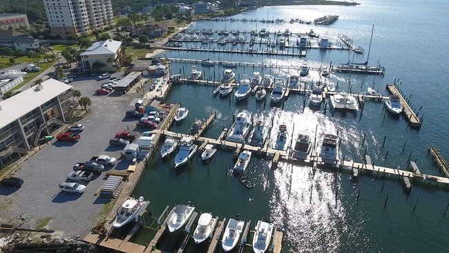
10121 Sinton Dr
Pensacola-Ferry Pass-Brent, FL
Quinavista
24-3S-31-1102-003-007
LT 1 2 3 4 5 6 7 & 8 BLK 4 SOUTHWIND S/D PB 11 P 23 OR 9283 P 594
Airport
Escambia
VE
Florida
12033C0528G
1
2024
1.27 AC
2025
Perdido
002607
Pensacola
224 SF
DEMOGRAPHICS near 10121 Sinton Dr
1 Mile
3 Mile
5 Mile
2024 Total Population
3,155
9,860
28,818
2029 Population
3,220
10,116
30,075
Pop Growth 2024-2029
+ 2.06%
+ 2.60%
+ 4.36%
Average Age
44
41
41
2024 Total Households
1,289
4,006
11,106
HH Growth 2024-2029
+ 2.17%
+ 2.57%
+ 4.86%
Median Household Inc
$98,354
$78,892
$69,985
Avg Household Size
2.40
2.40
2.40
2024 Avg HH Vehicles
2.00
2.00
2.00
Median Home Value
$350,766
$285,354
$268,823
Median Year Built
2001
1998
1996
Nearby Places
Map Layers
Map Styles
 Street
 Aerial
- Restaurants
- Banks
- Shops
- Fitness
- Groceries
PUBLIC TRANSPORTATION
AIRPORT
Pensacola International
DRIVE
WALK
Distance
Pensacola International
34 min
17.8 mi
Freight Ports
Port of Mobile
DRIVE
WALK
Distance
Port of Mobile
80 min
63.3 mi
SALE & LEASE HISTORY
LISTING DATE
SALE/LEASE

May 25, 2017
For Sale
Feb 22, 2017
For Sale
Aug 12, 2020
For Sale
Nearby Properties
Address
Land Use
TOTAL SIZE
Lot Size
Zoning
Address
Land Use
TOTAL SIZE
Lot Size
Zoning
124.51 AC
NONE
Address
Land Use
TOTAL SIZE
Lot Size
Zoning
73.08 AC
NONE
Address
Land Use
TOTAL SIZE
Lot Size
Zoning
199,800 SF
14.05 AC
HC/LI
Address
Land Use
TOTAL SIZE
Lot Size
Zoning
106.11 AC
NONE
Address
Land Use
TOTAL SIZE
Lot Size
Zoning
174,904 SF
12.71 AC
HC/LI
Address
Land Use
TOTAL SIZE
Lot Size
Zoning
193,561 SF
23.31 AC
COM
Address
Land Use
TOTAL SIZE
Lot Size
Zoning
381,252 SF
25.22 AC
COM
Address
Land Use
TOTAL SIZE
Lot Size
Zoning
72.60 AC
NONE
Address
Land Use
TOTAL SIZE
Lot Size
Zoning
174.99 AC
NONE
Address
Land Use
TOTAL SIZE
Lot Size
Zoning
153,007 SF
6.34 AC
COM
Address
Land Use
TOTAL SIZE
Lot Size
Zoning
208,596 SF
24.20 AC
COM
Address
Land Use
TOTAL SIZE
Lot Size
Zoning
53.94 AC
NONE
Address
Land Use
TOTAL SIZE
Lot Size
Zoning
20,818 SF
104.24 AC
NONE
Address
Land Use
TOTAL SIZE
Lot Size
Zoning
39 AC
NONE
Address
Land Use
TOTAL SIZE
Lot Size
Zoning
138,339 SF
57.97 AC
LDR
Address
Land Use
TOTAL SIZE
Lot Size
Zoning
128,434 SF
11.44 AC
COM
Address
Land Use
TOTAL SIZE
Lot Size
Zoning
36,960 SF
15.78 AC
COM
Address
Land Use
TOTAL SIZE
Lot Size
Zoning
41,837 SF
16.61 AC
MDR
Address
Land Use
TOTAL SIZE
Lot Size
Zoning
64,000 SF
4.72 AC
COM
Address
Land Use
TOTAL SIZE
Lot Size
Zoning
24,200 SF
3 AC
COM
Address
Land Use
TOTAL SIZE
Lot Size
Zoning
20,157 SF
2.60 AC
COM
Address
Land Use
TOTAL SIZE
Lot Size
Zoning
17,664 SF
0.82 AC
HDMU
Address
Land Use
TOTAL SIZE
Lot Size
Zoning
2,500 SF
32.40 AC
HC/LI
Address
Land Use
TOTAL SIZE
Lot Size
Zoning
48,126 SF
6.88 AC
HDMU
Address
Land Use
TOTAL SIZE
Lot Size
Zoning
5,685 SF
9.87 AC
COM
Address
Land Use
TOTAL SIZE
Lot Size
Zoning
6,937 SF
0.88 AC
COM
Address
Land Use
TOTAL SIZE
Lot Size
Zoning
9,621 SF
1.01 AC
COM
Address
Land Use
TOTAL SIZE
Lot Size
Zoning
47,000 SF
5.05 AC
COM
Address
Land Use
TOTAL SIZE
Lot Size
Zoning
9,960 SF
1.15 AC
COM
Address
Land Use
TOTAL SIZE
Lot Size
Zoning
30,670 SF
2.60 AC
HC/LI
The World's #1 Commercial Real Estate Marketplace
Connect with us
© 2026 CoStar Group
The information above has been obtained from sources believed reliable. While we do not doubt its accuracy we have not verified it and make no guarantee, warranty or representation about it. It is your responsibility to independently confirm its accuracy and completeness. Any projections, opinions, assumptions, or estimates used are for example only and do not represent the current or future performance of the property. The value of this transaction to you depends on tax and other factors which should be evaluated by your tax, financial, and legal advisors. You and your advisors should conduct a careful, independent investigation of the property to determine to your satisfaction the suitability of the property for your needs.