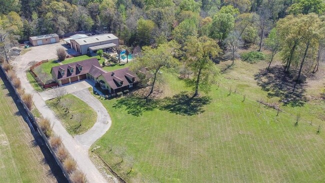
Property Record
10125 Fostoria Rd, Cleveland, TX 77328


NEARBY LISTINGS FOR SALE OR LEASE
Property Detail
10125 Fostoria Rd
Houston-Pasadena-The Woodlands, TX
M B Lawrence
000306-000222-000
000306 M B LAWRENCE, TRACT 222, ACRES 2.983
Commercialnec
Liberty
X
Texas
48339C0450G
222
2024
2.98 AC
2025
Liberty County
700100
Houston
5,706 SF
DEMOGRAPHICS near 10125 Fostoria Rd
1 Mile
3 Mile
5 Mile
2024 Total Population
1,955
8,282
25,372
2029 Population
2,524
10,559
32,192
Pop Growth 2024-2029
+ 29.10%
+ 27.49%
+ 26.88%
Average Age
36
36
36
2024 Total Households
613
2,623
8,174
HH Growth 2024-2029
+ 28.55%
+ 27.11%
+ 26.44%
Median Household Inc
$50,119
$61,841
$53,861
Avg Household Size
3.00
3.00
3.00
2024 Avg HH Vehicles
2.00
2.00
2.00
Median Home Value
$142,126
$182,688
$163,921
Median Year Built
1995
1997
1995
Nearby Places
Map Layers
Map Styles
 Street
 Aerial
- Restaurants
- Banks
- Shops
- Fitness
- Groceries
PUBLIC TRANSPORTATION
AIRPORT
George Bush Intcntl/Houston
DRIVE
WALK
Distance
George Bush Intcntl/Houston
41 min
30.7 mi
Freight Ports
Port of Houston
DRIVE
WALK
Distance
Port of Houston
62 min
46.1 mi
SALE & LEASE HISTORY
LISTING DATE
SALE/LEASE

Dec 08, 2023
For Sale
Nearby Properties
Address
Land Use
TOTAL SIZE
Lot Size
Zoning
Address
Land Use
TOTAL SIZE
Lot Size
Zoning
84,249 SF
38.34 AC
Address
Land Use
TOTAL SIZE
Lot Size
Zoning
40,592 SF
33.55 AC
Address
Land Use
TOTAL SIZE
Lot Size
Zoning
32,600 SF
9.21 AC
5
Address
Land Use
TOTAL SIZE
Lot Size
Zoning
35,450 SF
17.90 AC
Address
Land Use
TOTAL SIZE
Lot Size
Zoning
12,634 SF
4.74 AC
Address
Land Use
TOTAL SIZE
Lot Size
Zoning
44,160 SF
10.98 AC
5
Address
Land Use
TOTAL SIZE
Lot Size
Zoning
93,030 SF
7.22 AC
Address
Land Use
TOTAL SIZE
Lot Size
Zoning
17,158 SF
11.25 AC
Address
Land Use
TOTAL SIZE
Lot Size
Zoning
9,880 SF
1.69 AC
Address
Land Use
TOTAL SIZE
Lot Size
Zoning
20,000 SF
39.64 AC
5
Address
Land Use
TOTAL SIZE
Lot Size
Zoning
9,740 SF
8.08 AC
5
Address
Land Use
TOTAL SIZE
Lot Size
Zoning
5,279 SF
11.33 AC
5
Address
Land Use
TOTAL SIZE
Lot Size
Zoning
31,430 SF
1.43 AC
Address
Land Use
TOTAL SIZE
Lot Size
Zoning
25,300 SF
5.13 AC
Address
Land Use
TOTAL SIZE
Lot Size
Zoning
49.40 AC
5
Address
Land Use
TOTAL SIZE
Lot Size
Zoning
9,000 SF
1.93 AC
Address
Land Use
TOTAL SIZE
Lot Size
Zoning
5.02 AC
5
Address
Land Use
TOTAL SIZE
Lot Size
Zoning
22,000 SF
3.01 AC
5
Address
Land Use
TOTAL SIZE
Lot Size
Zoning
21,840 SF
1.28 AC
Address
Land Use
TOTAL SIZE
Lot Size
Zoning
28,572 SF
3.58 AC
5
Address
Land Use
TOTAL SIZE
Lot Size
Zoning
32,154 SF
3.16 AC
Address
Land Use
TOTAL SIZE
Lot Size
Zoning
22,900 SF
4.30 AC
5
Address
Land Use
TOTAL SIZE
Lot Size
Zoning
5,500 SF
3 AC
Address
Land Use
TOTAL SIZE
Lot Size
Zoning
4,680 SF
5.19 AC
5
Address
Land Use
TOTAL SIZE
Lot Size
Zoning
19,656 SF
28.97 AC
Address
Land Use
TOTAL SIZE
Lot Size
Zoning
5,152 SF
1.86 AC
Address
Land Use
TOTAL SIZE
Lot Size
Zoning
14,000 SF
3 AC
Address
Land Use
TOTAL SIZE
Lot Size
Zoning
22,940 SF
7.56 AC
5
Address
Land Use
TOTAL SIZE
Lot Size
Zoning
18,752 SF
3.58 AC
5
The World's #1 Commercial Real Estate Marketplace
Connect with us
© 2026 CoStar Group
The information above has been obtained from sources believed reliable. While we do not doubt its accuracy we have not verified it and make no guarantee, warranty or representation about it. It is your responsibility to independently confirm its accuracy and completeness. Any projections, opinions, assumptions, or estimates used are for example only and do not represent the current or future performance of the property. The value of this transaction to you depends on tax and other factors which should be evaluated by your tax, financial, and legal advisors. You and your advisors should conduct a careful, independent investigation of the property to determine to your satisfaction the suitability of the property for your needs.