Property Record
1013 S Main St, Plymouth, MI 48170
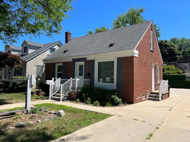
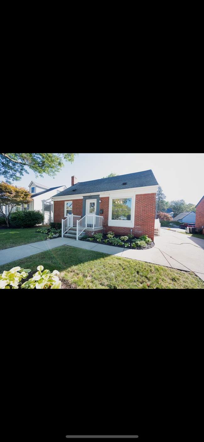
This Property Is For Sale
NEARBY LISTINGS FOR SALE OR LEASE
Property Detail
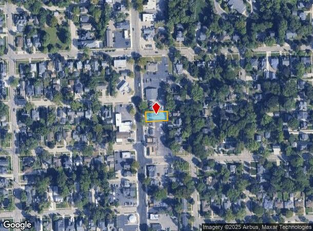
1013 S Main St
Detroit-Warren-Dearborn, MI
Brook View
49-011-03-0004-000
35C4 LOT 4 BROOK VIEW SUB TIS R8E L58 P78 WCR
Officebuilding
Wayne
X
Michigan
26163C0201E
4
2024
0.14 AC
2025
Southern I-275 Corridor
562700
Detroit
938 SF
DEMOGRAPHICS near 1013 S Main St
1 Mile
3 Mile
5 Mile
2024 Total Population
10,763
66,779
177,951
2029 Population
10,320
64,011
170,602
Pop Growth 2024-2029
(4.12%)
(4.15%)
(4.13%)
Average Age
43
43
42
2024 Total Households
4,829
27,801
72,942
HH Growth 2024-2029
(4.18%)
(4.07%)
(4.06%)
Median Household Inc
$105,818
$103,257
$96,973
Avg Household Size
2.20
2.40
2.40
2024 Avg HH Vehicles
2.00
2.00
2.00
Median Home Value
$354,457
$308,260
$301,990
Median Year Built
1965
1975
1978
Nearby Places
Map Layers
Map Styles
 Street
 Aerial
- Restaurants
- Banks
- Shops
- Fitness
- Groceries
PUBLIC TRANSPORTATION
AIRPORT
Detroit Metro Wayne County
DRIVE
WALK
Distance
Detroit Metro Wayne County
24 min
18.0 mi
Windsor International
DRIVE
WALK
Distance
Windsor International
55 min
35.6 mi
Freight Ports
Port of Toledo
DRIVE
WALK
Distance
Port of Toledo
73 min
59.7 mi
Nearby Properties
Address
Land Use
TOTAL SIZE
Lot Size
Zoning
Address
Land Use
TOTAL SIZE
Lot Size
Zoning
1,005,040 SF
Address
Land Use
TOTAL SIZE
Lot Size
Zoning
234,403 SF
74.21 AC
OS
Address
Land Use
TOTAL SIZE
Lot Size
Zoning
400,857 SF
27.44 AC
RP
Address
Land Use
TOTAL SIZE
Lot Size
Zoning
37.30 AC
MR
Address
Land Use
TOTAL SIZE
Lot Size
Zoning
517,265 SF
116.72 AC
Address
Land Use
TOTAL SIZE
Lot Size
Zoning
192,478 SF
IND
Address
Land Use
TOTAL SIZE
Lot Size
Zoning
176,796 SF
17.08 AC
C-2
Address
Land Use
TOTAL SIZE
Lot Size
Zoning
167,491 SF
18.59 AC
Address
Land Use
TOTAL SIZE
Lot Size
Zoning
408,122 SF
23.31 AC
MR
Address
Land Use
TOTAL SIZE
Lot Size
Zoning
21.71 AC
MR
Address
Land Use
TOTAL SIZE
Lot Size
Zoning
334,346 SF
55.65 AC
TAR
Address
Land Use
TOTAL SIZE
Lot Size
Zoning
311,556 SF
23.17 AC
C-3
Address
Land Use
TOTAL SIZE
Lot Size
Zoning
114,894 SF
4.94 AC
ARC
Address
Land Use
TOTAL SIZE
Lot Size
Zoning
24.63 AC
MR
Address
Land Use
TOTAL SIZE
Lot Size
Zoning
361,807 SF
18.77 AC
M-2
Address
Land Use
TOTAL SIZE
Lot Size
Zoning
225,164 SF
25.66 AC
IND
Address
Land Use
TOTAL SIZE
Lot Size
Zoning
283,710 SF
IND
Address
Land Use
TOTAL SIZE
Lot Size
Zoning
221,508 SF
26.03 AC
IND
Address
Land Use
TOTAL SIZE
Lot Size
Zoning
113,292 SF
15.79 AC
IND
Address
Land Use
TOTAL SIZE
Lot Size
Zoning
123,225 SF
9 AC
CJ/ARC
Address
Land Use
TOTAL SIZE
Lot Size
Zoning
954,882 SF
47.92 AC
LI-2
Address
Land Use
TOTAL SIZE
Lot Size
Zoning
249,795 SF
21.17 AC
Address
Land Use
TOTAL SIZE
Lot Size
Zoning
78,164 SF
5.51 AC
PUD
Address
Land Use
TOTAL SIZE
Lot Size
Zoning
186,967 SF
9.75 AC
Address
Land Use
TOTAL SIZE
Lot Size
Zoning
103,075 SF
8.15 AC
PUD
Address
Land Use
TOTAL SIZE
Lot Size
Zoning
11.40 AC
MR
Address
Land Use
TOTAL SIZE
Lot Size
Zoning
172,094 SF
11.84 AC
M-2
Address
Land Use
TOTAL SIZE
Lot Size
Zoning
16.03 AC
MR
Address
Land Use
TOTAL SIZE
Lot Size
Zoning
243,371 SF
16.04 AC
Address
Land Use
TOTAL SIZE
Lot Size
Zoning
135,586 SF
8.08 AC
IND
The World's #1 Commercial Real Estate Marketplace
Connect with us
© 2025 CoStar Group
The information above has been obtained from sources believed reliable. While we do not doubt its accuracy we have not verified it and make no guarantee, warranty or representation about it. It is your responsibility to independently confirm its accuracy and completeness. Any projections, opinions, assumptions, or estimates used are for example only and do not represent the current or future performance of the property. The value of this transaction to you depends on tax and other factors which should be evaluated by your tax, financial, and legal advisors. You and your advisors should conduct a careful, independent investigation of the property to determine to your satisfaction the suitability of the property for your needs.