Property Record
1013 Thorrez Rd, Jackson, MI 49201
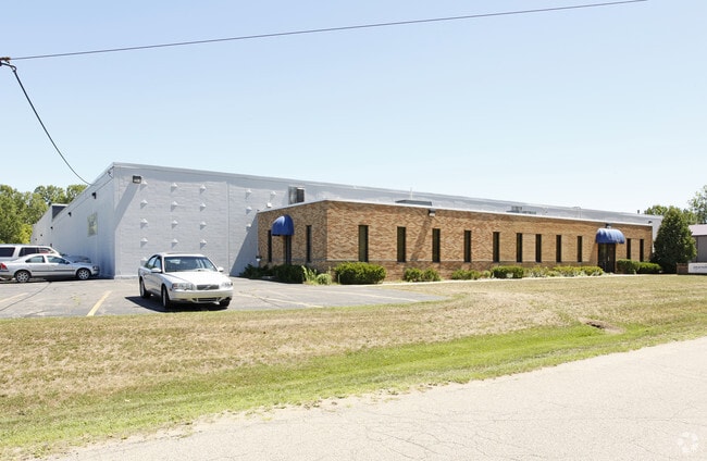


Property Detail
1013 Thorrez Rd
051-07-36-427-001-01
LOT 12 HURST RESEARCH PARK
Warehouse
Jackson
L.I-1
Michigan
B and X Area of moderate flood hazard, usually the area between the limits of the 100-year and 500-year floods.
12
2024
3.07 AC
2025
Jackson County
006500
West Michigan
51,936 SF
Jackson, MI
NEARBY LISTINGS FOR SALE OR LEASE
-
-
View all Jackson listings for lease on LoopNet.com
DEMOGRAPHICS near 1013 Thorrez Rd
1 mile
3 mile
5 mile
2025 Total Population
738
21,027
63,504
2030 Population
736
20,907
63,288
Pop Growth 2025-2030
(0.27%)
(0.57%)
(0.34%)
Average Age
42
42
40
2025 Total Households
301
9,627
26,359
HH Growth 2025-2030
(0.33%)
(0.53%)
(0.33%)
Median Household Inc
$82,143
$56,825
$54,038
Avg Household Size
2.40
2.10
2.30
2025 Avg HH Vehicles
2.00
2.00
2.00
Median Home Value
$210,606
$188,382
$167,645
Median Year Built
1968
1968
1959
Nearby Places
Map Layers
Map Styles
 Street
 Aerial
Layers
 Traffic
 Biking
Places
Listings with unknown addresses are not visible on the map
- Restaurants
- Banks
- Shops
- Fitness
- Groceries
PUBLIC TRANSPORTATION
COMMUTER RAIL
Drive
Walk
Distance
9 min
4.8 mi
SALE & LEASE HISTORY
LISTING DATE
SALE/LEASE

Sep 03, 2024
For Lease
Apr 17, 2024
For Sale
Nearby Properties
Address
Land Use
TOTAL SIZE
Lot Size
Zoning
Address
Land Use
TOTAL SIZE
Lot Size
Zoning
121,532 SF
29.94 AC
PC-1
Address
Land Use
TOTAL SIZE
Lot Size
Zoning
398,449 SF
41.51 AC
PR-1
Address
Land Use
TOTAL SIZE
Lot Size
Zoning
240,148 SF
30.64 AC
PC-1
Address
Land Use
TOTAL SIZE
Lot Size
Zoning
224,803 SF
22.59 AC
RM-1
Address
Land Use
TOTAL SIZE
Lot Size
Zoning
217,115 SF
92.26 AC
I-1
Address
Land Use
TOTAL SIZE
Lot Size
Zoning
187,264 SF
7.10 AC
R-4
Address
Land Use
TOTAL SIZE
Lot Size
Zoning
302,225 SF
55.18 AC
I-2
Address
Land Use
TOTAL SIZE
Lot Size
Zoning
123,770 SF
I-2
Address
Land Use
TOTAL SIZE
Lot Size
Zoning
202,757 SF
13 AC
PC-1
Address
Land Use
TOTAL SIZE
Lot Size
Zoning
84,489 SF
55.50 AC
RM-1
Address
Land Use
TOTAL SIZE
Lot Size
Zoning
145,152 SF
41.45 AC
RM-1
Address
Land Use
TOTAL SIZE
Lot Size
Zoning
84,084 SF
6.50 AC
PB
Address
Land Use
TOTAL SIZE
Lot Size
Zoning
242,708 SF
29.44 AC
PC-1
Address
Land Use
TOTAL SIZE
Lot Size
Zoning
110,011 SF
12.50 AC
Address
Land Use
TOTAL SIZE
Lot Size
Zoning
207,420 SF
15.10 AC
RM-1
Address
Land Use
TOTAL SIZE
Lot Size
Zoning
217,324 SF
40.24 AC
I-2
Address
Land Use
TOTAL SIZE
Lot Size
Zoning
137,313 SF
23.30 AC
C-3
Address
Land Use
TOTAL SIZE
Lot Size
Zoning
159,432 SF
31.90 AC
RM-1
Address
Land Use
TOTAL SIZE
Lot Size
Zoning
98,560 SF
13.35 AC
RM-1
Address
Land Use
TOTAL SIZE
Lot Size
Zoning
110,894 SF
21.68 AC
PR-1
Address
Land Use
TOTAL SIZE
Lot Size
Zoning
79,923 SF
8.17 AC
C-2
Address
Land Use
TOTAL SIZE
Lot Size
Zoning
54,672 SF
5.93 AC
C-2
Address
Land Use
TOTAL SIZE
Lot Size
Zoning
23 AC
O-1
Address
Land Use
TOTAL SIZE
Lot Size
Zoning
130,497 SF
13.51 AC
C-2
Address
Land Use
TOTAL SIZE
Lot Size
Zoning
66,062 SF
3.38 AC
PC-1
Address
Land Use
TOTAL SIZE
Lot Size
Zoning
67,589 SF
8.50 AC
PB
Address
Land Use
TOTAL SIZE
Lot Size
Zoning
65,979 SF
6.46 AC
RM-1
Address
Land Use
TOTAL SIZE
Lot Size
Zoning
85,292 SF
8.58 AC
RM-1
Address
Land Use
TOTAL SIZE
Lot Size
Zoning
114,030 SF
14.80 AC
PR1
Address
Land Use
TOTAL SIZE
Lot Size
Zoning
83,345 SF
5.96 AC
C-4
The World's #1 Commercial Real Estate Marketplace
Connect with us
© 2026 CoStar Group
The information above has been obtained from sources believed reliable. While we do not doubt its accuracy we have not verified it and make no guarantee, warranty or representation about it. It is your responsibility to independently confirm its accuracy and completeness. Any projections, opinions, assumptions, or estimates used are for example only and do not represent the current or future performance of the property. The value of this transaction to you depends on tax and other factors which should be evaluated by your tax, financial, and legal advisors. You and your advisors should conduct a careful, independent investigation of the property to determine to your satisfaction the suitability of the property for your needs.