Property Record
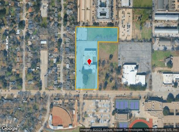
1013 W Park Row Dr, Arlington, TX 76013


NEARBY LISTINGS FOR SALE OR LEASE
Property Detail
1013 W Park Row Dr
41406095
University Bap Church Sub
Commercialnec
UNIVERSITY BAP CHURCH SUB BLOCK AR
X
Tarrant
48439C0355L
Texas
0
4.92 AC
2025
Arlington/Mansfield
122402
Dallas/Ft Worth
43,560 SF
Dallas-Fort Worth-Arlington, TX
DEMOGRAPHICS near 1013 W Park Row Dr
1 mile
3 mile
5 mile
2024 Total Population
21,850
145,804
308,230
2029 Population
23,311
153,953
324,756
Pop Growth 2024-2029
+ 6.69%
+ 5.59%
+ 5.36%
Average Age
32
36
36
2024 Total Households
7,810
52,288
116,740
HH Growth 2024-2029
+ 7.07%
+ 5.74%
+ 5.46%
Median Household Inc
$37,009
$50,294
$55,966
Avg Household Size
2.30
2.60
2.50
2024 Avg HH Vehicles
2.00
2.00
2.00
Median Home Value
$251,777
$224,552
$239,551
Median Year Built
1978
1975
1981
Nearby Places
Map Layers
Map Styles
 Street
 Aerial
Transit
 Traffic
 Biking
Places
Listings with unknown addresses are not visible on the map
- Restaurants
- Banks
- Shops
- Fitness
- Groceries
PUBLIC TRANSPORTATION
COMMUTER RAIL
Hurst/Bell (TRINITY RAILWAY - Dallas Area Rapid Transit (DART), Trinity Railway Express - Dallas Area Rapid Transit (DART))
Drive
Walk
Distance
Hurst/Bell (TRINITY RAILWAY - Dallas Area Rapid Transit (DART), Trinity Railway Express - Dallas Area Rapid Transit (DART))
19 min
8.0 mi
AIRPORT
Dallas-Fort Worth International
Drive
Walk
Distance
Dallas-Fort Worth International
27 min
17.7 mi
Dallas Love Field
Drive
Walk
Distance
Dallas Love Field
39 min
26.4 mi
Freight Ports
Port of Shreveport
Drive
Walk
Distance
Port of Shreveport
237 min
217.9 mi
Nearby Properties
Address
Land Use
TOTAL SIZE
Lot Size
Zoning
Address
Land Use
TOTAL SIZE
Lot Size
Zoning
1,700,000 SF
8.23 AC
Address
Land Use
TOTAL SIZE
Lot Size
Zoning
3,015,800 SF
72.86 AC
Address
Land Use
TOTAL SIZE
Lot Size
Zoning
1,400,000 SF
15.30 AC
Address
Land Use
TOTAL SIZE
Lot Size
Zoning
1,342,617 SF
40.67 AC
Address
Land Use
TOTAL SIZE
Lot Size
Zoning
269,257 SF
21.33 AC
Address
Land Use
TOTAL SIZE
Lot Size
Zoning
569,876 SF
47.80 AC
Address
Land Use
TOTAL SIZE
Lot Size
Zoning
378,182 SF
5.02 AC
Address
Land Use
TOTAL SIZE
Lot Size
Zoning
287,560 SF
3.28 AC
Address
Land Use
TOTAL SIZE
Lot Size
Zoning
1,129,022 SF
16.84 AC
Address
Land Use
TOTAL SIZE
Lot Size
Zoning
320,636 SF
12.71 AC
Address
Land Use
TOTAL SIZE
Lot Size
Zoning
595,207 SF
7.20 AC
Address
Land Use
TOTAL SIZE
Lot Size
Zoning
537,189 SF
29.08 AC
Address
Land Use
TOTAL SIZE
Lot Size
Zoning
492,970 SF
44.82 AC
Address
Land Use
TOTAL SIZE
Lot Size
Zoning
799,893 SF
19.43 AC
Address
Land Use
TOTAL SIZE
Lot Size
Zoning
462,207 SF
2.82 AC
Address
Land Use
TOTAL SIZE
Lot Size
Zoning
578,395 SF
6.22 AC
Address
Land Use
TOTAL SIZE
Lot Size
Zoning
422,300 SF
2.50 AC
Address
Land Use
TOTAL SIZE
Lot Size
Zoning
347,421 SF
4.47 AC
Address
Land Use
TOTAL SIZE
Lot Size
Zoning
548,806 SF
5.56 AC
Address
Land Use
TOTAL SIZE
Lot Size
Zoning
377,463 SF
19.50 AC
Address
Land Use
TOTAL SIZE
Lot Size
Zoning
139,821 SF
Address
Land Use
TOTAL SIZE
Lot Size
Zoning
492,837 SF
4.99 AC
Address
Land Use
TOTAL SIZE
Lot Size
Zoning
389,946 SF
2.35 AC
Address
Land Use
TOTAL SIZE
Lot Size
Zoning
462,396 SF
25.76 AC
Address
Land Use
TOTAL SIZE
Lot Size
Zoning
539,000 SF
3.91 AC
Address
Land Use
TOTAL SIZE
Lot Size
Zoning
280,000 SF
10.85 AC
Address
Land Use
TOTAL SIZE
Lot Size
Zoning
296,092 SF
7.66 AC
Address
Land Use
TOTAL SIZE
Lot Size
Zoning
327,309 SF
3.45 AC
Address
Land Use
TOTAL SIZE
Lot Size
Zoning
720,000 SF
9.80 AC
Address
Land Use
TOTAL SIZE
Lot Size
Zoning
162,537 SF
19.70 AC
The World's #1 Commercial Real Estate Marketplace
Connect with us
© 2026 CoStar Group
The information above has been obtained from sources believed reliable. While we do not doubt its accuracy we have not verified it and make no guarantee, warranty or representation about it. It is your responsibility to independently confirm its accuracy and completeness. Any projections, opinions, assumptions, or estimates used are for example only and do not represent the current or future performance of the property. The value of this transaction to you depends on tax and other factors which should be evaluated by your tax, financial, and legal advisors. You and your advisors should conduct a careful, independent investigation of the property to determine to your satisfaction the suitability of the property for your needs.