Property Record
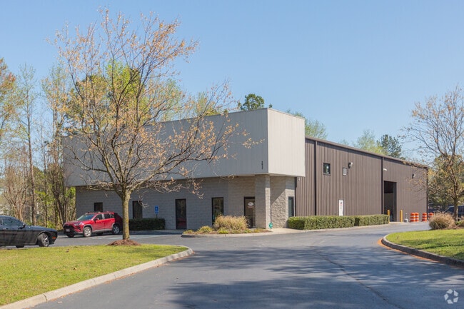
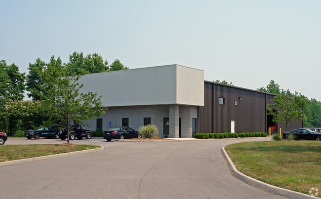
1013 Wallboard Dr, Chesapeake, VA 23323

Property Detail
1013 Wallboard Dr
0240000001720
PAR 93 SUBD PROP INDUSTRIAL DEVE AUTHORITY 10.470A
Warehouse
CHESAPEAKE
M1: LIGHT
Virginia
C and X Area of minimal flood hazard, usually depicted on FIRMs as above the 500-year flood level.
10.47 AC
2024
Cavalier
2025
Hampton Roads
021402
Virginia Beach-Chesapeake-Norfolk, VA-NC
11,156 SF
NEARBY LISTINGS FOR SALE OR LEASE
DEMOGRAPHICS near 1013 Wallboard Dr
1 mile
3 mile
5 mile
2025 Total Population
1,855
48,087
126,304
2030 Population
1,840
47,992
126,924
Pop Growth 2025-2030
(0.81%)
(0.20%)
+ 0.49%
Average Age
46
40
38
2025 Total Households
726
18,091
46,967
HH Growth 2025-2030
(0.83%)
(0.30%)
+ 0.41%
Median Household Inc
$66,079
$70,385
$72,309
Avg Household Size
2.50
2.60
2.60
2025 Avg HH Vehicles
2.00
2.00
2.00
Median Home Value
$320,175
$272,962
$299,888
Median Year Built
1976
1972
1974
Nearby Places
Map Layers
Map Styles
 Street
 Aerial
Transit
 Traffic
 Biking
Places
Listings with unknown addresses are not visible on the map
- Restaurants
- Banks
- Shops
- Fitness
- Groceries
PUBLIC TRANSPORTATION
COMMUTER RAIL
Norfolk (Northeast Regional - Amtrak)
Drive
Walk
Distance
Norfolk (Northeast Regional - Amtrak)
18 min
8.8 mi
AIRPORT
Norfolk International
Drive
Walk
Distance
Norfolk International
30 min
15.2 mi
Newport News/Williamsburg International
Drive
Walk
Distance
Newport News/Williamsburg International
51 min
35.6 mi
Freight Ports
Virginia Port Authority - Portsmouth
Drive
Walk
Distance
Virginia Port Authority - Portsmouth
20 min
8.1 mi
SALE & LEASE HISTORY
LISTING DATE
SALE/LEASE

Nov 19, 2019
For Sale
Mar 19, 2020
For Lease
Dec 16, 2019
For Sale
Nearby Properties
Address
Land Use
TOTAL SIZE
Lot Size
Zoning
Address
Land Use
TOTAL SIZE
Lot Size
Zoning
250,000 SF
38 AC
MUH
Address
Land Use
TOTAL SIZE
Lot Size
Zoning
300,829 SF
38.40 AC
IL
Address
Land Use
TOTAL SIZE
Lot Size
Zoning
71,039 SF
22.69 AC
R10S: RESI
Address
Land Use
TOTAL SIZE
Lot Size
Zoning
1,684 SF
23.36 AC
RMF1: MULT
Address
Land Use
TOTAL SIZE
Lot Size
Zoning
120,471 SF
10.32 AC
M1: LIGHT
Address
Land Use
TOTAL SIZE
Lot Size
Zoning
295,000 SF
27.89 AC
M1: LIGHT
Address
Land Use
TOTAL SIZE
Lot Size
Zoning
178,068 SF
14.72 AC
M1: LIGHT
Address
Land Use
TOTAL SIZE
Lot Size
Zoning
206,652 SF
64.32 AC
A1: AGRICU
Address
Land Use
TOTAL SIZE
Lot Size
Zoning
264,975 SF
50.36 AC
R10S: RESI
Address
Land Use
TOTAL SIZE
Lot Size
Zoning
333,833 SF
23.53 AC
M1: LIGHT
Address
Land Use
TOTAL SIZE
Lot Size
Zoning
241,397 SF
50.65 AC
M1: LIGHT
Address
Land Use
TOTAL SIZE
Lot Size
Zoning
195,550 SF
8.58 AC
M1: LIGHT
Address
Land Use
TOTAL SIZE
Lot Size
Zoning
181,723 SF
41.87 AC
M1: LIGHT
Address
Land Use
TOTAL SIZE
Lot Size
Zoning
274,700 SF
24.69 AC
UR
Address
Land Use
TOTAL SIZE
Lot Size
Zoning
143,220 SF
44.78 AC
M1: LIGHT
Address
Land Use
TOTAL SIZE
Lot Size
Zoning
130,510 SF
33.74 AC
M1: LIGHT
Address
Land Use
TOTAL SIZE
Lot Size
Zoning
2,434 SF
39.25 AC
B2: GENERA
Address
Land Use
TOTAL SIZE
Lot Size
Zoning
85,266 SF
10.10 AC
M1: LIGHT
Address
Land Use
TOTAL SIZE
Lot Size
Zoning
205,470 SF
12.39 AC
URM
Address
Land Use
TOTAL SIZE
Lot Size
Zoning
126,250 SF
31.69 AC
R10S: RESI
Address
Land Use
TOTAL SIZE
Lot Size
Zoning
193,534 SF
17.99 AC
M1: LIGHT
Address
Land Use
TOTAL SIZE
Lot Size
Zoning
167,400 SF
10.74 AC
M1: LIGHT
Address
Land Use
TOTAL SIZE
Lot Size
Zoning
197,533 SF
15 AC
M1: LIGHT
Address
Land Use
TOTAL SIZE
Lot Size
Zoning
98,715 SF
20.64 AC
UR
Address
Land Use
TOTAL SIZE
Lot Size
Zoning
155,750 SF
12.01 AC
URM
Address
Land Use
TOTAL SIZE
Lot Size
Zoning
97,012 SF
5.40 AC
URM
Address
Land Use
TOTAL SIZE
Lot Size
Zoning
50,486 SF
11.50 AC
M1: LIGHT
Address
Land Use
TOTAL SIZE
Lot Size
Zoning
48,511 SF
20.71 AC
M1: LIGHT
Address
Land Use
TOTAL SIZE
Lot Size
Zoning
135,234 SF
14.15 AC
GMU
Address
Land Use
TOTAL SIZE
Lot Size
Zoning
115,740 SF
12.07 AC
M1: LIGHT
The World's #1 Commercial Real Estate Marketplace
Connect with us
© 2026 CoStar Group
The information above has been obtained from sources believed reliable. While we do not doubt its accuracy we have not verified it and make no guarantee, warranty or representation about it. It is your responsibility to independently confirm its accuracy and completeness. Any projections, opinions, assumptions, or estimates used are for example only and do not represent the current or future performance of the property. The value of this transaction to you depends on tax and other factors which should be evaluated by your tax, financial, and legal advisors. You and your advisors should conduct a careful, independent investigation of the property to determine to your satisfaction the suitability of the property for your needs.