Property Record
10134 Us Highway 50, Poncha Springs, CO 81242
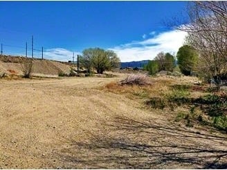

Property Detail
10134 Us Highway 50
R380510226196
LOT 1 ARK-VALLEY HUMANE SOCIETY AND HOLIDAY RV BLA PLAT 395169 PS52 REC 397966 499110
Storebuilding
CHAFFEE
B and X Area of moderate flood hazard, usually the area between the limits of the 100-year and 500-year floods.
Colorado
2025
1
2025
2.30 AC
000300
Colorado Southwest Area
9,671 SF
Other Market Areas
NEARBY LISTINGS FOR SALE OR LEASE
-
-
View all Poncha Springs listings for sale on LoopNet.com
DEMOGRAPHICS near 10134 Us Highway 50
1 mile
3 mile
5 mile
2025 Total Population
1,022
1,861
8,266
2030 Population
1,089
1,973
8,667
Pop Growth 2025-2030
+ 6.56%
+ 6.02%
+ 4.85%
Average Age
46
46
47
2025 Total Households
479
867
3,892
HH Growth 2025-2030
+ 6.68%
+ 6.34%
+ 5.16%
Median Household Inc
$86,475
$84,598
$76,095
Avg Household Size
2.10
2.10
2.10
2025 Avg HH Vehicles
2.00
2.00
2.00
Median Home Value
$729,729
$737,857
$697,797
Median Year Built
2001
2000
1994
Nearby Places
Map Layers
Map Styles
 Street
 Aerial
Layers
 Traffic
 Biking
Places
Listings with unknown addresses are not visible on the map
- Restaurants
- Banks
- Shops
- Fitness
- Groceries
Nearby Properties
Address
Land Use
TOTAL SIZE
Lot Size
Zoning
Address
Land Use
TOTAL SIZE
Lot Size
Zoning
32,100 SF
1.33 AC
Address
Land Use
TOTAL SIZE
Lot Size
Zoning
55,512 SF
4.19 AC
Address
Land Use
TOTAL SIZE
Lot Size
Zoning
35,395 SF
2.96 AC
Address
Land Use
TOTAL SIZE
Lot Size
Zoning
21,700 SF
20 AC
Address
Land Use
TOTAL SIZE
Lot Size
Zoning
54,950 SF
4.15 AC
Address
Land Use
TOTAL SIZE
Lot Size
Zoning
9,660 SF
70.58 AC
Address
Land Use
TOTAL SIZE
Lot Size
Zoning
44,600 SF
10.36 AC
Address
Land Use
TOTAL SIZE
Lot Size
Zoning
3,915 SF
208.75 AC
Address
Land Use
TOTAL SIZE
Lot Size
Zoning
19,520 SF
16.02 AC
Address
Land Use
TOTAL SIZE
Lot Size
Zoning
35,500 SF
6.47 AC
Address
Land Use
TOTAL SIZE
Lot Size
Zoning
10,572 SF
2.36 AC
Address
Land Use
TOTAL SIZE
Lot Size
Zoning
26,080 SF
1.91 AC
Address
Land Use
TOTAL SIZE
Lot Size
Zoning
8,000 SF
0.56 AC
Address
Land Use
TOTAL SIZE
Lot Size
Zoning
31,200 SF
1.74 AC
Address
Land Use
TOTAL SIZE
Lot Size
Zoning
120 SF
59.52 AC
Address
Land Use
TOTAL SIZE
Lot Size
Zoning
17,060 SF
3.27 AC
Address
Land Use
TOTAL SIZE
Lot Size
Zoning
15,000 SF
2.07 AC
Address
Land Use
TOTAL SIZE
Lot Size
Zoning
8,848 SF
3.35 AC
Address
Land Use
TOTAL SIZE
Lot Size
Zoning
24,000 SF
3.36 AC
Address
Land Use
TOTAL SIZE
Lot Size
Zoning
12,400 SF
2.60 AC
Address
Land Use
TOTAL SIZE
Lot Size
Zoning
3,484 SF
185 AC
Address
Land Use
TOTAL SIZE
Lot Size
Zoning
13,102 SF
1.42 AC
Address
Land Use
TOTAL SIZE
Lot Size
Zoning
1,107 SF
0.89 AC
Address
Land Use
TOTAL SIZE
Lot Size
Zoning
23,468 SF
Address
Land Use
TOTAL SIZE
Lot Size
Zoning
21,104 SF
1.15 AC
Address
Land Use
TOTAL SIZE
Lot Size
Zoning
9.50 AC
Address
Land Use
TOTAL SIZE
Lot Size
Zoning
4,800 SF
3.65 AC
Address
Land Use
TOTAL SIZE
Lot Size
Zoning
3,870 SF
0.97 AC
Address
Land Use
TOTAL SIZE
Lot Size
Zoning
3,360 SF
10.34 AC
The World's #1 Commercial Real Estate Marketplace
Connect with us
© 2026 CoStar Group
The information above has been obtained from sources believed reliable. While we do not doubt its accuracy we have not verified it and make no guarantee, warranty or representation about it. It is your responsibility to independently confirm its accuracy and completeness. Any projections, opinions, assumptions, or estimates used are for example only and do not represent the current or future performance of the property. The value of this transaction to you depends on tax and other factors which should be evaluated by your tax, financial, and legal advisors. You and your advisors should conduct a careful, independent investigation of the property to determine to your satisfaction the suitability of the property for your needs.