Property Record
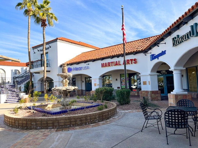
10135 E Via Linda, Scottsdale, AZ 85258


NEARBY LISTINGS FOR SALE OR LEASE
Property Detail
10135 E Via Linda
217-35-985H
TH PT SE4 SEC LY S OF VIA LINDA AVE & NLY OF MOUNTAIN VIEW RD EX TH PT DESC P/F 84-182080 & EX PT P/F 86-054652 & EX PT P/F 91-130660
Regionalshoppingcenterormallwithanchorstore
Maricopa
X
Arizona
04013C1780L
8.59 AC
2025
Central Scottsdale
2025
Phoenix
216833
Phoenix-Mesa-Scottsdale, AZ
120,360 SF
DEMOGRAPHICS near 10135 E Via Linda
1 Mile
3 Mile
5 Mile
2024 Total Population
9,426
58,643
130,319
2029 Population
10,376
63,940
142,476
Pop Growth 2024-2029
+ 10.08%
+ 9.03%
+ 9.33%
Average Age
50
47
46
2024 Total Households
4,652
27,016
59,649
HH Growth 2024-2029
+ 10.49%
+ 9.24%
+ 9.51%
Median Household Inc
$95,239
$106,071
$108,193
Avg Household Size
2.00
2.10
2.10
2024 Avg HH Vehicles
2.00
2.00
2.00
Median Home Value
$714,896
$681,952
$692,763
Median Year Built
1985
1987
1988
Nearby Places
Map Layers
Map Styles
 Street
 Aerial
- Restaurants
- Banks
- Shops
- Fitness
- Groceries
PUBLIC TRANSPORTATION
AIRPORT
Phoenix Sky Harbor International
DRIVE
WALK
Distance
Phoenix Sky Harbor International
26 min
18.0 mi
Phoenix-Mesa Gateway
DRIVE
WALK
Distance
Phoenix-Mesa Gateway
46 min
33.0 mi
Freight Ports
Port of San Diego
DRIVE
WALK
Distance
Port of San Diego
421 min
383.5 mi
SALE & LEASE HISTORY
LISTING DATE
SALE/LEASE

Sep 24, 2016
For Lease
Apr 18, 2023
For Sale
Nearby Properties
Address
Land Use
TOTAL SIZE
Lot Size
Zoning
Address
Land Use
TOTAL SIZE
Lot Size
Zoning
500,010 SF
4.52 AC
PF
Address
Land Use
TOTAL SIZE
Lot Size
Zoning
6.71 AC
PAD
Address
Land Use
TOTAL SIZE
Lot Size
Zoning
124,656 SF
160 AC
R-35
Address
Land Use
TOTAL SIZE
Lot Size
Zoning
380,106 SF
38.10 AC
C-T
Address
Land Use
TOTAL SIZE
Lot Size
Zoning
355,757 SF
32.44 AC
C-R
Address
Land Use
TOTAL SIZE
Lot Size
Zoning
250,415 SF
21 AC
I-P
Address
Land Use
TOTAL SIZE
Lot Size
Zoning
353,691 SF
16.18 AC
M-H
Address
Land Use
TOTAL SIZE
Lot Size
Zoning
345,713 SF
18.25 AC
M-H
Address
Land Use
TOTAL SIZE
Lot Size
Zoning
247,810 SF
29.27 AC
Address
Land Use
TOTAL SIZE
Lot Size
Zoning
20,355 SF
38.96 AC
M-H
Address
Land Use
TOTAL SIZE
Lot Size
Zoning
321,782 SF
7.62 AC
M-H
Address
Land Use
TOTAL SIZE
Lot Size
Zoning
360,143 SF
11.88 AC
C-C
Address
Land Use
TOTAL SIZE
Lot Size
Zoning
339,020 SF
15.13 AC
M-H
Address
Land Use
TOTAL SIZE
Lot Size
Zoning
256,962 SF
5.20 AC
PF
Address
Land Use
TOTAL SIZE
Lot Size
Zoning
361,486 SF
16.92 AC
M-H
Address
Land Use
TOTAL SIZE
Lot Size
Zoning
184,912 SF
18.07 AC
PF
Address
Land Use
TOTAL SIZE
Lot Size
Zoning
63,321 SF
15.65 AC
R-10
Address
Land Use
TOTAL SIZE
Lot Size
Zoning
107,123 SF
8.54 AC
C-T
Address
Land Use
TOTAL SIZE
Lot Size
Zoning
143,184 SF
3.32 AC
C-T
Address
Land Use
TOTAL SIZE
Lot Size
Zoning
292,054 SF
13.87 AC
M-H
Address
Land Use
TOTAL SIZE
Lot Size
Zoning
167,091 SF
7.44 AC
C-T
Address
Land Use
TOTAL SIZE
Lot Size
Zoning
76,120 SF
35 AC
R-7
Address
Land Use
TOTAL SIZE
Lot Size
Zoning
110,582 SF
8.45 AC
C-R
Address
Land Use
TOTAL SIZE
Lot Size
Zoning
73 AC
OS
Address
Land Use
TOTAL SIZE
Lot Size
Zoning
68,276 SF
6.19 AC
C-T
Address
Land Use
TOTAL SIZE
Lot Size
Zoning
110,358 SF
6.60 AC
C-C
Address
Land Use
TOTAL SIZE
Lot Size
Zoning
73,950 SF
7.03 AC
Address
Land Use
TOTAL SIZE
Lot Size
Zoning
111,113 SF
8.09 AC
C-R
Address
Land Use
TOTAL SIZE
Lot Size
Zoning
159,188 SF
9.53 AC
C-T
The World's #1 Commercial Real Estate Marketplace
Connect with us
© 2025 CoStar Group
The information above has been obtained from sources believed reliable. While we do not doubt its accuracy we have not verified it and make no guarantee, warranty or representation about it. It is your responsibility to independently confirm its accuracy and completeness. Any projections, opinions, assumptions, or estimates used are for example only and do not represent the current or future performance of the property. The value of this transaction to you depends on tax and other factors which should be evaluated by your tax, financial, and legal advisors. You and your advisors should conduct a careful, independent investigation of the property to determine to your satisfaction the suitability of the property for your needs.