Property Record
10136 Beach Dr Sw, Calabash, NC 28467
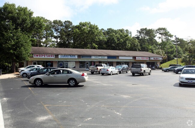


Property Detail
10136 Beach Dr Sw
25400007
.63 AC S-3 CS DB PL 385/379
Stripcommercialcenter
Brunswick
CB
North Carolina
B and X Area of moderate flood hazard, usually the area between the limits of the 100-year and 500-year floods.
0.63 AC
2025
West Brunswick
2025
Wilmington
020516
Wilmington, NC
7,000 SF
NEARBY LISTINGS FOR SALE OR LEASE
DEMOGRAPHICS near 10136 Beach Dr Sw
1 mile
3 mile
5 mile
2025 Total Population
2,694
19,610
44,671
2030 Population
3,120
22,980
52,836
Pop Growth 2025-2030
+ 15.81%
+ 17.19%
+ 18.28%
Average Age
57
55
57
2025 Total Households
1,357
9,508
22,071
HH Growth 2025-2030
+ 15.55%
+ 17.05%
+ 18.19%
Median Household Inc
$70,349
$69,218
$73,643
Avg Household Size
2.00
2.00
2.00
2025 Avg HH Vehicles
2.00
2.00
2.00
Median Home Value
$287,772
$315,806
$349,553
Median Year Built
1995
2004
2002
Nearby Places
Map Layers
Map Styles
 Street
 Aerial
Layers
 Traffic
 Biking
Places
Listings with unknown addresses are not visible on the map
- Restaurants
- Banks
- Shops
- Fitness
- Groceries
PUBLIC TRANSPORTATION
AIRPORT
Myrtle Beach International
Drive
Walk
Distance
Myrtle Beach International
47 min
30.1 mi
Freight Ports
Port of Wilmington
Drive
Walk
Distance
Port of Wilmington
73 min
50.3 mi
SALE & LEASE HISTORY
LISTING DATE
SALE/LEASE

May 08, 2020
For Lease
Jan 04, 2024
For Lease
Nearby Properties
Address
Land Use
TOTAL SIZE
Lot Size
Zoning
Address
Land Use
TOTAL SIZE
Lot Size
Zoning
Address
Land Use
TOTAL SIZE
Lot Size
Zoning
9,150 SF
28.13 AC
Address
Land Use
TOTAL SIZE
Lot Size
Zoning
95,288 SF
10.35 AC
Address
Land Use
TOTAL SIZE
Lot Size
Zoning
Address
Land Use
TOTAL SIZE
Lot Size
Zoning
19,008 SF
7.09 AC
R75
Address
Land Use
TOTAL SIZE
Lot Size
Zoning
11,748 SF
18.20 AC
R8
Address
Land Use
TOTAL SIZE
Lot Size
Zoning
10,580 SF
152.16 AC
Address
Land Use
TOTAL SIZE
Lot Size
Zoning
Address
Land Use
TOTAL SIZE
Lot Size
Zoning
156.28 AC
Address
Land Use
TOTAL SIZE
Lot Size
Zoning
43,520 SF
25.71 AC
Address
Land Use
TOTAL SIZE
Lot Size
Zoning
1,539 SF
4.25 AC
CB
Address
Land Use
TOTAL SIZE
Lot Size
Zoning
Address
Land Use
TOTAL SIZE
Lot Size
Zoning
450 SF
215.99 AC
PUD
Address
Land Use
TOTAL SIZE
Lot Size
Zoning
13,903 SF
12.80 AC
Address
Land Use
TOTAL SIZE
Lot Size
Zoning
28,437 SF
2.68 AC
Address
Land Use
TOTAL SIZE
Lot Size
Zoning
Address
Land Use
TOTAL SIZE
Lot Size
Zoning
101,133 SF
1.96 AC
HC
Address
Land Use
TOTAL SIZE
Lot Size
Zoning
13.34 AC
Address
Land Use
TOTAL SIZE
Lot Size
Zoning
9,877 SF
644.40 AC
PUD
Address
Land Use
TOTAL SIZE
Lot Size
Zoning
9,100 SF
181.26 AC
PUD
Address
Land Use
TOTAL SIZE
Lot Size
Zoning
21.42 AC
Address
Land Use
TOTAL SIZE
Lot Size
Zoning
33,186 SF
7.74 AC
Address
Land Use
TOTAL SIZE
Lot Size
Zoning
20,713 SF
2.49 AC
NB
Address
Land Use
TOTAL SIZE
Lot Size
Zoning
352 SF
8.27 AC
Address
Land Use
TOTAL SIZE
Lot Size
Zoning
34,987 SF
6.10 AC
NB
Address
Land Use
TOTAL SIZE
Lot Size
Zoning
2,378 SF
0.70 AC
Address
Land Use
TOTAL SIZE
Lot Size
Zoning
1,200 SF
11.09 AC
HC
Address
Land Use
TOTAL SIZE
Lot Size
Zoning
15,086 SF
314.53 AC
R8
Address
Land Use
TOTAL SIZE
Lot Size
Zoning
68,841 SF
4.35 AC
MR32
The World's #1 Commercial Real Estate Marketplace
Connect with us
© 2026 CoStar Group
The information above has been obtained from sources believed reliable. While we do not doubt its accuracy we have not verified it and make no guarantee, warranty or representation about it. It is your responsibility to independently confirm its accuracy and completeness. Any projections, opinions, assumptions, or estimates used are for example only and do not represent the current or future performance of the property. The value of this transaction to you depends on tax and other factors which should be evaluated by your tax, financial, and legal advisors. You and your advisors should conduct a careful, independent investigation of the property to determine to your satisfaction the suitability of the property for your needs.