Property Record
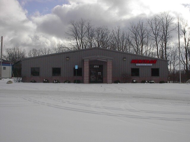
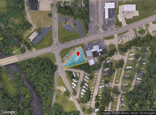
1014 Columbia Ave E, Battle Creek, MI 49014
NEARBY LISTINGS FOR SALE OR LEASE
Property Detail
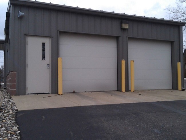
1014 Columbia Ave E
10-018-035-04
Bakers Add
Vehiclerentalsvehiclesales
EMMETT TWP/T2S R7W, SEC 18: PART NE1/4 DESC AS COM ON S'LY R/W COLUMBIA AVE. S75 DEG 53'10"W 785.97 FT FROM PT 'G' BAKER'S
X
Calhoun
26025C0191C
Michigan
2024
0.75 AC
2025
Battle Crk/W Calhoun Cnty
001900
West Michigan
2,100 SF
Battle Creek, MI
DEMOGRAPHICS near 1014 Columbia Ave E
1 Mile
3 Mile
5 Mile
2024 Total Population
5,360
45,699
73,108
2029 Population
5,305
45,347
72,388
Pop Growth 2024-2029
(1.03%)
(0.77%)
(0.98%)
Average Age
37
39
40
2024 Total Households
2,024
18,299
29,848
HH Growth 2024-2029
(1.09%)
(0.81%)
(1.01%)
Median Household Inc
$38,905
$49,015
$50,732
Avg Household Size
2.50
2.40
2.30
2024 Avg HH Vehicles
2.00
2.00
2.00
Median Home Value
$76,241
$107,266
$122,061
Median Year Built
1947
1953
1959
Nearby Places
Map Layers
Map Styles
 Street
 Aerial
- Restaurants
- Banks
- Shops
- Fitness
- Groceries
PUBLIC TRANSPORTATION
COMMUTER RAIL
Battle Creek (Blue Water - Amtrak, Wolverine - Amtrak)
DRIVE
WALK
Distance
Battle Creek (Blue Water - Amtrak, Wolverine - Amtrak)
4 min
1.9 mi
AIRPORT
Kalamazoo/Battle Creek International
DRIVE
WALK
Distance
Kalamazoo/Battle Creek International
34 min
25.2 mi
Freight Ports
Port of Toledo
DRIVE
WALK
Distance
Port of Toledo
150 min
122.0 mi
Nearby Properties
Address
Land Use
TOTAL SIZE
Lot Size
Zoning
Address
Land Use
TOTAL SIZE
Lot Size
Zoning
1,513,110 SF
108.07 AC
I2
Address
Land Use
TOTAL SIZE
Lot Size
Zoning
337,297 SF
18.85 AC
T4
Address
Land Use
TOTAL SIZE
Lot Size
Zoning
291,206 SF
18.98 AC
T4
Address
Land Use
TOTAL SIZE
Lot Size
Zoning
1,131,895 SF
26.46 AC
I1
Address
Land Use
TOTAL SIZE
Lot Size
Zoning
324,731 SF
69.91 AC
MF
Address
Land Use
TOTAL SIZE
Lot Size
Zoning
63,180 SF
3.55 AC
RC
Address
Land Use
TOTAL SIZE
Lot Size
Zoning
174,064 SF
T4
Address
Land Use
TOTAL SIZE
Lot Size
Zoning
52,764 SF
3.52 AC
AG
Address
Land Use
TOTAL SIZE
Lot Size
Zoning
79,074 SF
4.98 AC
RC
Address
Land Use
TOTAL SIZE
Lot Size
Zoning
221,522 SF
23.23 AC
RC
Address
Land Use
TOTAL SIZE
Lot Size
Zoning
196,120 SF
21.42 AC
RC
Address
Land Use
TOTAL SIZE
Lot Size
Zoning
134,482 SF
17.15 AC
MFR
Address
Land Use
TOTAL SIZE
Lot Size
Zoning
134,355 SF
5.35 AC
MFR
Address
Land Use
TOTAL SIZE
Lot Size
Zoning
137,827 SF
20.09 AC
B2
Address
Land Use
TOTAL SIZE
Lot Size
Zoning
192,680 SF
21.66 AC
RC
Address
Land Use
TOTAL SIZE
Lot Size
Zoning
63,180 SF
12.12 AC
RC
Address
Land Use
TOTAL SIZE
Lot Size
Zoning
65,773 SF
2.42 AC
RC
Address
Land Use
TOTAL SIZE
Lot Size
Zoning
129,598 SF
0.62 AC
T5
Address
Land Use
TOTAL SIZE
Lot Size
Zoning
56,349 SF
7.54 AC
RC
Address
Land Use
TOTAL SIZE
Lot Size
Zoning
34,452 SF
1.12 AC
T4
Address
Land Use
TOTAL SIZE
Lot Size
Zoning
124,141 SF
21.18 AC
RC
Address
Land Use
TOTAL SIZE
Lot Size
Zoning
81,857 SF
9.29 AC
RC
Address
Land Use
TOTAL SIZE
Lot Size
Zoning
106,703 SF
9.69 AC
MFR
Address
Land Use
TOTAL SIZE
Lot Size
Zoning
126,060 SF
15.89 AC
MF
Address
Land Use
TOTAL SIZE
Lot Size
Zoning
366,290 SF
31.87 AC
B2
Address
Land Use
TOTAL SIZE
Lot Size
Zoning
44,034 SF
1.60 AC
RC
Address
Land Use
TOTAL SIZE
Lot Size
Zoning
72,260 SF
12.33 AC
B2
Address
Land Use
TOTAL SIZE
Lot Size
Zoning
49,412 SF
Address
Land Use
TOTAL SIZE
Lot Size
Zoning
188,388 SF
18.15 AC
T3
Address
Land Use
TOTAL SIZE
Lot Size
Zoning
85,654 SF
12.12 AC
RC
The World's #1 Commercial Real Estate Marketplace
Connect with us
© 2025 CoStar Group
The information above has been obtained from sources believed reliable. While we do not doubt its accuracy we have not verified it and make no guarantee, warranty or representation about it. It is your responsibility to independently confirm its accuracy and completeness. Any projections, opinions, assumptions, or estimates used are for example only and do not represent the current or future performance of the property. The value of this transaction to you depends on tax and other factors which should be evaluated by your tax, financial, and legal advisors. You and your advisors should conduct a careful, independent investigation of the property to determine to your satisfaction the suitability of the property for your needs.