Property Record
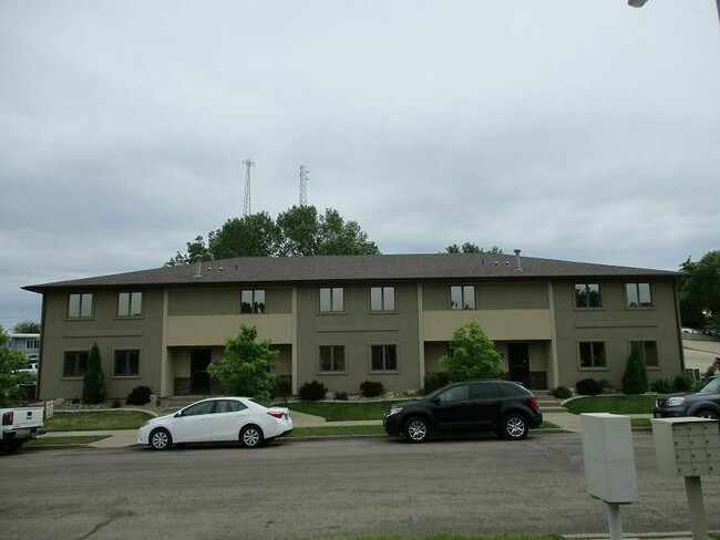
1014 E Central Ave, Bismarck, ND 58501

Property Detail
1014 E Central Ave
0486-015-103
REPLAT TIBESAR'S 1ST SUB LOTS 24-26 CENTRAL AVENUE PLAZA OFFICE CONDOMINIUMS UNIT 1004
Officebuilding
BURLEIGH
RT
North Dakota
B and X Area of moderate flood hazard, usually the area between the limits of the 100-year and 500-year floods.
101
2025
0.75 AC
2025
Downtown Bismarck
010400
Other Market Areas
1,000 SF
Bismarck, ND
NEARBY LISTINGS FOR SALE OR LEASE
DEMOGRAPHICS near 1014 E Central Ave
1 mile
3 mile
5 mile
2025 Total Population
13,275
67,854
93,121
2030 Population
13,591
69,941
96,145
Pop Growth 2025-2030
+ 2.38%
+ 3.08%
+ 3.25%
Average Age
42
41
40
2025 Total Households
6,229
29,401
39,275
HH Growth 2025-2030
+ 2.86%
+ 3.41%
+ 3.55%
Median Household Inc
$72,191
$77,132
$83,620
Avg Household Size
2.00
2.20
2.20
2025 Avg HH Vehicles
2.00
2.00
2.00
Median Home Value
$254,562
$283,030
$301,019
Median Year Built
1968
1981
1988
Nearby Places
Map Layers
Map Styles
 Street
 Aerial
Transit
 Traffic
 Biking
Places
Listings with unknown addresses are not visible on the map
- Restaurants
- Banks
- Shops
- Fitness
- Groceries
PUBLIC TRANSPORTATION
AIRPORT
Bismarck Municipal
Drive
Walk
Distance
Bismarck Municipal
18 min
5.9 mi
SALE & LEASE HISTORY
LISTING DATE
SALE/LEASE

May 05, 2021
For Lease
Nearby Properties
Address
Land Use
TOTAL SIZE
Lot Size
Zoning
Address
Land Use
TOTAL SIZE
Lot Size
Zoning
45.23 AC
CG
Address
Land Use
TOTAL SIZE
Lot Size
Zoning
13.47 AC
PUD
Address
Land Use
TOTAL SIZE
Lot Size
Zoning
93,860 SF
1.44 AC
HM
Address
Land Use
TOTAL SIZE
Lot Size
Zoning
28.06 AC
CG
Address
Land Use
TOTAL SIZE
Lot Size
Zoning
30.33 AC
MA
Address
Land Use
TOTAL SIZE
Lot Size
Zoning
76,233 SF
14.71 AC
RM20
Address
Land Use
TOTAL SIZE
Lot Size
Zoning
70,182 SF
3.83 AC
PUD
Address
Land Use
TOTAL SIZE
Lot Size
Zoning
18.70 AC
RM15
Address
Land Use
TOTAL SIZE
Lot Size
Zoning
27.48 AC
CG
Address
Land Use
TOTAL SIZE
Lot Size
Zoning
20.87 AC
CG
Address
Land Use
TOTAL SIZE
Lot Size
Zoning
20.41 AC
MA
Address
Land Use
TOTAL SIZE
Lot Size
Zoning
7.67 AC
CG
Address
Land Use
TOTAL SIZE
Lot Size
Zoning
16.12 AC
CG
Address
Land Use
TOTAL SIZE
Lot Size
Zoning
81,092 SF
4.17 AC
HM
Address
Land Use
TOTAL SIZE
Lot Size
Zoning
38,467 SF
13.89 AC
CG
Address
Land Use
TOTAL SIZE
Lot Size
Zoning
68,211 SF
10 AC
RT
Address
Land Use
TOTAL SIZE
Lot Size
Zoning
31,202 SF
9.05 AC
RM30
Address
Land Use
TOTAL SIZE
Lot Size
Zoning
7.83 AC
RM20
Address
Land Use
TOTAL SIZE
Lot Size
Zoning
38,275 SF
10.53 AC
RM30
Address
Land Use
TOTAL SIZE
Lot Size
Zoning
39,771 SF
9.65 AC
CG
Address
Land Use
TOTAL SIZE
Lot Size
Zoning
11.48 AC
CG
Address
Land Use
TOTAL SIZE
Lot Size
Zoning
8,685 SF
12.51 AC
CG
Address
Land Use
TOTAL SIZE
Lot Size
Zoning
65,001 SF
9.88 AC
RT
Address
Land Use
TOTAL SIZE
Lot Size
Zoning
10.84 AC
CG
Address
Land Use
TOTAL SIZE
Lot Size
Zoning
13.98 AC
CG
Address
Land Use
TOTAL SIZE
Lot Size
Zoning
14.70 AC
MA
Address
Land Use
TOTAL SIZE
Lot Size
Zoning
52,718 SF
2.67 AC
RM15
Address
Land Use
TOTAL SIZE
Lot Size
Zoning
52,710 SF
7.13 AC
RM30
Address
Land Use
TOTAL SIZE
Lot Size
Zoning
14.22 AC
MA
Address
Land Use
TOTAL SIZE
Lot Size
Zoning
77,694 SF
8.66 AC
RT
The World's #1 Commercial Real Estate Marketplace
Connect with us
© 2026 CoStar Group
The information above has been obtained from sources believed reliable. While we do not doubt its accuracy we have not verified it and make no guarantee, warranty or representation about it. It is your responsibility to independently confirm its accuracy and completeness. Any projections, opinions, assumptions, or estimates used are for example only and do not represent the current or future performance of the property. The value of this transaction to you depends on tax and other factors which should be evaluated by your tax, financial, and legal advisors. You and your advisors should conduct a careful, independent investigation of the property to determine to your satisfaction the suitability of the property for your needs.