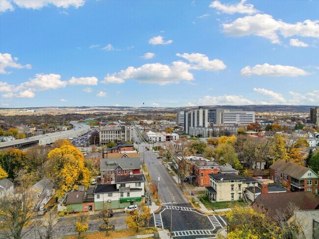
Property Record
1014 State St, Utica, NY 13502


Property Detail
1014 State St
Utica-Rome, NY
5-01-03-010 40X788 318.049-0001-020.000/0000
318-049-0001-020-000-0000
Oneida
Commercialofficeresidentialmixeduse
New York
B and X Area of moderate flood hazard, usually the area between the limits of the 100-year and 500-year floods.
20.000
2025
0.12 AC
2025
Utica
020300
Utica/Rome
4,234 SF
NEARBY LISTINGS FOR SALE OR LEASE
DEMOGRAPHICS near 1014 State St
1 mile
3 mile
5 mile
2025 Total Population
22,882
71,574
102,725
2030 Population
22,799
70,418
101,401
Pop Growth 2025-2030
(0.36%)
(1.62%)
(1.29%)
Average Age
36
39
40
2025 Total Households
9,084
28,757
42,138
HH Growth 2025-2030
(0.12%)
(1.62%)
(1.31%)
Median Household Inc
$32,635
$48,690
$56,006
Avg Household Size
2.30
2.30
2.30
2025 Avg HH Vehicles
1.00
1.00
1.00
Median Home Value
$89,788
$158,813
$180,621
Median Year Built
1947
1948
1952
Nearby Places
Map Layers
Map Styles
 Street
 Aerial
Layers
 Traffic
 Biking
Places
Listings with unknown addresses are not visible on the map
- Restaurants
- Banks
- Shops
- Fitness
- Groceries
PUBLIC TRANSPORTATION
COMMUTER RAIL
Drive
Walk
Distance
3 min
1.2 mi
SALE & LEASE HISTORY
LISTING DATE
SALE/LEASE

Sep 11, 2020
For Sale
Nov 15, 2022
For Sale
Nearby Properties
Address
Land Use
TOTAL SIZE
Lot Size
Zoning
Address
Land Use
TOTAL SIZE
Lot Size
Zoning
742,550 SF
2.03 AC
Address
Land Use
TOTAL SIZE
Lot Size
Zoning
446,163 SF
24.81 AC
05 - COMME
Address
Land Use
TOTAL SIZE
Lot Size
Zoning
127,002 SF
89.68 AC
Address
Land Use
TOTAL SIZE
Lot Size
Zoning
9.79 AC
Address
Land Use
TOTAL SIZE
Lot Size
Zoning
276,146 SF
304.48 AC
Address
Land Use
TOTAL SIZE
Lot Size
Zoning
98,832 SF
1.61 AC
Address
Land Use
TOTAL SIZE
Lot Size
Zoning
279,786 SF
121 AC
Address
Land Use
TOTAL SIZE
Lot Size
Zoning
236,597 SF
2.10 AC
Address
Land Use
TOTAL SIZE
Lot Size
Zoning
109,000 SF
13.56 AC
01 - NOT Z
Address
Land Use
TOTAL SIZE
Lot Size
Zoning
8,600 SF
8.33 AC
05 - COMME
Address
Land Use
TOTAL SIZE
Lot Size
Zoning
124,950 SF
0.01 AC
05 - COMME
Address
Land Use
TOTAL SIZE
Lot Size
Zoning
131,534 SF
16 AC
05 - COMME
Address
Land Use
TOTAL SIZE
Lot Size
Zoning
25,860 SF
18.45 AC
05 - COMME
Address
Land Use
TOTAL SIZE
Lot Size
Zoning
271,000 SF
16.50 AC
Address
Land Use
TOTAL SIZE
Lot Size
Zoning
55,172 SF
81.24 AC
Address
Land Use
TOTAL SIZE
Lot Size
Zoning
6,000 SF
1.46 AC
Address
Land Use
TOTAL SIZE
Lot Size
Zoning
12,692 SF
20.24 AC
Address
Land Use
TOTAL SIZE
Lot Size
Zoning
205,097 SF
7.90 AC
Address
Land Use
TOTAL SIZE
Lot Size
Zoning
53,777 SF
Address
Land Use
TOTAL SIZE
Lot Size
Zoning
55,916 SF
4.50 AC
Address
Land Use
TOTAL SIZE
Lot Size
Zoning
129,948 SF
6.90 AC
Address
Land Use
TOTAL SIZE
Lot Size
Zoning
132,972 SF
30.76 AC
Address
Land Use
TOTAL SIZE
Lot Size
Zoning
87,120 SF
2.31 AC
Address
Land Use
TOTAL SIZE
Lot Size
Zoning
64,016 SF
57.30 AC
05 - COMME
Address
Land Use
TOTAL SIZE
Lot Size
Zoning
94,050 SF
22.58 AC
05 - COMME
Address
Land Use
TOTAL SIZE
Lot Size
Zoning
12,544 SF
21.80 AC
Address
Land Use
TOTAL SIZE
Lot Size
Zoning
77,584 SF
8 AC
Address
Land Use
TOTAL SIZE
Lot Size
Zoning
3,472 SF
1.06 AC
Address
Land Use
TOTAL SIZE
Lot Size
Zoning
163,404 SF
2.58 AC
Address
Land Use
TOTAL SIZE
Lot Size
Zoning
65,120 SF
1.79 AC
The World's #1 Commercial Real Estate Marketplace
Connect with us
© 2026 CoStar Group
The information above has been obtained from sources believed reliable. While we do not doubt its accuracy we have not verified it and make no guarantee, warranty or representation about it. It is your responsibility to independently confirm its accuracy and completeness. Any projections, opinions, assumptions, or estimates used are for example only and do not represent the current or future performance of the property. The value of this transaction to you depends on tax and other factors which should be evaluated by your tax, financial, and legal advisors. You and your advisors should conduct a careful, independent investigation of the property to determine to your satisfaction the suitability of the property for your needs.