Property Record
10140 S 120Th St, Bennet, NE 68317


NEARBY LISTINGS FOR SALE OR LEASE
Property Detail
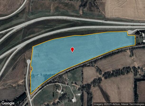
10140 S 120Th St
Lincoln, NE
Stockton
22-32-100-008-000
S32, T9, R8, 6TH PRINCIPAL MERIDIAN, LOTS 9, 62 & 63 NW
Agriculturalland
Lancaster
X
Nebraska
31109C0458G
9
2024
49 AC
2025
South Lancaster County
010402
Lincoln
DEMOGRAPHICS near 10140 S 120Th St
1 Mile
3 Mile
5 Mile
2024 Total Population
99
2,771
25,697
2029 Population
98
2,882
26,746
Pop Growth 2024-2029
(1.01%)
+ 4.01%
+ 4.08%
Average Age
44
40
40
2024 Total Households
37
1,144
9,557
HH Growth 2024-2029
0.00%
+ 4.28%
+ 4.06%
Median Household Inc
$73,499
$101,007
$125,027
Avg Household Size
2.70
2.40
2.60
2024 Avg HH Vehicles
3.00
2.00
2.00
Median Home Value
$394,444
$372,120
$369,793
Median Year Built
1981
2010
2008
Nearby Places
Map Layers
Map Styles
 Street
 Aerial
- Restaurants
- Banks
- Shops
- Fitness
- Groceries
PUBLIC TRANSPORTATION
AIRPORT
Lincoln
DRIVE
WALK
Distance
Lincoln
30 min
19.2 mi
Freight Ports
Tulsa Port Of Catoosa
DRIVE
WALK
Distance
Tulsa Port Of Catoosa
450 min
380.4 mi
SALE & LEASE HISTORY
LISTING DATE
SALE/LEASE

Nov 07, 2021
For Sale
Nearby Properties
Address
Land Use
TOTAL SIZE
Lot Size
Zoning
Address
Land Use
TOTAL SIZE
Lot Size
Zoning
24,771 SF
11.45 AC
R5
Address
Land Use
TOTAL SIZE
Lot Size
Zoning
65,640 SF
7.24 AC
B5
Address
Land Use
TOTAL SIZE
Lot Size
Zoning
82,644 SF
18.57 AC
R3
Address
Land Use
TOTAL SIZE
Lot Size
Zoning
197,801 SF
22.85 AC
B5
Address
Land Use
TOTAL SIZE
Lot Size
Zoning
206,564 SF
18.37 AC
B5
Address
Land Use
TOTAL SIZE
Lot Size
Zoning
87,522 SF
3.68 AC
R3
Address
Land Use
TOTAL SIZE
Lot Size
Zoning
40,644 SF
1.38 AC
B5
Address
Land Use
TOTAL SIZE
Lot Size
Zoning
40,000 SF
4.70 AC
H4
Address
Land Use
TOTAL SIZE
Lot Size
Zoning
104,478 SF
7.61 AC
B2
Address
Land Use
TOTAL SIZE
Lot Size
Zoning
44.05 AC
Address
Land Use
TOTAL SIZE
Lot Size
Zoning
12,066 SF
5.01 AC
AG
Address
Land Use
TOTAL SIZE
Lot Size
Zoning
15,258 SF
1.49 AC
Address
Land Use
TOTAL SIZE
Lot Size
Zoning
9,653 SF
2.14 AC
B5
Address
Land Use
TOTAL SIZE
Lot Size
Zoning
33,307 SF
1.82 AC
B5
Address
Land Use
TOTAL SIZE
Lot Size
Zoning
8,772 SF
152.54 AC
AG
Address
Land Use
TOTAL SIZE
Lot Size
Zoning
27,602 SF
1.73 AC
B5
Address
Land Use
TOTAL SIZE
Lot Size
Zoning
22,584 SF
3.32 AC
H4
Address
Land Use
TOTAL SIZE
Lot Size
Zoning
3,444 SF
117.64 AC
AG
Address
Land Use
TOTAL SIZE
Lot Size
Zoning
10,132 SF
54.22 AC
AG
Address
Land Use
TOTAL SIZE
Lot Size
Zoning
17,064 SF
1.50 AC
R3
Address
Land Use
TOTAL SIZE
Lot Size
Zoning
26.39 AC
Address
Land Use
TOTAL SIZE
Lot Size
Zoning
35,850 SF
2.59 AC
H3
Address
Land Use
TOTAL SIZE
Lot Size
Zoning
11,630 SF
14.43 AC
Address
Land Use
TOTAL SIZE
Lot Size
Zoning
10,382 SF
151.74 AC
AG
Address
Land Use
TOTAL SIZE
Lot Size
Zoning
9,823 SF
0.36 AC
O3
Address
Land Use
TOTAL SIZE
Lot Size
Zoning
7,311 SF
1.46 AC
B5
Address
Land Use
TOTAL SIZE
Lot Size
Zoning
7,349 SF
20.10 AC
Address
Land Use
TOTAL SIZE
Lot Size
Zoning
14,400 SF
4.04 AC
Address
Land Use
TOTAL SIZE
Lot Size
Zoning
8,328 SF
31.42 AC
The World's #1 Commercial Real Estate Marketplace
Connect with us
© 2025 CoStar Group
The information above has been obtained from sources believed reliable. While we do not doubt its accuracy we have not verified it and make no guarantee, warranty or representation about it. It is your responsibility to independently confirm its accuracy and completeness. Any projections, opinions, assumptions, or estimates used are for example only and do not represent the current or future performance of the property. The value of this transaction to you depends on tax and other factors which should be evaluated by your tax, financial, and legal advisors. You and your advisors should conduct a careful, independent investigation of the property to determine to your satisfaction the suitability of the property for your needs.