Property Record
10140 W Lake Pleasant Pkwy, Peoria, AZ 85382


NEARBY LISTINGS FOR SALE OR LEASE
Property Detail
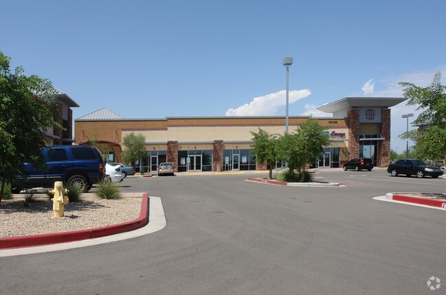
10140 W Lake Pleasant Pkwy
Phoenix-Mesa-Scottsdale, AZ
Camino A Lago Marketplace
200-09-971
CAMINO A LAGO MARKETPLACE MCR 947-08
Regionalshoppingcenterormallwithanchorstore
Maricopa
X
Arizona
04013C1245L
7
2025
1.79 AC
2025
Ctrl Peoria/Arrowhead
613601
Phoenix
12,000 SF
DEMOGRAPHICS near 10140 W Lake Pleasant Pkwy
1 Mile
3 Mile
5 Mile
2024 Total Population
15,783
80,333
201,143
2029 Population
17,224
87,249
218,492
Pop Growth 2024-2029
+ 9.13%
+ 8.61%
+ 8.63%
Average Age
42
47
48
2024 Total Households
5,744
32,541
84,478
HH Growth 2024-2029
+ 9.21%
+ 8.81%
+ 8.81%
Median Household Inc
$104,701
$83,183
$80,172
Avg Household Size
2.70
2.40
2.30
2024 Avg HH Vehicles
2.00
2.00
2.00
Median Home Value
$371,449
$368,629
$369,964
Median Year Built
2000
1995
1993
Nearby Places
Map Layers
Map Styles
 Street
 Aerial
- Restaurants
- Banks
- Shops
- Fitness
- Groceries
PUBLIC TRANSPORTATION
AIRPORT
Phoenix Sky Harbor International
DRIVE
WALK
Distance
Phoenix Sky Harbor International
48 min
33.5 mi
Freight Ports
Port of San Diego
DRIVE
WALK
Distance
Port of San Diego
404 min
358.1 mi
SALE & LEASE HISTORY
LISTING DATE
SALE/LEASE

Sep 25, 2016
For Lease
Nearby Properties
Address
Land Use
TOTAL SIZE
Lot Size
Zoning
Address
Land Use
TOTAL SIZE
Lot Size
Zoning
248,777 SF
51.46 AC
AG
Address
Land Use
TOTAL SIZE
Lot Size
Zoning
235,399 SF
41.79 AC
M-M
Address
Land Use
TOTAL SIZE
Lot Size
Zoning
399,561 SF
16.30 AC
Address
Land Use
TOTAL SIZE
Lot Size
Zoning
394,394 SF
15.24 AC
PAD
Address
Land Use
TOTAL SIZE
Lot Size
Zoning
284,715 SF
7.15 AC
M-M
Address
Land Use
TOTAL SIZE
Lot Size
Zoning
122,780 SF
18.75 AC
PAD
Address
Land Use
TOTAL SIZE
Lot Size
Zoning
112,300 SF
13.72 AC
PAD
Address
Land Use
TOTAL SIZE
Lot Size
Zoning
283,107 SF
14.60 AC
M-M
Address
Land Use
TOTAL SIZE
Lot Size
Zoning
96,045 SF
13.69 AC
PAD
Address
Land Use
TOTAL SIZE
Lot Size
Zoning
113,189 SF
15 AC
R-6
Address
Land Use
TOTAL SIZE
Lot Size
Zoning
311,614 SF
19.03 AC
PAD
Address
Land Use
TOTAL SIZE
Lot Size
Zoning
187,392 SF
10.36 AC
PAD
Address
Land Use
TOTAL SIZE
Lot Size
Zoning
18.76 AC
M1
Address
Land Use
TOTAL SIZE
Lot Size
Zoning
Address
Land Use
TOTAL SIZE
Lot Size
Zoning
96,954 SF
13.47 AC
PAD
Address
Land Use
TOTAL SIZE
Lot Size
Zoning
217,564 SF
22.91 AC
PAD
Address
Land Use
TOTAL SIZE
Lot Size
Zoning
123,090 SF
11.22 AC
PAD
Address
Land Use
TOTAL SIZE
Lot Size
Zoning
139,095 SF
13.67 AC
PAD
Address
Land Use
TOTAL SIZE
Lot Size
Zoning
93,234 SF
11.90 AC
C-C
Address
Land Use
TOTAL SIZE
Lot Size
Zoning
65,825 SF
10.26 AC
PAD
Address
Land Use
TOTAL SIZE
Lot Size
Zoning
82,014 SF
14.64 AC
M-M
Address
Land Use
TOTAL SIZE
Lot Size
Zoning
255,933 SF
15.20 AC
PAD
Address
Land Use
TOTAL SIZE
Lot Size
Zoning
78,822 SF
8.14 AC
AG
Address
Land Use
TOTAL SIZE
Lot Size
Zoning
179,107 SF
15.29 AC
PAD
Address
Land Use
TOTAL SIZE
Lot Size
Zoning
113,722 SF
10.49 AC
Address
Land Use
TOTAL SIZE
Lot Size
Zoning
61,914 SF
8.10 AC
PAD
Address
Land Use
TOTAL SIZE
Lot Size
Zoning
227,740 SF
14 AC
PAD
Address
Land Use
TOTAL SIZE
Lot Size
Zoning
175,236 SF
14.73 AC
PAD
Address
Land Use
TOTAL SIZE
Lot Size
Zoning
98,090 SF
7.26 AC
PAD
The World's #1 Commercial Real Estate Marketplace
Connect with us
© 2025 CoStar Group
The information above has been obtained from sources believed reliable. While we do not doubt its accuracy we have not verified it and make no guarantee, warranty or representation about it. It is your responsibility to independently confirm its accuracy and completeness. Any projections, opinions, assumptions, or estimates used are for example only and do not represent the current or future performance of the property. The value of this transaction to you depends on tax and other factors which should be evaluated by your tax, financial, and legal advisors. You and your advisors should conduct a careful, independent investigation of the property to determine to your satisfaction the suitability of the property for your needs.