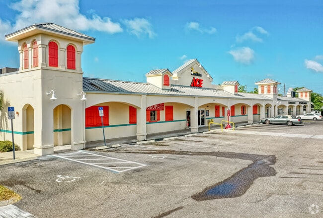
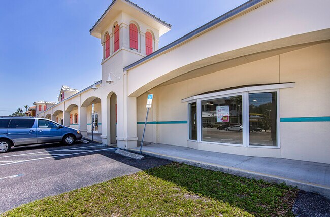
Property Record
4215 E Bay Dr, Clearwater, FL 33764

NEARBY LISTINGS FOR SALE OR LEASE
Property Detail
4215 E Bay Dr
Tampa-St. Petersburg-Clearwater, FL
Woodside Village Condo
31-29-16-99081-034-0151
HAMMERHEAD COMMERCIAL SUB LOT 1
Condominium
Pinellas
X
Florida
12103C0136H
1
2024
19.80 AC
2025
Mid-Pinellas
025603
Tampa/St Petersburg
870 SF
DEMOGRAPHICS near 4215 E Bay Dr
1 Mile
3 Mile
5 Mile
2024 Total Population
13,886
100,250
243,872
2029 Population
14,112
100,994
246,629
Pop Growth 2024-2029
+ 1.63%
+ 0.74%
+ 1.13%
Average Age
48
48
47
2024 Total Households
6,769
47,102
111,696
HH Growth 2024-2029
+ 1.37%
+ 0.63%
+ 1.17%
Median Household Inc
$50,049
$57,298
$59,533
Avg Household Size
2.00
2.00
2.10
2024 Avg HH Vehicles
1.00
2.00
2.00
Median Home Value
$237,615
$259,456
$279,313
Median Year Built
1971
1974
1975
Nearby Places
Map Layers
Map Styles
 Street
 Aerial
- Restaurants
- Banks
- Shops
- Fitness
- Groceries
PUBLIC TRANSPORTATION
AIRPORT
St Pete-Clearwater International
DRIVE
WALK
Distance
St Pete-Clearwater International
18 min
7.3 mi
Tampa International
DRIVE
WALK
Distance
Tampa International
30 min
17.8 mi
Freight Ports
Port of Tampa Bay
DRIVE
WALK
Distance
Port of Tampa Bay
39 min
24.1 mi
SALE & LEASE HISTORY
LISTING DATE
SALE/LEASE

Oct 22, 2020
For Lease
Apr 07, 2022
For Lease
Nearby Properties
Address
Land Use
TOTAL SIZE
Lot Size
Zoning
Address
Land Use
TOTAL SIZE
Lot Size
Zoning
795,890 SF
69.11 AC
M1
Address
Land Use
TOTAL SIZE
Lot Size
Zoning
130,544 SF
1,313.50 AC
PCAIRPOR
Address
Land Use
TOTAL SIZE
Lot Size
Zoning
524,588 SF
17.15 AC
Address
Land Use
TOTAL SIZE
Lot Size
Zoning
389,810 SF
16.93 AC
Address
Land Use
TOTAL SIZE
Lot Size
Zoning
498,319 SF
15.52 AC
Address
Land Use
TOTAL SIZE
Lot Size
Zoning
529,506 SF
23.06 AC
Address
Land Use
TOTAL SIZE
Lot Size
Zoning
520,871 SF
29 AC
R6
Address
Land Use
TOTAL SIZE
Lot Size
Zoning
367,411 SF
16.12 AC
Address
Land Use
TOTAL SIZE
Lot Size
Zoning
382,389 SF
13.62 AC
Address
Land Use
TOTAL SIZE
Lot Size
Zoning
492,016 SF
19.86 AC
Address
Land Use
TOTAL SIZE
Lot Size
Zoning
337,954 SF
21 AC
R3
Address
Land Use
TOTAL SIZE
Lot Size
Zoning
588,657 SF
33 AC
Address
Land Use
TOTAL SIZE
Lot Size
Zoning
364,675 SF
66.40 AC
AE
Address
Land Use
TOTAL SIZE
Lot Size
Zoning
384,124 SF
25.78 AC
C3
Address
Land Use
TOTAL SIZE
Lot Size
Zoning
321,140 SF
18.02 AC
Address
Land Use
TOTAL SIZE
Lot Size
Zoning
446,556 SF
14.95 AC
M1
Address
Land Use
TOTAL SIZE
Lot Size
Zoning
396,822 SF
36.20 AC
RPD5
Address
Land Use
TOTAL SIZE
Lot Size
Zoning
362,618 SF
40.19 AC
R6
Address
Land Use
TOTAL SIZE
Lot Size
Zoning
266,396 SF
23.18 AC
Address
Land Use
TOTAL SIZE
Lot Size
Zoning
294,478 SF
44.79 AC
M1
Address
Land Use
TOTAL SIZE
Lot Size
Zoning
352,158 SF
47.45 AC
Address
Land Use
TOTAL SIZE
Lot Size
Zoning
160,014 SF
7.77 AC
Address
Land Use
TOTAL SIZE
Lot Size
Zoning
296,919 SF
39.10 AC
Address
Land Use
TOTAL SIZE
Lot Size
Zoning
244,655 SF
16.84 AC
AE
Address
Land Use
TOTAL SIZE
Lot Size
Zoning
582,271 SF
17.14 AC
Address
Land Use
TOTAL SIZE
Lot Size
Zoning
225,515 SF
26.82 AC
Address
Land Use
TOTAL SIZE
Lot Size
Zoning
241,547 SF
9.27 AC
Address
Land Use
TOTAL SIZE
Lot Size
Zoning
249,699 SF
15 AC
Address
Land Use
TOTAL SIZE
Lot Size
Zoning
280,129 SF
Address
Land Use
TOTAL SIZE
Lot Size
Zoning
296,868 SF
20.99 AC
The World's #1 Commercial Real Estate Marketplace
Connect with us
© 2025 CoStar Group
The information above has been obtained from sources believed reliable. While we do not doubt its accuracy we have not verified it and make no guarantee, warranty or representation about it. It is your responsibility to independently confirm its accuracy and completeness. Any projections, opinions, assumptions, or estimates used are for example only and do not represent the current or future performance of the property. The value of this transaction to you depends on tax and other factors which should be evaluated by your tax, financial, and legal advisors. You and your advisors should conduct a careful, independent investigation of the property to determine to your satisfaction the suitability of the property for your needs.