Property Record
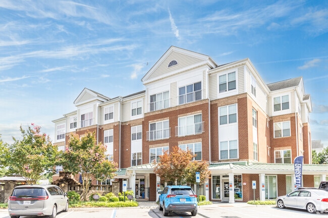
1015 Bolling Ave, Norfolk, VA 23508

NEARBY LISTINGS FOR SALE OR LEASE
Property Detail
1015 Bolling Ave
Virginia Beach-Norfolk-Newport News, VA-NC
Collins Recap Iii,
00001067
LOT 50
Apartment
Norfolk City
AE
Virginia
5101040018H
50
2025
1.13 AC
2025
Larchmont/Edgewater
002300
Hampton Roads
59,199 SF
DEMOGRAPHICS near 1015 Bolling Ave
1 Mile
3 Mile
5 Mile
2024 Total Population
19,847
95,110
234,076
2029 Population
19,611
93,072
229,337
Pop Growth 2024-2029
(1.19%)
(2.14%)
(2.02%)
Average Age
32
36
36
2024 Total Households
6,642
39,869
91,203
HH Growth 2024-2029
(1.37%)
(2.51%)
(2.38%)
Median Household Inc
$68,095
$60,498
$56,851
Avg Household Size
2.30
2.20
2.30
2024 Avg HH Vehicles
2.00
2.00
2.00
Median Home Value
$360,696
$282,567
$239,499
Median Year Built
1957
1960
1963
Nearby Places
Map Layers
Map Styles
 Street
 Aerial
- Restaurants
- Banks
- Shops
- Fitness
- Groceries
PUBLIC TRANSPORTATION
COMMUTER RAIL
Norfolk (Northeast Regional - Amtrak)
DRIVE
WALK
Distance
Norfolk (Northeast Regional - Amtrak)
11 min
4.8 mi
AIRPORT
Norfolk International
DRIVE
WALK
Distance
Norfolk International
18 min
7.7 mi
Newport News/Williamsburg International
DRIVE
WALK
Distance
Newport News/Williamsburg International
43 min
27.7 mi
Freight Ports
Virginia Port Authority - Norfolk
DRIVE
WALK
Distance
Virginia Port Authority - Norfolk
13 min
3.7 mi
Nearby Properties
Address
Land Use
TOTAL SIZE
Lot Size
Zoning
Address
Land Use
TOTAL SIZE
Lot Size
Zoning
1,190.45 AC
Address
Land Use
TOTAL SIZE
Lot Size
Zoning
842.34 AC
I5
Address
Land Use
TOTAL SIZE
Lot Size
Zoning
777.89 AC
Address
Land Use
TOTAL SIZE
Lot Size
Zoning
331,760 SF
24.97 AC
Address
Land Use
TOTAL SIZE
Lot Size
Zoning
85,756 SF
3.59 AC
D5
Address
Land Use
TOTAL SIZE
Lot Size
Zoning
421,540 SF
2.37 AC
Address
Land Use
TOTAL SIZE
Lot Size
Zoning
192,422 SF
10.70 AC
D4
Address
Land Use
TOTAL SIZE
Lot Size
Zoning
390,960 SF
4.43 AC
Address
Land Use
TOTAL SIZE
Lot Size
Zoning
73,136 SF
5.34 AC
IN2
Address
Land Use
TOTAL SIZE
Lot Size
Zoning
92.17 AC
OSP
Address
Land Use
TOTAL SIZE
Lot Size
Zoning
310,912 SF
3.94 AC
Address
Land Use
TOTAL SIZE
Lot Size
Zoning
68,643 SF
24.68 AC
Address
Land Use
TOTAL SIZE
Lot Size
Zoning
213 AC
I5
Address
Land Use
TOTAL SIZE
Lot Size
Zoning
126,088 SF
4.91 AC
C2
Address
Land Use
TOTAL SIZE
Lot Size
Zoning
66,718 SF
4.09 AC
D5
Address
Land Use
TOTAL SIZE
Lot Size
Zoning
4.92 AC
IN1
Address
Land Use
TOTAL SIZE
Lot Size
Zoning
291,748 SF
3.40 AC
G1
Address
Land Use
TOTAL SIZE
Lot Size
Zoning
91,982 SF
22.78 AC
IN1
Address
Land Use
TOTAL SIZE
Lot Size
Zoning
79,577 SF
3.04 AC
C2
Address
Land Use
TOTAL SIZE
Lot Size
Zoning
640,920 SF
3.67 AC
HCEF
Address
Land Use
TOTAL SIZE
Lot Size
Zoning
130,750 SF
68.79 AC
IN
Address
Land Use
TOTAL SIZE
Lot Size
Zoning
254,194 SF
1.93 AC
D3
Address
Land Use
TOTAL SIZE
Lot Size
Zoning
24,710 SF
0.44 AC
Address
Land Use
TOTAL SIZE
Lot Size
Zoning
137,320 SF
7.45 AC
Address
Land Use
TOTAL SIZE
Lot Size
Zoning
293,094 SF
1.92 AC
Address
Land Use
TOTAL SIZE
Lot Size
Zoning
10.40 AC
IN1
Address
Land Use
TOTAL SIZE
Lot Size
Zoning
13,415 SF
122.41 AC
Address
Land Use
TOTAL SIZE
Lot Size
Zoning
235,750 SF
4.16 AC
UV
Address
Land Use
TOTAL SIZE
Lot Size
Zoning
199,530 SF
2.56 AC
IN2
Address
Land Use
TOTAL SIZE
Lot Size
Zoning
2.83 AC
The World's #1 Commercial Real Estate Marketplace
Connect with us
© 2025 CoStar Group
The information above has been obtained from sources believed reliable. While we do not doubt its accuracy we have not verified it and make no guarantee, warranty or representation about it. It is your responsibility to independently confirm its accuracy and completeness. Any projections, opinions, assumptions, or estimates used are for example only and do not represent the current or future performance of the property. The value of this transaction to you depends on tax and other factors which should be evaluated by your tax, financial, and legal advisors. You and your advisors should conduct a careful, independent investigation of the property to determine to your satisfaction the suitability of the property for your needs.