Property Record
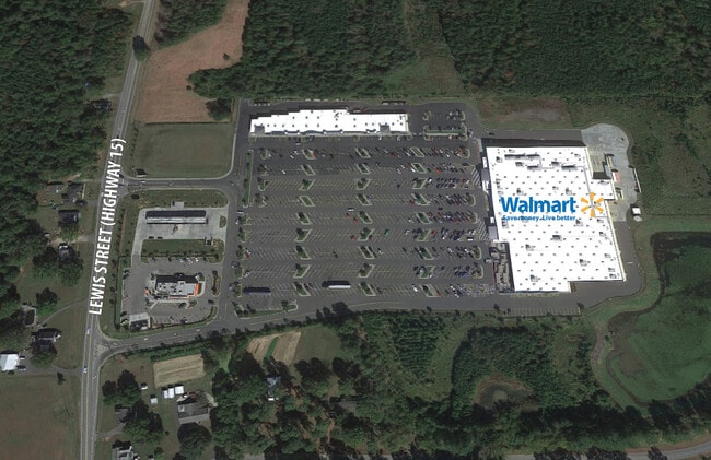
1015 Lewis St, Oxford, NC 27565


NEARBY LISTINGS FOR SALE OR LEASE
Property Detail
1015 Lewis St
191204608919
Oxford Retail Investment Llc
Wholesaleoutletdiscountstore
TR 1/STORE&ACCESS STRIP
X
Granville
3720191200K
North Carolina
2025
29.95 AC
2025
North Carolina Northeast Area
970400
Other Market Areas
149,950 SF
DEMOGRAPHICS near 1015 Lewis St
1 mile
3 mile
5 mile
2024 Total Population
223
9,173
15,653
2029 Population
236
9,693
16,519
Pop Growth 2024-2029
+ 5.83%
+ 5.67%
+ 5.53%
Average Age
39
41
42
2024 Total Households
83
3,781
6,311
HH Growth 2024-2029
+ 6.02%
+ 5.50%
+ 5.39%
Median Household Inc
$38,333
$41,758
$50,653
Avg Household Size
2.60
2.30
2.40
2024 Avg HH Vehicles
2.00
2.00
2.00
Median Home Value
$157,692
$166,972
$178,598
Median Year Built
1987
1973
1977
Nearby Places
Map Layers
Map Styles
 Street
 Aerial
Transit
 Traffic
 Biking
Places
Listings with unknown addresses are not visible on the map
- Restaurants
- Banks
- Shops
- Fitness
- Groceries
PUBLIC TRANSPORTATION
AIRPORT
Raleigh-Durham International
Drive
Walk
Distance
Raleigh-Durham International
50 min
37.1 mi
SALE & LEASE HISTORY
LISTING DATE
SALE/LEASE

Jan 07, 2021
For Lease
Nearby Properties
Address
Land Use
TOTAL SIZE
Lot Size
Zoning
Address
Land Use
TOTAL SIZE
Lot Size
Zoning
25,364 SF
266.74 AC
RAR6
Address
Land Use
TOTAL SIZE
Lot Size
Zoning
65,740 SF
37.29 AC
RA
Address
Land Use
TOTAL SIZE
Lot Size
Zoning
8,352 SF
110.84 AC
I2
Address
Land Use
TOTAL SIZE
Lot Size
Zoning
9,000 SF
36.08 AC
Address
Land Use
TOTAL SIZE
Lot Size
Zoning
14,634 SF
11.97 AC
B1
Address
Land Use
TOTAL SIZE
Lot Size
Zoning
5,294 SF
19.44 AC
B1
Address
Land Use
TOTAL SIZE
Lot Size
Zoning
15,346 SF
5.87 AC
I2
Address
Land Use
TOTAL SIZE
Lot Size
Zoning
186,443 SF
6 AC
I2
Address
Land Use
TOTAL SIZE
Lot Size
Zoning
88,275 SF
15.56 AC
I2AR40
Address
Land Use
TOTAL SIZE
Lot Size
Zoning
33,547 SF
10.03 AC
Address
Land Use
TOTAL SIZE
Lot Size
Zoning
39,844 SF
5.91 AC
B
Address
Land Use
TOTAL SIZE
Lot Size
Zoning
1,760 SF
9.91 AC
RA
Address
Land Use
TOTAL SIZE
Lot Size
Zoning
34,972 SF
19.19 AC
B1
Address
Land Use
TOTAL SIZE
Lot Size
Zoning
76,072 SF
26.53 AC
I2
Address
Land Use
TOTAL SIZE
Lot Size
Zoning
42,806 SF
0.96 AC
B1
Address
Land Use
TOTAL SIZE
Lot Size
Zoning
161,949 SF
69.03 AC
I2
Address
Land Use
TOTAL SIZE
Lot Size
Zoning
133,676 SF
11 AC
Address
Land Use
TOTAL SIZE
Lot Size
Zoning
2,812 SF
8.37 AC
Address
Land Use
TOTAL SIZE
Lot Size
Zoning
18,729 SF
6.66 AC
B1
Address
Land Use
TOTAL SIZE
Lot Size
Zoning
1,454 SF
12.25 AC
R6
Address
Land Use
TOTAL SIZE
Lot Size
Zoning
70,040 SF
15.32 AC
B2
Address
Land Use
TOTAL SIZE
Lot Size
Zoning
90,875 SF
20 AC
I2
Address
Land Use
TOTAL SIZE
Lot Size
Zoning
8,184 SF
280.85 AC
RA
Address
Land Use
TOTAL SIZE
Lot Size
Zoning
1,591 SF
6.50 AC
R25
Address
Land Use
TOTAL SIZE
Lot Size
Zoning
135,720 SF
10.31 AC
I2
Address
Land Use
TOTAL SIZE
Lot Size
Zoning
2,276 SF
3.35 AC
Address
Land Use
TOTAL SIZE
Lot Size
Zoning
18.78 AC
HB
Address
Land Use
TOTAL SIZE
Lot Size
Zoning
14,036 SF
4.84 AC
Address
Land Use
TOTAL SIZE
Lot Size
Zoning
23,454 SF
0.87 AC
B1
The World's #1 Commercial Real Estate Marketplace
Connect with us
© 2026 CoStar Group
The information above has been obtained from sources believed reliable. While we do not doubt its accuracy we have not verified it and make no guarantee, warranty or representation about it. It is your responsibility to independently confirm its accuracy and completeness. Any projections, opinions, assumptions, or estimates used are for example only and do not represent the current or future performance of the property. The value of this transaction to you depends on tax and other factors which should be evaluated by your tax, financial, and legal advisors. You and your advisors should conduct a careful, independent investigation of the property to determine to your satisfaction the suitability of the property for your needs.