Property Record
1015 Liberty Industrial Dr, O Fallon, MO 63366

NEARBY LISTINGS FOR SALE OR LEASE
Property Detail
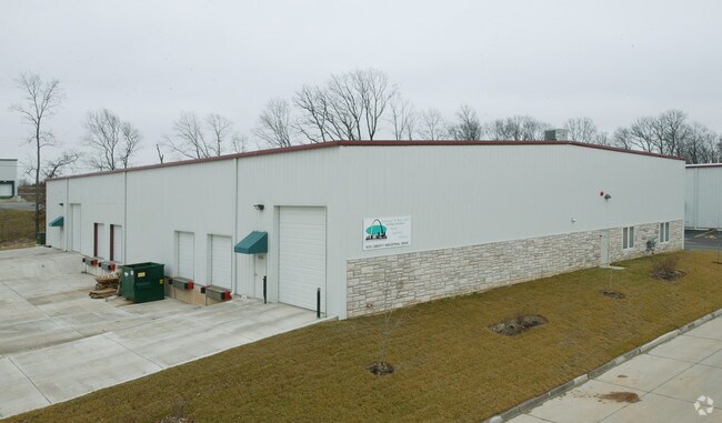
1015 Liberty Industrial Dr
St. Louis, MO-IL
Liberty Ind Pk
2-0049-9450-00-0003.0000000
LIBERTY IND PK LOT 3
Industrialgeneral
St. Charles
X
Missouri
29183C0210G
3
2024
1.27 AC
2025
St Charles County
311802
St. Louis
15,000 SF
DEMOGRAPHICS near 1015 Liberty Industrial Dr
1 mile
3 mile
5 mile
2024 Total Population
1,701
50,522
130,840
2029 Population
1,798
53,954
139,054
Pop Growth 2024-2029
+ 5.70%
+ 6.79%
+ 6.28%
Average Age
39
41
40
2024 Total Households
701
19,293
48,228
HH Growth 2024-2029
+ 5.71%
+ 6.75%
+ 6.31%
Median Household Inc
$82,708
$98,589
$100,895
Avg Household Size
2.40
2.60
2.70
2024 Avg HH Vehicles
2.00
2.00
2.00
Median Home Value
$260,683
$297,262
$288,829
Median Year Built
2001
1999
1999
Nearby Places
Map Layers
Map Styles
 Street
 Aerial
Transit
 Traffic
 Biking
Places
Listings with unknown addresses are not visible on the map
- Restaurants
- Banks
- Shops
- Fitness
- Groceries
PUBLIC TRANSPORTATION
AIRPORT
St Louis Lambert International
Drive
Walk
Distance
St Louis Lambert International
36 min
25.5 mi
Freight Ports
Tulsa Port of Inola
Drive
Walk
Distance
Tulsa Port of Inola
431 min
376.9 mi
SALE & LEASE HISTORY
LISTING DATE
SALE/LEASE

Jan 30, 2017
For Lease
Aug 02, 2023
For Lease
Nearby Properties
Address
Land Use
TOTAL SIZE
Lot Size
Zoning
Address
Land Use
TOTAL SIZE
Lot Size
Zoning
482.60 AC
AC7
Address
Land Use
TOTAL SIZE
Lot Size
Zoning
420,705 SF
37.21 AC
Address
Land Use
TOTAL SIZE
Lot Size
Zoning
244,087 SF
7.24 AC
Address
Land Use
TOTAL SIZE
Lot Size
Zoning
Address
Land Use
TOTAL SIZE
Lot Size
Zoning
254,435 SF
16.57 AC
Address
Land Use
TOTAL SIZE
Lot Size
Zoning
35,670 SF
1.12 AC
Address
Land Use
TOTAL SIZE
Lot Size
Zoning
77.65 AC
AC7
Address
Land Use
TOTAL SIZE
Lot Size
Zoning
36,438 SF
2.08 AC
AC4
Address
Land Use
TOTAL SIZE
Lot Size
Zoning
35,112 SF
0.88 AC
Address
Land Use
TOTAL SIZE
Lot Size
Zoning
251,169 SF
20.19 AC
Address
Land Use
TOTAL SIZE
Lot Size
Zoning
111,573 SF
19.11 AC
Address
Land Use
TOTAL SIZE
Lot Size
Zoning
210,095 SF
12.29 AC
AE9
Address
Land Use
TOTAL SIZE
Lot Size
Zoning
140,826 SF
7.09 AC
Address
Land Use
TOTAL SIZE
Lot Size
Zoning
183,416 SF
40.46 AC
Address
Land Use
TOTAL SIZE
Lot Size
Zoning
48.76 AC
AF0
Address
Land Use
TOTAL SIZE
Lot Size
Zoning
375,136 SF
34.40 AC
Address
Land Use
TOTAL SIZE
Lot Size
Zoning
147,526 SF
7.51 AC
AE8
Address
Land Use
TOTAL SIZE
Lot Size
Zoning
57.96 AC
Address
Land Use
TOTAL SIZE
Lot Size
Zoning
121,518 SF
3.40 AC
Address
Land Use
TOTAL SIZE
Lot Size
Zoning
Address
Land Use
TOTAL SIZE
Lot Size
Zoning
41.41 AC
AD9
Address
Land Use
TOTAL SIZE
Lot Size
Zoning
10,690 SF
11.23 AC
AA2
Address
Land Use
TOTAL SIZE
Lot Size
Zoning
106,447 SF
6.53 AC
Address
Land Use
TOTAL SIZE
Lot Size
Zoning
10.41 AC
Address
Land Use
TOTAL SIZE
Lot Size
Zoning
1,484 SF
90.24 AC
Address
Land Use
TOTAL SIZE
Lot Size
Zoning
35.34 AC
Address
Land Use
TOTAL SIZE
Lot Size
Zoning
69,500 SF
9.39 AC
Address
Land Use
TOTAL SIZE
Lot Size
Zoning
55,323 SF
8.44 AC
AC4
Address
Land Use
TOTAL SIZE
Lot Size
Zoning
Address
Land Use
TOTAL SIZE
Lot Size
Zoning
97,000 SF
6.25 AC
The World's #1 Commercial Real Estate Marketplace
Connect with us
© 2026 CoStar Group
The information above has been obtained from sources believed reliable. While we do not doubt its accuracy we have not verified it and make no guarantee, warranty or representation about it. It is your responsibility to independently confirm its accuracy and completeness. Any projections, opinions, assumptions, or estimates used are for example only and do not represent the current or future performance of the property. The value of this transaction to you depends on tax and other factors which should be evaluated by your tax, financial, and legal advisors. You and your advisors should conduct a careful, independent investigation of the property to determine to your satisfaction the suitability of the property for your needs.