Property Record
1015 Meadow Ln, Des Moines, IA 50315

NEARBY LISTINGS FOR SALE OR LEASE
-
-
View all Des Moines listings for sale on LoopNet.com
Property Detail
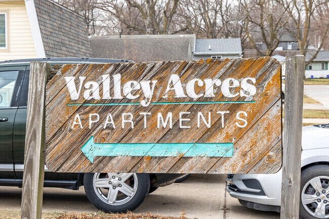
1015 Meadow Ln
Des Moines-West Des Moines, IA
Valley Acres
120-05910001000
LTS 38 THRU 42 & E 22.3F LT 43 VALLEY ACRES
Apartment
Polk
X
Iowa
19153C0345F
39
2024
2.31 AC
2025
Outer SE Des Moines S
004701
Des Moines
22,600 SF
DEMOGRAPHICS near 1015 Meadow Ln
1 Mile
3 Mile
5 Mile
2024 Total Population
5,934
44,168
97,854
2029 Population
6,154
46,201
103,119
Pop Growth 2024-2029
+ 3.71%
+ 4.60%
+ 5.38%
Average Age
38
38
38
2024 Total Households
2,342
17,459
40,573
HH Growth 2024-2029
+ 3.89%
+ 4.74%
+ 5.57%
Median Household Inc
$55,216
$62,289
$65,545
Avg Household Size
2.40
2.40
2.30
2024 Avg HH Vehicles
2.00
2.00
2.00
Median Home Value
$141,234
$159,153
$182,441
Median Year Built
1964
1971
1977
Nearby Places
Map Layers
Map Styles
 Street
 Aerial
- Restaurants
- Banks
- Shops
- Fitness
- Groceries
PUBLIC TRANSPORTATION
AIRPORT
Des Moines International
DRIVE
WALK
Distance
Des Moines International
10 min
4.3 mi
Freight Ports
Port Milwaukee
DRIVE
WALK
Distance
Port Milwaukee
425 min
379.3 mi
Nearby Properties
Address
Land Use
TOTAL SIZE
Lot Size
Zoning
Address
Land Use
TOTAL SIZE
Lot Size
Zoning
397,938 SF
27.97 AC
PUD
Address
Land Use
TOTAL SIZE
Lot Size
Zoning
302,800 SF
20.85 AC
Address
Land Use
TOTAL SIZE
Lot Size
Zoning
298,716 SF
18.90 AC
PUD
Address
Land Use
TOTAL SIZE
Lot Size
Zoning
93,889 SF
17.07 AC
Address
Land Use
TOTAL SIZE
Lot Size
Zoning
208,456 SF
14.42 AC
PUD
Address
Land Use
TOTAL SIZE
Lot Size
Zoning
231,168 SF
22.29 AC
PUD
Address
Land Use
TOTAL SIZE
Lot Size
Zoning
161,788 SF
9.41 AC
PBP
Address
Land Use
TOTAL SIZE
Lot Size
Zoning
260,420 SF
18.17 AC
R-3
Address
Land Use
TOTAL SIZE
Lot Size
Zoning
107,550 SF
7.30 AC
Address
Land Use
TOTAL SIZE
Lot Size
Zoning
131,361 SF
7.50 AC
Address
Land Use
TOTAL SIZE
Lot Size
Zoning
160,680 SF
20.08 AC
C-2
Address
Land Use
TOTAL SIZE
Lot Size
Zoning
684,064 SF
2 AC
C-3
Address
Land Use
TOTAL SIZE
Lot Size
Zoning
51,965 SF
3.83 AC
C-4
Address
Land Use
TOTAL SIZE
Lot Size
Zoning
82,044 SF
2.91 AC
Address
Land Use
TOTAL SIZE
Lot Size
Zoning
147,173 SF
20.84 AC
PUD
Address
Land Use
TOTAL SIZE
Lot Size
Zoning
301,434 SF
29.03 AC
C4
Address
Land Use
TOTAL SIZE
Lot Size
Zoning
121,200 SF
10.32 AC
C-2
Address
Land Use
TOTAL SIZE
Lot Size
Zoning
109,422 SF
16.09 AC
PBP
Address
Land Use
TOTAL SIZE
Lot Size
Zoning
178,721 SF
8.19 AC
C-2
Address
Land Use
TOTAL SIZE
Lot Size
Zoning
73,000 SF
4.07 AC
PUD
Address
Land Use
TOTAL SIZE
Lot Size
Zoning
310,851 SF
18.05 AC
C-4
Address
Land Use
TOTAL SIZE
Lot Size
Zoning
91,166 SF
C-4
Address
Land Use
TOTAL SIZE
Lot Size
Zoning
92,232 SF
6.01 AC
R-3
Address
Land Use
TOTAL SIZE
Lot Size
Zoning
110,260 SF
9.56 AC
PUD
Address
Land Use
TOTAL SIZE
Lot Size
Zoning
73,860 SF
2.52 AC
Address
Land Use
TOTAL SIZE
Lot Size
Zoning
74,600 SF
8.50 AC
Address
Land Use
TOTAL SIZE
Lot Size
Zoning
86,304 SF
3.56 AC
R-3
Address
Land Use
TOTAL SIZE
Lot Size
Zoning
100,800 SF
10.57 AC
Address
Land Use
TOTAL SIZE
Lot Size
Zoning
147,400 SF
15.05 AC
C-2
The World's #1 Commercial Real Estate Marketplace
Connect with us
© 2025 CoStar Group
The information above has been obtained from sources believed reliable. While we do not doubt its accuracy we have not verified it and make no guarantee, warranty or representation about it. It is your responsibility to independently confirm its accuracy and completeness. Any projections, opinions, assumptions, or estimates used are for example only and do not represent the current or future performance of the property. The value of this transaction to you depends on tax and other factors which should be evaluated by your tax, financial, and legal advisors. You and your advisors should conduct a careful, independent investigation of the property to determine to your satisfaction the suitability of the property for your needs.