Property Record
1015 S Fm, Weslaco, TX 78596
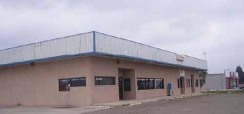

Property Detail
1015 S Fm
McAllen/Edinburg/Pharr
ADAMS TRACT W14.89AC FT 1001 14.89AC NET
McAllen-Edinburg-Mission, TX
HIDALGO
A0800-00-000-1001-00
Texas
Privatepreserveopenspacevacantlandforestlandconservation
1001
2024
14.89 AC
2025
Outlying Hidalgo County
022703
NEARBY LISTINGS FOR SALE OR LEASE
DEMOGRAPHICS near 1015 S Fm
1 mile
3 mile
5 mile
2025 Total Population
3,490
31,673
77,761
2030 Population
3,706
33,647
82,359
Pop Growth 2025-2030
+ 6.19%
+ 6.23%
+ 5.91%
Average Age
37
39
37
2025 Total Households
1,094
10,725
24,786
HH Growth 2025-2030
+ 6.31%
+ 7.20%
+ 6.33%
Median Household Inc
$50,571
$55,697
$51,375
Avg Household Size
3.20
2.90
3.00
2025 Avg HH Vehicles
2.00
2.00
2.00
Median Home Value
$83,364
$113,473
$124,625
Median Year Built
1986
1994
1994
Nearby Places
Map Layers
Map Styles
 Street
 Aerial
Transit
 Traffic
 Biking
Places
Listings with unknown addresses are not visible on the map
- Restaurants
- Banks
- Shops
- Fitness
- Groceries
PUBLIC TRANSPORTATION
AIRPORT
McAllen International
Drive
Walk
Distance
McAllen International
29 min
22.1 mi
Valley International
Drive
Walk
Distance
Valley International
33 min
25.0 mi
Freight Ports
Port of Brownsville
Drive
Walk
Distance
Port of Brownsville
51 min
44.3 mi
SALE & LEASE HISTORY
LISTING DATE
SALE/LEASE

Sep 23, 2016
For Sale
Nearby Properties
Address
Land Use
TOTAL SIZE
Lot Size
Zoning
Address
Land Use
TOTAL SIZE
Lot Size
Zoning
401,046 SF
13.97 AC
Address
Land Use
TOTAL SIZE
Lot Size
Zoning
552,365 SF
72.02 AC
GT
Address
Land Use
TOTAL SIZE
Lot Size
Zoning
184,092 SF
17.61 AC
Address
Land Use
TOTAL SIZE
Lot Size
Zoning
2 SF
48.88 AC
GT
Address
Land Use
TOTAL SIZE
Lot Size
Zoning
342,760 SF
42.33 AC
Address
Land Use
TOTAL SIZE
Lot Size
Zoning
5 SF
2.15 AC
Address
Land Use
TOTAL SIZE
Lot Size
Zoning
76,484 SF
20.60 AC
Address
Land Use
TOTAL SIZE
Lot Size
Zoning
3 SF
16.78 AC
Address
Land Use
TOTAL SIZE
Lot Size
Zoning
13 SF
29 AC
Address
Land Use
TOTAL SIZE
Lot Size
Zoning
9 SF
21.03 AC
Address
Land Use
TOTAL SIZE
Lot Size
Zoning
8 SF
18.79 AC
Address
Land Use
TOTAL SIZE
Lot Size
Zoning
8 SF
7.07 AC
Address
Land Use
TOTAL SIZE
Lot Size
Zoning
132,797 SF
7.88 AC
Address
Land Use
TOTAL SIZE
Lot Size
Zoning
8 SF
5 AC
Address
Land Use
TOTAL SIZE
Lot Size
Zoning
1 SF
12.23 AC
Address
Land Use
TOTAL SIZE
Lot Size
Zoning
39,592 SF
12.22 AC
Address
Land Use
TOTAL SIZE
Lot Size
Zoning
1 SF
21.22 AC
Address
Land Use
TOTAL SIZE
Lot Size
Zoning
22,144 SF
55.59 AC
Address
Land Use
TOTAL SIZE
Lot Size
Zoning
58,335 SF
2.57 AC
CO
Address
Land Use
TOTAL SIZE
Lot Size
Zoning
36,007 SF
12.78 AC
Address
Land Use
TOTAL SIZE
Lot Size
Zoning
39,875 SF
5.46 AC
AO
Address
Land Use
TOTAL SIZE
Lot Size
Zoning
15,250 SF
28.36 AC
CO
Address
Land Use
TOTAL SIZE
Lot Size
Zoning
110,725 SF
6.74 AC
Address
Land Use
TOTAL SIZE
Lot Size
Zoning
104,220 SF
7.71 AC
Address
Land Use
TOTAL SIZE
Lot Size
Zoning
12,148 SF
17.84 AC
M3
Address
Land Use
TOTAL SIZE
Lot Size
Zoning
18,618 SF
33.88 AC
M2
Address
Land Use
TOTAL SIZE
Lot Size
Zoning
2.15 AC
Address
Land Use
TOTAL SIZE
Lot Size
Zoning
63,104 SF
2.41 AC
Address
Land Use
TOTAL SIZE
Lot Size
Zoning
79.03 AC
Address
Land Use
TOTAL SIZE
Lot Size
Zoning
50,699 SF
11.40 AC
The World's #1 Commercial Real Estate Marketplace
Connect with us
© 2026 CoStar Group
The information above has been obtained from sources believed reliable. While we do not doubt its accuracy we have not verified it and make no guarantee, warranty or representation about it. It is your responsibility to independently confirm its accuracy and completeness. Any projections, opinions, assumptions, or estimates used are for example only and do not represent the current or future performance of the property. The value of this transaction to you depends on tax and other factors which should be evaluated by your tax, financial, and legal advisors. You and your advisors should conduct a careful, independent investigation of the property to determine to your satisfaction the suitability of the property for your needs.