Property Record
1015 Us Highway 70, Connelly Springs, NC 28612


NEARBY LISTINGS FOR SALE OR LEASE
-
-
View all Connelly Springs listings for sale on LoopNet.com
Property Detail
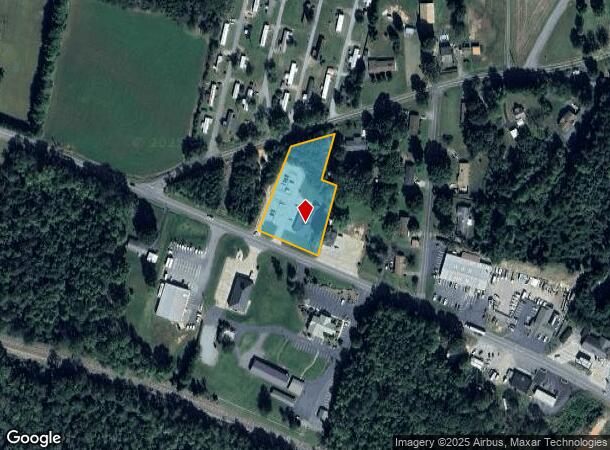
1015 Us Highway 70
12812
1015 US 70 CONNELLY SPRINGS, NC 28612
Uspostalservice
Burke
X
North Carolina
3710275300J
1.41 AC
2025
Burke County
2025
Charlotte
021000
Hickory-Lenoir-Morganton, NC
3,952 SF
DEMOGRAPHICS near 1015 Us Highway 70
1 Mile
3 Mile
5 Mile
2024 Total Population
1,080
7,849
23,509
2029 Population
1,073
7,823
23,439
Pop Growth 2024-2029
(0.65%)
(0.33%)
(0.30%)
Average Age
46
46
45
2024 Total Households
438
3,131
9,565
HH Growth 2024-2029
(0.68%)
(0.35%)
(0.29%)
Median Household Inc
$59,166
$61,907
$60,427
Avg Household Size
2.40
2.40
2.40
2024 Avg HH Vehicles
2.00
2.00
2.00
Median Home Value
$165,591
$160,621
$156,915
Median Year Built
1981
1980
1979
Nearby Places
Map Layers
Map Styles
 Street
 Aerial
- Restaurants
- Banks
- Shops
- Fitness
- Groceries
Nearby Properties
Address
Land Use
TOTAL SIZE
Lot Size
Zoning
Address
Land Use
TOTAL SIZE
Lot Size
Zoning
GENERAL BU
Address
Land Use
TOTAL SIZE
Lot Size
Zoning
GENERAL MA
Address
Land Use
TOTAL SIZE
Lot Size
Zoning
52,542 SF
RESIDENTIA
Address
Land Use
TOTAL SIZE
Lot Size
Zoning
RESIDENTIA
Address
Land Use
TOTAL SIZE
Lot Size
Zoning
36,767 SF
7.49 AC
RESIDENTIA
Address
Land Use
TOTAL SIZE
Lot Size
Zoning
42,565 SF
5.10 AC
GENERAL BU
Address
Land Use
TOTAL SIZE
Lot Size
Zoning
194,159 SF
41.19 AC
GENERAL MA
Address
Land Use
TOTAL SIZE
Lot Size
Zoning
205,525 SF
11.79 AC
GENERAL MA
Address
Land Use
TOTAL SIZE
Lot Size
Zoning
7,416 SF
RES LOW DE
Address
Land Use
TOTAL SIZE
Lot Size
Zoning
14,550 SF
1.56 AC
HIGHWAY BU
Address
Land Use
TOTAL SIZE
Lot Size
Zoning
76.07 AC
GENERAL MA
Address
Land Use
TOTAL SIZE
Lot Size
Zoning
163,919 SF
16.96 AC
GENERAL MA
Address
Land Use
TOTAL SIZE
Lot Size
Zoning
10,125 SF
1.38 AC
HIGHWAY BU
Address
Land Use
TOTAL SIZE
Lot Size
Zoning
6,576 SF
6.06 AC
R-8 RESIDE
Address
Land Use
TOTAL SIZE
Lot Size
Zoning
56,633 SF
17.91 AC
GENERAL MA
Address
Land Use
TOTAL SIZE
Lot Size
Zoning
26,338 SF
RESIDENTIA
Address
Land Use
TOTAL SIZE
Lot Size
Zoning
31,872 SF
CENTRAL BU
Address
Land Use
TOTAL SIZE
Lot Size
Zoning
4,320 SF
RESIDENTIA
Address
Land Use
TOTAL SIZE
Lot Size
Zoning
19,086 SF
OFFICE AND
Address
Land Use
TOTAL SIZE
Lot Size
Zoning
22,520 SF
GENERAL BU
Address
Land Use
TOTAL SIZE
Lot Size
Zoning
6,568 SF
0.69 AC
CENTRAL BU
Address
Land Use
TOTAL SIZE
Lot Size
Zoning
23,044 SF
2.30 AC
GENERAL BU
Address
Land Use
TOTAL SIZE
Lot Size
Zoning
3,281 SF
1.75 AC
GENERAL BU
Address
Land Use
TOTAL SIZE
Lot Size
Zoning
3,578 SF
1.49 AC
HIGHWAY BU
Address
Land Use
TOTAL SIZE
Lot Size
Zoning
101,877 SF
25.11 AC
GENERAL MA
Address
Land Use
TOTAL SIZE
Lot Size
Zoning
10,146 SF
1.16 AC
CENTRAL BU
Address
Land Use
TOTAL SIZE
Lot Size
Zoning
7,911 SF
RESIDENTIA
Address
Land Use
TOTAL SIZE
Lot Size
Zoning
7,211 SF
CENTRAL BU
Address
Land Use
TOTAL SIZE
Lot Size
Zoning
2,400 SF
0.90 AC
HIGHWAY BU
Address
Land Use
TOTAL SIZE
Lot Size
Zoning
409 SF
3.52 AC
R-8 RESIDE
The World's #1 Commercial Real Estate Marketplace
Connect with us
© 2025 CoStar Group
The information above has been obtained from sources believed reliable. While we do not doubt its accuracy we have not verified it and make no guarantee, warranty or representation about it. It is your responsibility to independently confirm its accuracy and completeness. Any projections, opinions, assumptions, or estimates used are for example only and do not represent the current or future performance of the property. The value of this transaction to you depends on tax and other factors which should be evaluated by your tax, financial, and legal advisors. You and your advisors should conduct a careful, independent investigation of the property to determine to your satisfaction the suitability of the property for your needs.