Property Record
1015 Uvalde Rd, Houston, TX 77015

NEARBY LISTINGS FOR SALE OR LEASE
Property Detail
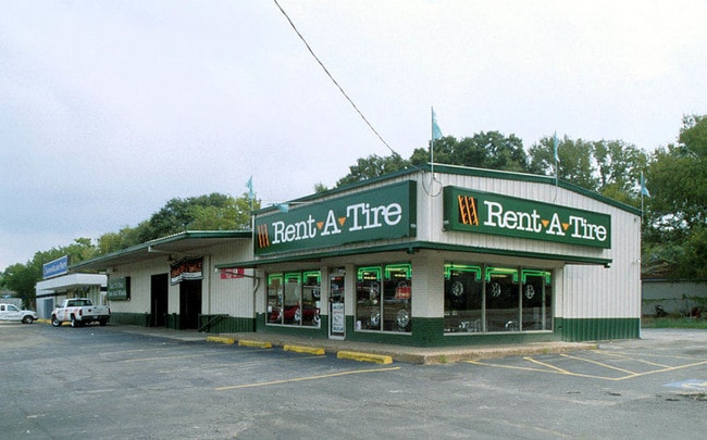
1015 Uvalde Rd
Houston-Pasadena-The Woodlands, TX
Home Owned Estates Sec 1
0750850110317
LTS 317 & 318 BLK 11 HOME OWNED ESTATES SEC 1
Storebuilding
Harris
AE
Texas
48201C0720M
317
2024
0.69 AC
2025
Northeast I-10
233200
Houston
8,362 SF
DEMOGRAPHICS near 1015 Uvalde Rd
1 Mile
3 Mile
5 Mile
2024 Total Population
14,881
95,788
172,031
2029 Population
15,118
97,310
175,222
Pop Growth 2024-2029
+ 1.59%
+ 1.59%
+ 1.85%
Average Age
33
35
34
2024 Total Households
4,182
29,674
52,405
HH Growth 2024-2029
+ 1.51%
+ 1.54%
+ 1.80%
Median Household Inc
$45,283
$51,528
$52,949
Avg Household Size
3.40
3.10
3.20
2024 Avg HH Vehicles
2.00
2.00
2.00
Median Home Value
$121,167
$144,185
$143,130
Median Year Built
1965
1980
1980
Nearby Places
Map Layers
Map Styles
 Street
 Aerial
- Restaurants
- Banks
- Shops
- Fitness
- Groceries
PUBLIC TRANSPORTATION
AIRPORT
William P Hobby
DRIVE
WALK
Distance
William P Hobby
30 min
17.0 mi
George Bush Intcntl/Houston
DRIVE
WALK
Distance
George Bush Intcntl/Houston
30 min
23.3 mi
Freight Ports
Port of Houston
DRIVE
WALK
Distance
Port of Houston
16 min
9.0 mi
Nearby Properties
Address
Land Use
TOTAL SIZE
Lot Size
Zoning
Address
Land Use
TOTAL SIZE
Lot Size
Zoning
13,460,439 SF
191.66 AC
Address
Land Use
TOTAL SIZE
Lot Size
Zoning
10,093,711 SF
30.83 AC
Address
Land Use
TOTAL SIZE
Lot Size
Zoning
873,718 SF
49.59 AC
Address
Land Use
TOTAL SIZE
Lot Size
Zoning
2,019,000 SF
20 AC
Address
Land Use
TOTAL SIZE
Lot Size
Zoning
486.59 AC
Address
Land Use
TOTAL SIZE
Lot Size
Zoning
337,331 SF
56.09 AC
Address
Land Use
TOTAL SIZE
Lot Size
Zoning
158.48 AC
Address
Land Use
TOTAL SIZE
Lot Size
Zoning
2,124,914 SF
243.08 AC
Address
Land Use
TOTAL SIZE
Lot Size
Zoning
30.84 AC
Address
Land Use
TOTAL SIZE
Lot Size
Zoning
520,866 SF
23.25 AC
Address
Land Use
TOTAL SIZE
Lot Size
Zoning
398,995 SF
27.39 AC
Address
Land Use
TOTAL SIZE
Lot Size
Zoning
271,428 SF
10.57 AC
Address
Land Use
TOTAL SIZE
Lot Size
Zoning
351,250 SF
23.84 AC
Address
Land Use
TOTAL SIZE
Lot Size
Zoning
450,084 SF
15.13 AC
Address
Land Use
TOTAL SIZE
Lot Size
Zoning
496.18 AC
Address
Land Use
TOTAL SIZE
Lot Size
Zoning
840,000 SF
200.29 AC
Address
Land Use
TOTAL SIZE
Lot Size
Zoning
202,544 SF
4.06 AC
Address
Land Use
TOTAL SIZE
Lot Size
Zoning
503 AC
Address
Land Use
TOTAL SIZE
Lot Size
Zoning
187,726 SF
32.24 AC
Address
Land Use
TOTAL SIZE
Lot Size
Zoning
526,975 SF
21.08 AC
Address
Land Use
TOTAL SIZE
Lot Size
Zoning
889,587 SF
137.68 AC
Address
Land Use
TOTAL SIZE
Lot Size
Zoning
227,679 SF
13.31 AC
Address
Land Use
TOTAL SIZE
Lot Size
Zoning
49,384 SF
69.01 AC
Address
Land Use
TOTAL SIZE
Lot Size
Zoning
200.06 AC
Address
Land Use
TOTAL SIZE
Lot Size
Zoning
235,624 SF
10.06 AC
Address
Land Use
TOTAL SIZE
Lot Size
Zoning
205,001 SF
16.63 AC
Address
Land Use
TOTAL SIZE
Lot Size
Zoning
208,648 SF
8.99 AC
Address
Land Use
TOTAL SIZE
Lot Size
Zoning
377,109 SF
17.36 AC
Address
Land Use
TOTAL SIZE
Lot Size
Zoning
197,953 SF
8.29 AC
Address
Land Use
TOTAL SIZE
Lot Size
Zoning
246,277 SF
10.91 AC
The World's #1 Commercial Real Estate Marketplace
Connect with us
© 2026 CoStar Group
The information above has been obtained from sources believed reliable. While we do not doubt its accuracy we have not verified it and make no guarantee, warranty or representation about it. It is your responsibility to independently confirm its accuracy and completeness. Any projections, opinions, assumptions, or estimates used are for example only and do not represent the current or future performance of the property. The value of this transaction to you depends on tax and other factors which should be evaluated by your tax, financial, and legal advisors. You and your advisors should conduct a careful, independent investigation of the property to determine to your satisfaction the suitability of the property for your needs.