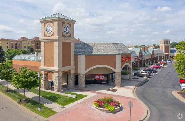
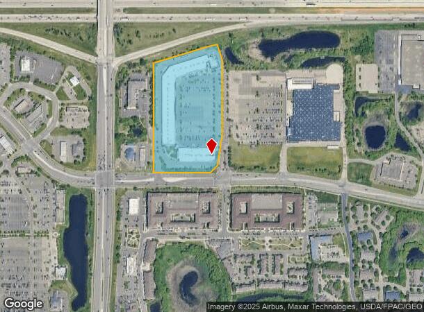
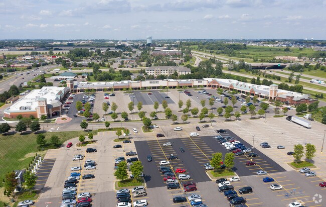
Property Record
10150 Hudson Rd, Saint Paul, MN 55129

NEARBY LISTINGS FOR SALE OR LEASE
Property Detail
10150 Hudson Rd
Minneapolis-St. Paul-Bloomington, MN-WI
Marketplace Add
02-028-21-22-0008
SUBDIVISIONNAME MARKETPLACE ADD LOT 1 BLOCK 1 SUBDIVISIONCD 01049 SUBJ TO EASE
Commercialnec
Washington
X
Minnesota
27163C0335E
1
2025
19.98 AC
2024
Woodbury
071021
Minneapolis/St Paul
122,461 SF
DEMOGRAPHICS near 10150 Hudson Rd
1 Mile
3 Mile
5 Mile
2024 Total Population
7,544
44,784
116,951
2029 Population
8,228
48,546
126,350
Pop Growth 2024-2029
+ 9.07%
+ 8.40%
+ 8.04%
Average Age
40
39
39
2024 Total Households
3,137
16,675
43,247
HH Growth 2024-2029
+ 9.15%
+ 8.53%
+ 8.09%
Median Household Inc
$110,502
$131,065
$113,151
Avg Household Size
2.40
2.60
2.60
2024 Avg HH Vehicles
2.00
2.00
2.00
Median Home Value
$422,790
$414,653
$387,080
Median Year Built
2002
1998
1994
Nearby Places
Map Layers
Map Styles
 Street
 Aerial
- Restaurants
- Banks
- Shops
- Fitness
- Groceries
PUBLIC TRANSPORTATION
COMMUTER RAIL
St. Paul-Minneapolis (Empire Builder - Amtrak)
DRIVE
WALK
Distance
St. Paul-Minneapolis (Empire Builder - Amtrak)
16 min
9.8 mi
AIRPORT
Minneapolis-St Paul International/Wold-Chamberlain
DRIVE
WALK
Distance
Minneapolis-St Paul International/Wold-Chamberlain
30 min
19.6 mi
Freight Ports
Port Milwaukee
DRIVE
WALK
Distance
Port Milwaukee
351 min
320.0 mi
SALE & LEASE HISTORY
LISTING DATE
SALE/LEASE

Sep 25, 2016
For Lease
Nearby Properties
Address
Land Use
TOTAL SIZE
Lot Size
Zoning
Address
Land Use
TOTAL SIZE
Lot Size
Zoning
925,234 SF
37.62 AC
Address
Land Use
TOTAL SIZE
Lot Size
Zoning
Address
Land Use
TOTAL SIZE
Lot Size
Zoning
335,655 SF
Address
Land Use
TOTAL SIZE
Lot Size
Zoning
4.81 AC
Address
Land Use
TOTAL SIZE
Lot Size
Zoning
219,844 SF
Address
Land Use
TOTAL SIZE
Lot Size
Zoning
Address
Land Use
TOTAL SIZE
Lot Size
Zoning
467,160 SF
5 AC
Address
Land Use
TOTAL SIZE
Lot Size
Zoning
15.11 AC
Address
Land Use
TOTAL SIZE
Lot Size
Zoning
14,294 SF
2.38 AC
Address
Land Use
TOTAL SIZE
Lot Size
Zoning
47,717 SF
10.10 AC
Address
Land Use
TOTAL SIZE
Lot Size
Zoning
282,494 SF
9 AC
Address
Land Use
TOTAL SIZE
Lot Size
Zoning
136,726 SF
Address
Land Use
TOTAL SIZE
Lot Size
Zoning
Address
Land Use
TOTAL SIZE
Lot Size
Zoning
228,036 SF
31.11 AC
Address
Land Use
TOTAL SIZE
Lot Size
Zoning
516,859 SF
Address
Land Use
TOTAL SIZE
Lot Size
Zoning
100,358 SF
24.99 AC
Address
Land Use
TOTAL SIZE
Lot Size
Zoning
85,400 SF
6.43 AC
Address
Land Use
TOTAL SIZE
Lot Size
Zoning
476,928 SF
Address
Land Use
TOTAL SIZE
Lot Size
Zoning
86,572 SF
7.92 AC
Address
Land Use
TOTAL SIZE
Lot Size
Zoning
121,705 SF
35 AC
Address
Land Use
TOTAL SIZE
Lot Size
Zoning
79,898 SF
31 AC
Address
Land Use
TOTAL SIZE
Lot Size
Zoning
124,110 SF
Address
Land Use
TOTAL SIZE
Lot Size
Zoning
Address
Land Use
TOTAL SIZE
Lot Size
Zoning
75,825 SF
19.49 AC
Address
Land Use
TOTAL SIZE
Lot Size
Zoning
304,342 SF
24.94 AC
Address
Land Use
TOTAL SIZE
Lot Size
Zoning
111,528 SF
20.30 AC
Address
Land Use
TOTAL SIZE
Lot Size
Zoning
80,019 SF
10.21 AC
Address
Land Use
TOTAL SIZE
Lot Size
Zoning
435,050 SF
Address
Land Use
TOTAL SIZE
Lot Size
Zoning
52,312 SF
4.48 AC
The World's #1 Commercial Real Estate Marketplace
Connect with us
© 2026 CoStar Group
The information above has been obtained from sources believed reliable. While we do not doubt its accuracy we have not verified it and make no guarantee, warranty or representation about it. It is your responsibility to independently confirm its accuracy and completeness. Any projections, opinions, assumptions, or estimates used are for example only and do not represent the current or future performance of the property. The value of this transaction to you depends on tax and other factors which should be evaluated by your tax, financial, and legal advisors. You and your advisors should conduct a careful, independent investigation of the property to determine to your satisfaction the suitability of the property for your needs.