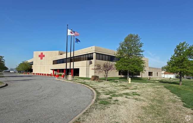
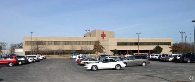
Property Record
10151 E 11Th St, Tulsa, OK 74128

Save to a Folder
{{folder.Name}}
{{folder.ListingIds.length}} Properties
{{folder.ListingIds.length}} Property
Create a New Folder
Property Detail
10151 E 11Th St
17175-94-06-30510
PRT LT 1 & ALL LT 3 BEG 657.83N SWC LT 1 TH N597.54 E327.60 N326.64 E329.27 S556.05 SELY140.48 SELY APR 422.68 NWLY APR 300.84 W311.67 POB BLK 1
Officebuilding
Tulsa
CS
Oklahoma
AE The base floodplain where base flood elevations are provided. AE Zones are now used on new format FIRMs instead of A1-A30 Zones.
3
0
12.85 AC
2025
North Central
008900
Tulsa
66,324 SF
Tulsa, OK
NEARBY LISTINGS FOR SALE OR LEASE
DEMOGRAPHICS near 10151 E 11Th St
1 mile
3 mile
5 mile
2025 Total Population
9,705
79,791
166,497
2030 Population
10,015
82,138
171,761
Pop Growth 2025-2030
+ 3.19%
+ 2.94%
+ 3.16%
Average Age
37
36
37
2025 Total Households
3,640
29,726
65,705
HH Growth 2025-2030
+ 3.35%
+ 3.09%
+ 3.28%
Median Household Inc
$45,873
$50,433
$53,238
Avg Household Size
2.50
2.60
2.40
2025 Avg HH Vehicles
2.00
2.00
2.00
Median Home Value
$120,520
$141,282
$158,023
Median Year Built
1968
1969
1967
Nearby Places
Map Layers
Map Styles
 Street
 Aerial
Layers
 Traffic
 Biking
Places
Listings with unknown addresses are not visible on the map
- Restaurants
- Banks
- Shops
- Fitness
- Groceries
PUBLIC TRANSPORTATION
AIRPORT
Tulsa International
Drive
Walk
Distance
Tulsa International
14 min
8.1 mi
Freight Ports
Drive
Walk
Distance
18 min
11.9 mi
Nearby Properties
Address
Land Use
TOTAL SIZE
Lot Size
Zoning
Address
Land Use
TOTAL SIZE
Lot Size
Zoning
350,741 SF
28.01 AC
CS
Address
Land Use
TOTAL SIZE
Lot Size
Zoning
349,823 SF
203.39 AC
IL
Address
Land Use
TOTAL SIZE
Lot Size
Zoning
228.59 AC
IL
Address
Land Use
TOTAL SIZE
Lot Size
Zoning
77,346 SF
8.59 AC
RS3
Address
Land Use
TOTAL SIZE
Lot Size
Zoning
112,556 SF
11.07 AC
CH
Address
Land Use
TOTAL SIZE
Lot Size
Zoning
96,983 SF
5.42 AC
RM2
Address
Land Use
TOTAL SIZE
Lot Size
Zoning
118,824 SF
38.79 AC
IM
Address
Land Use
TOTAL SIZE
Lot Size
Zoning
73,294 SF
10.08 AC
RS3
Address
Land Use
TOTAL SIZE
Lot Size
Zoning
103,248 SF
8.87 AC
IL
Address
Land Use
TOTAL SIZE
Lot Size
Zoning
106,270 SF
9.47 AC
RM0
Address
Land Use
TOTAL SIZE
Lot Size
Zoning
92,121 SF
9.34 AC
CS
Address
Land Use
TOTAL SIZE
Lot Size
Zoning
124,648 SF
21.23 AC
IL
Address
Land Use
TOTAL SIZE
Lot Size
Zoning
62,352 SF
4.88 AC
CS
Address
Land Use
TOTAL SIZE
Lot Size
Zoning
86,980 SF
2.74 AC
RM1
Address
Land Use
TOTAL SIZE
Lot Size
Zoning
117,204 SF
9.79 AC
IM
Address
Land Use
TOTAL SIZE
Lot Size
Zoning
35,474 SF
6.11 AC
CM
Address
Land Use
TOTAL SIZE
Lot Size
Zoning
101,090 SF
1.70 AC
RS2
Address
Land Use
TOTAL SIZE
Lot Size
Zoning
40,626 SF
2.25 AC
CS
Address
Land Use
TOTAL SIZE
Lot Size
Zoning
55,425 SF
2.96 AC
IL
Address
Land Use
TOTAL SIZE
Lot Size
Zoning
24,113 SF
3.54 AC
CS
Address
Land Use
TOTAL SIZE
Lot Size
Zoning
56,531 SF
7.79 AC
RS3
Address
Land Use
TOTAL SIZE
Lot Size
Zoning
498,836 SF
50.22 AC
CS
Address
Land Use
TOTAL SIZE
Lot Size
Zoning
49,953 SF
2.36 AC
OL
Address
Land Use
TOTAL SIZE
Lot Size
Zoning
30,291 SF
4.49 AC
AG
Address
Land Use
TOTAL SIZE
Lot Size
Zoning
673,050 SF
52.77 AC
IM
Address
Land Use
TOTAL SIZE
Lot Size
Zoning
36,425 SF
5.90 AC
RS3
Address
Land Use
TOTAL SIZE
Lot Size
Zoning
18,325 SF
3.05 AC
CS
Address
Land Use
TOTAL SIZE
Lot Size
Zoning
75.35 AC
AG
Address
Land Use
TOTAL SIZE
Lot Size
Zoning
40,202 SF
2.93 AC
RM0
The World's #1 Commercial Real Estate Marketplace
Connect with us
© 2026 CoStar Group
The information above has been obtained from sources believed reliable. While we do not doubt its accuracy we have not verified it and make no guarantee, warranty or representation about it. It is your responsibility to independently confirm its accuracy and completeness. Any projections, opinions, assumptions, or estimates used are for example only and do not represent the current or future performance of the property. The value of this transaction to you depends on tax and other factors which should be evaluated by your tax, financial, and legal advisors. You and your advisors should conduct a careful, independent investigation of the property to determine to your satisfaction the suitability of the property for your needs.