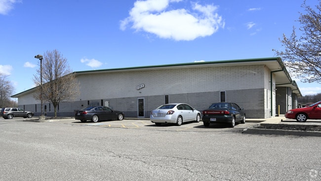
Property Record
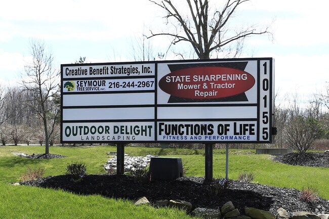
10155H Broadview Rd, Broadview Heights, OH 44147
NEARBY LISTINGS FOR SALE OR LEASE
Property Detail
10155H Broadview Rd
585-20-308
Business Park Cond
Warehouse
UNIT 5 VOL 158 PG 06-13 OL 63 10155 BUSINESS PARK CONDOMINIUM 2007S/R
X
Cuyahoga
39035C0316E
Ohio
2024
0.28 AC
2024
Brecksville/Vly View
136105
Cleveland
2,800 SF
Cleveland-Elyria, OH
DEMOGRAPHICS near 10155H Broadview Rd
1 Mile
3 Mile
5 Mile
2024 Total Population
4,471
23,808
65,508
2029 Population
4,341
23,168
63,785
Pop Growth 2024-2029
(2.91%)
(2.69%)
(2.63%)
Average Age
44
43
44
2024 Total Households
1,783
9,624
26,790
HH Growth 2024-2029
(3.20%)
(2.96%)
(2.83%)
Median Household Inc
$124,874
$100,952
$94,685
Avg Household Size
2.50
2.40
2.40
2024 Avg HH Vehicles
2.00
2.00
2.00
Median Home Value
$304,588
$329,566
$288,129
Median Year Built
2000
1985
1980
Nearby Places
Map Layers
Map Styles
 Street
 Aerial
- Restaurants
- Banks
- Shops
- Fitness
- Groceries
PUBLIC TRANSPORTATION
COMMUTER RAIL
DRIVE
WALK
Distance
15 min
7.3 mi
DRIVE
WALK
Distance
20 min
9.5 mi
AIRPORT
Cleveland-Hopkins International
DRIVE
WALK
Distance
Cleveland-Hopkins International
33 min
18.5 mi
Akron-Canton Regional
DRIVE
WALK
Distance
Akron-Canton Regional
47 min
35.6 mi
Nearby Properties
Address
Land Use
TOTAL SIZE
Lot Size
Zoning
Address
Land Use
TOTAL SIZE
Lot Size
Zoning
105,027 SF
14.05 AC
O-L
Address
Land Use
TOTAL SIZE
Lot Size
Zoning
118.84 AC
L-B
Address
Land Use
TOTAL SIZE
Lot Size
Zoning
485,330 SF
47.02 AC
TCD
Address
Land Use
TOTAL SIZE
Lot Size
Zoning
306,640 SF
19.15 AC
M-D
Address
Land Use
TOTAL SIZE
Lot Size
Zoning
614 SF
19.13 AC
RRZ
Address
Land Use
TOTAL SIZE
Lot Size
Zoning
166,699 SF
65.80 AC
B-5
Address
Land Use
TOTAL SIZE
Lot Size
Zoning
48,682 SF
4.64 AC
C-4
Address
Land Use
TOTAL SIZE
Lot Size
Zoning
63,282 SF
20.09 AC
O-B
Address
Land Use
TOTAL SIZE
Lot Size
Zoning
196,491 SF
2.56 AC
R-20
Address
Land Use
TOTAL SIZE
Lot Size
Zoning
28,189 SF
15.33 AC
B-1OR2
Address
Land Use
TOTAL SIZE
Lot Size
Zoning
10,560 SF
22.12 AC
RM-D
Address
Land Use
TOTAL SIZE
Lot Size
Zoning
337,568 SF
26.88 AC
O-L
Address
Land Use
TOTAL SIZE
Lot Size
Zoning
207,280 SF
18.60 AC
M-D
Address
Land Use
TOTAL SIZE
Lot Size
Zoning
24,900 SF
4.42 AC
B-1OR2
Address
Land Use
TOTAL SIZE
Lot Size
Zoning
55,332 SF
3.01 AC
E-2
Address
Land Use
TOTAL SIZE
Lot Size
Zoning
89,807 SF
7.29 AC
Address
Land Use
TOTAL SIZE
Lot Size
Zoning
49,470 SF
6.61 AC
E-1
Address
Land Use
TOTAL SIZE
Lot Size
Zoning
83,495 SF
9.70 AC
E-1
Address
Land Use
TOTAL SIZE
Lot Size
Zoning
131,001 SF
13.47 AC
Address
Land Use
TOTAL SIZE
Lot Size
Zoning
167,857 SF
10.60 AC
M-D
Address
Land Use
TOTAL SIZE
Lot Size
Zoning
11.97 AC
R-8
Address
Land Use
TOTAL SIZE
Lot Size
Zoning
142,510 SF
13.87 AC
E-2
Address
Land Use
TOTAL SIZE
Lot Size
Zoning
183.35 AC
Address
Land Use
TOTAL SIZE
Lot Size
Zoning
59,813 SF
5.56 AC
Address
Land Use
TOTAL SIZE
Lot Size
Zoning
111,152 SF
80.99 AC
C-F
Address
Land Use
TOTAL SIZE
Lot Size
Zoning
123.70 AC
A-1
Address
Land Use
TOTAL SIZE
Lot Size
Zoning
78,800 SF
38.13 AC
NONE
Address
Land Use
TOTAL SIZE
Lot Size
Zoning
119,793 SF
10.44 AC
M-D
Address
Land Use
TOTAL SIZE
Lot Size
Zoning
82,064 SF
26.29 AC
O-L
Address
Land Use
TOTAL SIZE
Lot Size
Zoning
102,446 SF
8.21 AC
TCD
The World's #1 Commercial Real Estate Marketplace
Connect with us
© 2026 CoStar Group
The information above has been obtained from sources believed reliable. While we do not doubt its accuracy we have not verified it and make no guarantee, warranty or representation about it. It is your responsibility to independently confirm its accuracy and completeness. Any projections, opinions, assumptions, or estimates used are for example only and do not represent the current or future performance of the property. The value of this transaction to you depends on tax and other factors which should be evaluated by your tax, financial, and legal advisors. You and your advisors should conduct a careful, independent investigation of the property to determine to your satisfaction the suitability of the property for your needs.