Property Record
1016 Pike Rd, Birmingham, AL 35218

Save to a Folder
{{folder.Name}}
{{folder.ListingIds.length}} Properties
{{folder.ListingIds.length}} Property
Create a New Folder
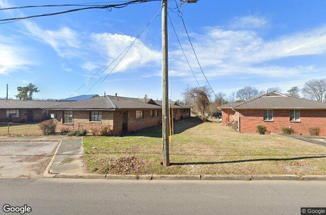
Property Detail
1016 Pike Rd
30-00-01-4-035-005.000
LOT 9 & 10 & PT OF 11 BLK 34-J ENSLEY 17TH ADD DESC AS BEG NE COR OF LOT 9 TH SW 114 FT TH SW 32.4 FT TH SE 129.5 FT TH NE 115 FT TH NW 137 FT TO POB
Apartment
Jefferson
R5
Alabama
B and X Area of moderate flood hazard, usually the area between the limits of the 100-year and 500-year floods.
9,10
2024
0.45 AC
2025
Ensley Highlands
003700
Birmingham
6,240 SF
Birmingham, AL
NEARBY LISTINGS FOR SALE OR LEASE
DEMOGRAPHICS near 1016 Pike Rd
1 mile
3 mile
5 mile
2025 Total Population
10,861
58,978
121,969
2030 Population
10,891
59,950
123,444
Pop Growth 2025-2030
+ 0.28%
+ 1.65%
+ 1.21%
Average Age
41
41
41
2025 Total Households
4,615
24,617
52,249
HH Growth 2025-2030
+ 0.20%
+ 1.65%
+ 1.24%
Median Household Inc
$40,968
$41,828
$42,199
Avg Household Size
2.30
2.20
2.20
2025 Avg HH Vehicles
2.00
2.00
2.00
Median Home Value
$78,467
$82,853
$107,161
Median Year Built
1954
1958
1964
Nearby Places
Map Layers
Map Styles
 Street
 Aerial
Layers
 Traffic
 Biking
Places
Listings with unknown addresses are not visible on the map
- Restaurants
- Banks
- Shops
- Fitness
- Groceries
PUBLIC TRANSPORTATION
COMMUTER RAIL
Birmingham (Crescent - Amtrak)
Drive
Walk
Distance
Birmingham (Crescent - Amtrak)
9 min
6.5 mi
AIRPORT
Birmingham-Shuttlesworth International
Drive
Walk
Distance
Birmingham-Shuttlesworth International
15 min
11.3 mi
Freight Ports
Port of Mobile
Drive
Walk
Distance
Port of Mobile
284 min
260.9 mi
Nearby Properties
Address
Land Use
TOTAL SIZE
Lot Size
Zoning
Address
Land Use
TOTAL SIZE
Lot Size
Zoning
2,573,547 SF
112 AC
I2
Address
Land Use
TOTAL SIZE
Lot Size
Zoning
1,244,986 SF
I2
Address
Land Use
TOTAL SIZE
Lot Size
Zoning
127,240 SF
4 AC
R4
Address
Land Use
TOTAL SIZE
Lot Size
Zoning
200,650 SF
19 AC
R4
Address
Land Use
TOTAL SIZE
Lot Size
Zoning
250,918 SF
10 AC
B-2
Address
Land Use
TOTAL SIZE
Lot Size
Zoning
191,664 SF
15 AC
R4
Address
Land Use
TOTAL SIZE
Lot Size
Zoning
93,081 SF
1 AC
B2
Address
Land Use
TOTAL SIZE
Lot Size
Zoning
225,942 SF
7 AC
M1
Address
Land Use
TOTAL SIZE
Lot Size
Zoning
65,299 SF
2 AC
B2
Address
Land Use
TOTAL SIZE
Lot Size
Zoning
41,695 SF
5.40 AC
R4
Address
Land Use
TOTAL SIZE
Lot Size
Zoning
46,155 SF
1 AC
R4
Address
Land Use
TOTAL SIZE
Lot Size
Zoning
130,563 SF
I3
Address
Land Use
TOTAL SIZE
Lot Size
Zoning
218,210 SF
11 AC
CM-2
Address
Land Use
TOTAL SIZE
Lot Size
Zoning
37,619 SF
9 AC
R3
Address
Land Use
TOTAL SIZE
Lot Size
Zoning
211,517 SF
10 AC
M1
Address
Land Use
TOTAL SIZE
Lot Size
Zoning
65,260 SF
5 AC
B2
Address
Land Use
TOTAL SIZE
Lot Size
Zoning
95,991 SF
5 AC
R5
Address
Land Use
TOTAL SIZE
Lot Size
Zoning
92,678 SF
2.07 AC
R4
Address
Land Use
TOTAL SIZE
Lot Size
Zoning
39,347 SF
6 AC
B2
Address
Land Use
TOTAL SIZE
Lot Size
Zoning
128,484 SF
9 AC
QB1
Address
Land Use
TOTAL SIZE
Lot Size
Zoning
65,371 SF
1 AC
B2
Address
Land Use
TOTAL SIZE
Lot Size
Zoning
104,775 SF
9 AC
B-2
Address
Land Use
TOTAL SIZE
Lot Size
Zoning
157,183 SF
7 AC
B2
Address
Land Use
TOTAL SIZE
Lot Size
Zoning
147,113 SF
18 AC
M2
Address
Land Use
TOTAL SIZE
Lot Size
Zoning
1,437,077 SF
I2
Address
Land Use
TOTAL SIZE
Lot Size
Zoning
94,026 SF
5 AC
I2R2
Address
Land Use
TOTAL SIZE
Lot Size
Zoning
45,666 SF
3 AC
R5
Address
Land Use
TOTAL SIZE
Lot Size
Zoning
1 SF
11 AC
QB1
Address
Land Use
TOTAL SIZE
Lot Size
Zoning
96,543 SF
9 AC
B2
Address
Land Use
TOTAL SIZE
Lot Size
Zoning
34,509 SF
0.52 AC
R3
The World's #1 Commercial Real Estate Marketplace
Connect with us
© 2026 CoStar Group
The information above has been obtained from sources believed reliable. While we do not doubt its accuracy we have not verified it and make no guarantee, warranty or representation about it. It is your responsibility to independently confirm its accuracy and completeness. Any projections, opinions, assumptions, or estimates used are for example only and do not represent the current or future performance of the property. The value of this transaction to you depends on tax and other factors which should be evaluated by your tax, financial, and legal advisors. You and your advisors should conduct a careful, independent investigation of the property to determine to your satisfaction the suitability of the property for your needs.