Property Record
10160 Gainey Rd, Holly, MI 48442

NEARBY LISTINGS FOR SALE OR LEASE
-
-
View all Holly listings for sale on LoopNet.com
Property Detail
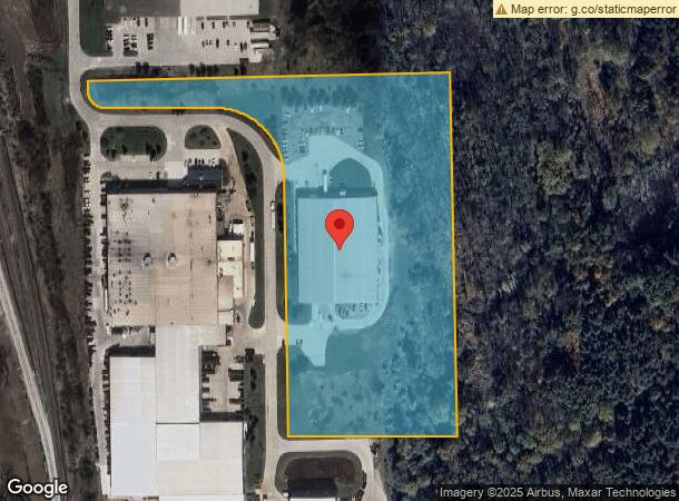
10160 Gainey Rd
12-34-100-019
A PARCEL OF LAND BEG N 89 DEG 12 MIN 53 SEC E 1322.5 FT & S 1 DEG 25 MIN 07 SEC E 1526.67 FT & N 89 DEG 12 MIN 53 SEC E 4 FT
Industrialgeneral
Genesee
X
Michigan
26049C0338D
10.42 AC
2024
Flint
2025
Detroit
011102
Flint, MI
49,950 SF
DEMOGRAPHICS near 10160 Gainey Rd
1 Mile
3 Mile
5 Mile
2024 Total Population
718
16,881
46,591
2029 Population
679
16,431
45,522
Pop Growth 2024-2029
(5.43%)
(2.67%)
(2.29%)
Average Age
41
43
41
2024 Total Households
278
6,545
19,043
HH Growth 2024-2029
(6.12%)
(2.81%)
(2.35%)
Median Household Inc
$91,999
$93,812
$78,235
Avg Household Size
2.30
2.50
2.40
2024 Avg HH Vehicles
2.00
2.00
2.00
Median Home Value
$247,260
$265,088
$247,253
Median Year Built
1999
1993
1986
Nearby Places
Map Layers
Map Styles
 Street
 Aerial
- Restaurants
- Banks
- Shops
- Fitness
- Groceries
PUBLIC TRANSPORTATION
AIRPORT
Bishop International
DRIVE
WALK
Distance
Bishop International
27 min
11.8 mi
Nearby Properties
Address
Land Use
TOTAL SIZE
Lot Size
Zoning
Address
Land Use
TOTAL SIZE
Lot Size
Zoning
55,378 SF
23 AC
PO
Address
Land Use
TOTAL SIZE
Lot Size
Zoning
248,816 SF
20.22 AC
HCD
Address
Land Use
TOTAL SIZE
Lot Size
Zoning
231,775 SF
I-1
Address
Land Use
TOTAL SIZE
Lot Size
Zoning
86,286 SF
71.83 AC
HCD
Address
Land Use
TOTAL SIZE
Lot Size
Zoning
147,756 SF
59.86 AC
R2
Address
Land Use
TOTAL SIZE
Lot Size
Zoning
173,074 SF
10 AC
MDM
Address
Land Use
TOTAL SIZE
Lot Size
Zoning
22.13 AC
MDM
Address
Land Use
TOTAL SIZE
Lot Size
Zoning
Address
Land Use
TOTAL SIZE
Lot Size
Zoning
76,856 SF
28.13 AC
I-1
Address
Land Use
TOTAL SIZE
Lot Size
Zoning
125,825 SF
13.01 AC
B-2
Address
Land Use
TOTAL SIZE
Lot Size
Zoning
64,897 SF
1.86 AC
GC
Address
Land Use
TOTAL SIZE
Lot Size
Zoning
41,010 SF
37.06 AC
RD
Address
Land Use
TOTAL SIZE
Lot Size
Zoning
59,043 SF
8.19 AC
MDM
Address
Land Use
TOTAL SIZE
Lot Size
Zoning
241,145 SF
Address
Land Use
TOTAL SIZE
Lot Size
Zoning
36,638 SF
10.01 AC
GC
Address
Land Use
TOTAL SIZE
Lot Size
Zoning
210.33 AC
MHP
Address
Land Use
TOTAL SIZE
Lot Size
Zoning
51,625 SF
6 AC
HCD
Address
Land Use
TOTAL SIZE
Lot Size
Zoning
63,088 SF
12.31 AC
I-1
Address
Land Use
TOTAL SIZE
Lot Size
Zoning
243,976 SF
17.67 AC
I-1
Address
Land Use
TOTAL SIZE
Lot Size
Zoning
48,275 SF
8.69 AC
OS
Address
Land Use
TOTAL SIZE
Lot Size
Zoning
199,920 SF
20.47 AC
I-1
Address
Land Use
TOTAL SIZE
Lot Size
Zoning
41,853 SF
4.54 AC
OS
Address
Land Use
TOTAL SIZE
Lot Size
Zoning
42,672 SF
I-1
Address
Land Use
TOTAL SIZE
Lot Size
Zoning
27,866 SF
3.90 AC
GC
Address
Land Use
TOTAL SIZE
Lot Size
Zoning
22,026 SF
2.59 AC
GC
Address
Land Use
TOTAL SIZE
Lot Size
Zoning
82,400 SF
5.90 AC
PUD
Address
Land Use
TOTAL SIZE
Lot Size
Zoning
38,393 SF
5.61 AC
GC
Address
Land Use
TOTAL SIZE
Lot Size
Zoning
54,611 SF
I-1
Address
Land Use
TOTAL SIZE
Lot Size
Zoning
32,019 SF
2.61 AC
HCD
Address
Land Use
TOTAL SIZE
Lot Size
Zoning
241,145 SF
106.08 AC
LI
The World's #1 Commercial Real Estate Marketplace
Connect with us
© 2025 CoStar Group
The information above has been obtained from sources believed reliable. While we do not doubt its accuracy we have not verified it and make no guarantee, warranty or representation about it. It is your responsibility to independently confirm its accuracy and completeness. Any projections, opinions, assumptions, or estimates used are for example only and do not represent the current or future performance of the property. The value of this transaction to you depends on tax and other factors which should be evaluated by your tax, financial, and legal advisors. You and your advisors should conduct a careful, independent investigation of the property to determine to your satisfaction the suitability of the property for your needs.