Property Record
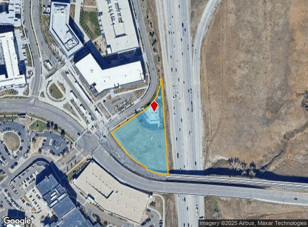
10160 Trainstation Cir, Lone Tree, CO 80124


NEARBY LISTINGS FOR SALE OR LEASE
Property Detail
10160 Trainstation Cir
Denver-Aurora-Centennial, CO
Ridgegate Section 15
2231-151-05-013
MOST LOT 5 RIDGEGATE SECTION 15 FLG 17 2.143 AM/L
Officebuilding
Douglas
X
Colorado
08035C0061H
5
2024
2.14 AC
2025
Lone Tree
014125
Denver
4,951 SF
DEMOGRAPHICS near 10160 Trainstation Cir
1 Mile
3 Mile
5 Mile
2024 Total Population
9,628
57,284
189,619
2029 Population
11,217
65,094
209,600
Pop Growth 2024-2029
+ 16.50%
+ 13.63%
+ 10.54%
Average Age
40
38
39
2024 Total Households
4,966
23,310
72,191
HH Growth 2024-2029
+ 16.83%
+ 13.99%
+ 10.54%
Median Household Inc
$96,276
$118,028
$124,790
Avg Household Size
1.90
2.40
2.60
2024 Avg HH Vehicles
1.00
2.00
2.00
Median Home Value
$816,430
$691,449
$655,746
Median Year Built
2010
2005
1999
Nearby Places
Map Layers
Map Styles
 Street
 Aerial
- Restaurants
- Banks
- Shops
- Fitness
- Groceries
PUBLIC TRANSPORTATION
TRANSIT/SUBWAY
Sky Ridge Station (Union Station to RidgeGate Parkway Station - Regional Transportation District)
DRIVE
WALK
Distance
Sky Ridge Station (Union Station to RidgeGate Parkway Station - Regional Transportation District)
0 min
2 min
0.1 mi
Lone Tree City Center Station (Union Station to RidgeGate Parkway Station - Regional Transportation District)
DRIVE
WALK
Distance
Lone Tree City Center Station (Union Station to RidgeGate Parkway Station - Regional Transportation District)
2 min
13 min
0.6 mi
AIRPORT
Denver International
DRIVE
WALK
Distance
Denver International
39 min
34.6 mi
Freight Ports
Tulsa Port Of Catoosa
DRIVE
WALK
Distance
Tulsa Port Of Catoosa
732 min
714.5 mi
Nearby Properties
Address
Land Use
TOTAL SIZE
Lot Size
Zoning
Address
Land Use
TOTAL SIZE
Lot Size
Zoning
709,725 SF
15.21 AC
Address
Land Use
TOTAL SIZE
Lot Size
Zoning
709,725 SF
29.14 AC
Address
Land Use
TOTAL SIZE
Lot Size
Zoning
805,440 SF
28.65 AC
Address
Land Use
TOTAL SIZE
Lot Size
Zoning
260,667 SF
19.72 AC
Address
Land Use
TOTAL SIZE
Lot Size
Zoning
1,630,979 SF
32.01 AC
Address
Land Use
TOTAL SIZE
Lot Size
Zoning
1,210,850 SF
13.65 AC
AMU
Address
Land Use
TOTAL SIZE
Lot Size
Zoning
29,070 SF
308.89 AC
Address
Land Use
TOTAL SIZE
Lot Size
Zoning
305,198 SF
34.41 AC
PUD
Address
Land Use
TOTAL SIZE
Lot Size
Zoning
162,758 SF
11.21 AC
Address
Land Use
TOTAL SIZE
Lot Size
Zoning
621,565 SF
32.64 AC
PDU
Address
Land Use
TOTAL SIZE
Lot Size
Zoning
139,291 SF
8.63 AC
AMU
Address
Land Use
TOTAL SIZE
Lot Size
Zoning
163,443 SF
14.39 AC
Address
Land Use
TOTAL SIZE
Lot Size
Zoning
650,416 SF
33.37 AC
LI
Address
Land Use
TOTAL SIZE
Lot Size
Zoning
661,139 SF
Address
Land Use
TOTAL SIZE
Lot Size
Zoning
231,715 SF
5.58 AC
Address
Land Use
TOTAL SIZE
Lot Size
Zoning
128,812 SF
2.55 AC
Address
Land Use
TOTAL SIZE
Lot Size
Zoning
488,998 SF
32.43 AC
PDU
Address
Land Use
TOTAL SIZE
Lot Size
Zoning
418,258 SF
14.46 AC
PDU
Address
Land Use
TOTAL SIZE
Lot Size
Zoning
355,326 SF
12.27 AC
PUD
Address
Land Use
TOTAL SIZE
Lot Size
Zoning
126,202 SF
2.27 AC
Address
Land Use
TOTAL SIZE
Lot Size
Zoning
112,021 SF
3.17 AC
Address
Land Use
TOTAL SIZE
Lot Size
Zoning
494,862 SF
30.59 AC
PDU
Address
Land Use
TOTAL SIZE
Lot Size
Zoning
441,689 SF
25.31 AC
Address
Land Use
TOTAL SIZE
Lot Size
Zoning
632,485 SF
38.43 AC
PDU
Address
Land Use
TOTAL SIZE
Lot Size
Zoning
181,361 SF
549.62 AC
Address
Land Use
TOTAL SIZE
Lot Size
Zoning
651,701 SF
10.77 AC
PDU
Address
Land Use
TOTAL SIZE
Lot Size
Zoning
326,230 SF
9.69 AC
Address
Land Use
TOTAL SIZE
Lot Size
Zoning
187,757 SF
7.47 AC
Address
Land Use
TOTAL SIZE
Lot Size
Zoning
122,017 SF
11.39 AC
PDU
Address
Land Use
TOTAL SIZE
Lot Size
Zoning
89,546 SF
9.55 AC
SR
The World's #1 Commercial Real Estate Marketplace
Connect with us
© 2026 CoStar Group
The information above has been obtained from sources believed reliable. While we do not doubt its accuracy we have not verified it and make no guarantee, warranty or representation about it. It is your responsibility to independently confirm its accuracy and completeness. Any projections, opinions, assumptions, or estimates used are for example only and do not represent the current or future performance of the property. The value of this transaction to you depends on tax and other factors which should be evaluated by your tax, financial, and legal advisors. You and your advisors should conduct a careful, independent investigation of the property to determine to your satisfaction the suitability of the property for your needs.