Property Record
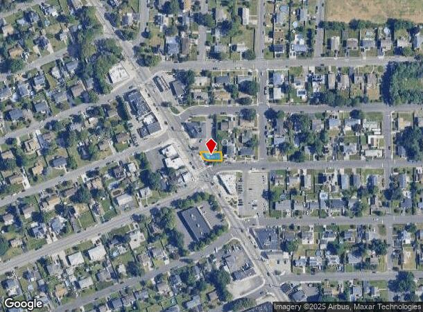
1017 Little East Neck Rd, West Babylon, NY 11704


NEARBY LISTINGS FOR SALE OR LEASE
Property Detail
1017 Little East Neck Rd
Nassau County-Suffolk County, NY
Map Belmont Terrace Section C
0100-138-00-02-00-004-000
FILED MAP 183 SEC C BLK 34 LOTS 22 & PT 21
Restaurantbuilding
Suffolk
X
New York
36103C0855H
4
2024
0.06 AC
2024
Southwestern Suffolk
123001
Long Island (New York)
985 SF
DEMOGRAPHICS near 1017 Little East Neck Rd
1 Mile
3 Mile
5 Mile
2024 Total Population
19,718
129,846
292,199
2029 Population
19,119
126,791
285,928
Pop Growth 2024-2029
(3.04%)
(2.35%)
(2.15%)
Average Age
40
40
41
2024 Total Households
6,110
41,640
95,436
HH Growth 2024-2029
(3.34%)
(2.59%)
(2.35%)
Median Household Inc
$118,098
$112,458
$114,266
Avg Household Size
3.10
3.00
2.90
2024 Avg HH Vehicles
2.00
2.00
2.00
Median Home Value
$431,505
$447,684
$466,008
Median Year Built
1960
1961
1961
Nearby Places
- Restaurants
- Banks
- Shops
- Fitness
- Groceries
PUBLIC TRANSPORTATION
COMMUTER RAIL
Wyandanch Station (Ronkonkoma Branch - Long Island Rail Road)
DRIVE
WALK
Distance
Wyandanch Station (Ronkonkoma Branch - Long Island Rail Road)
4 min
2.5 mi
Babylon Station (Babylon Branch - Long Island Rail Road, Montauk Branch - Long Island Rail Road)
DRIVE
WALK
Distance
Babylon Station (Babylon Branch - Long Island Rail Road, Montauk Branch - Long Island Rail Road)
5 min
3.1 mi
AIRPORT
Long Island MacArthur
DRIVE
WALK
Distance
Long Island MacArthur
26 min
17.5 mi
John F Kennedy International
DRIVE
WALK
Distance
John F Kennedy International
39 min
27.6 mi
LaGuardia
DRIVE
WALK
Distance
LaGuardia
49 min
34.5 mi
Freight Ports
NY - Red Hook Container Terminal
DRIVE
WALK
Distance
NY - Red Hook Container Terminal
60 min
39.0 mi
Nearby Properties
Address
Land Use
TOTAL SIZE
Lot Size
Zoning
Address
Land Use
TOTAL SIZE
Lot Size
Zoning
4,290 SF
1.50 AC
VILLA
Address
Land Use
TOTAL SIZE
Lot Size
Zoning
6.66 AC
A
Address
Land Use
TOTAL SIZE
Lot Size
Zoning
13.30 AC
A
Address
Land Use
TOTAL SIZE
Lot Size
Zoning
756 SF
0.36 AC
B1
Address
Land Use
TOTAL SIZE
Lot Size
Zoning
24.90 AC
B
Address
Land Use
TOTAL SIZE
Lot Size
Zoning
9.70 AC
B
Address
Land Use
TOTAL SIZE
Lot Size
Zoning
19.40 AC
IND1
Address
Land Use
TOTAL SIZE
Lot Size
Zoning
11 AC
B
Address
Land Use
TOTAL SIZE
Lot Size
Zoning
6.37 AC
BUS3
Address
Land Use
TOTAL SIZE
Lot Size
Zoning
2,388 SF
0.36 AC
B1
Address
Land Use
TOTAL SIZE
Lot Size
Zoning
400 AC
A
Address
Land Use
TOTAL SIZE
Lot Size
Zoning
13.63 AC
B
Address
Land Use
TOTAL SIZE
Lot Size
Zoning
1,680 SF
0.15 AC
B1
Address
Land Use
TOTAL SIZE
Lot Size
Zoning
0.65 AC
R40
Address
Land Use
TOTAL SIZE
Lot Size
Zoning
5.95 AC
C
Address
Land Use
TOTAL SIZE
Lot Size
Zoning
Address
Land Use
TOTAL SIZE
Lot Size
Zoning
44 AC
E
Address
Land Use
TOTAL SIZE
Lot Size
Zoning
2.24 AC
Address
Land Use
TOTAL SIZE
Lot Size
Zoning
0.55 AC
VILLA
Address
Land Use
TOTAL SIZE
Lot Size
Zoning
2.10 AC
IND1
Address
Land Use
TOTAL SIZE
Lot Size
Zoning
16.90 AC
EA
Address
Land Use
TOTAL SIZE
Lot Size
Zoning
9.68 AC
SC
Address
Land Use
TOTAL SIZE
Lot Size
Zoning
3.80 AC
BUS1
Address
Land Use
TOTAL SIZE
Lot Size
Zoning
114.70 AC
A
Address
Land Use
TOTAL SIZE
Lot Size
Zoning
292.40 AC
A
Address
Land Use
TOTAL SIZE
Lot Size
Zoning
0.26 AC
R20
Address
Land Use
TOTAL SIZE
Lot Size
Zoning
2.09 AC
BUS3
Address
Land Use
TOTAL SIZE
Lot Size
Zoning
16.81 AC
Address
Land Use
TOTAL SIZE
Lot Size
Zoning
248.60 AC
A
Address
Land Use
TOTAL SIZE
Lot Size
Zoning
12.50 AC
C
The World's #1 Commercial Real Estate Marketplace
Connect with us
© 2025 CoStar Group
The information above has been obtained from sources believed reliable. While we do not doubt its accuracy we have not verified it and make no guarantee, warranty or representation about it. It is your responsibility to independently confirm its accuracy and completeness. Any projections, opinions, assumptions, or estimates used are for example only and do not represent the current or future performance of the property. The value of this transaction to you depends on tax and other factors which should be evaluated by your tax, financial, and legal advisors. You and your advisors should conduct a careful, independent investigation of the property to determine to your satisfaction the suitability of the property for your needs.