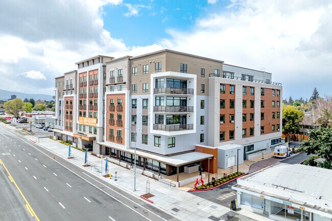
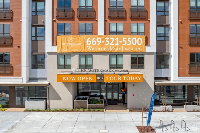
Property Record
1017 S Bascom Ave, San Jose, CA 95128

Current Lease Availabilities
Property Detail
1017 S Bascom Ave
282-11-036
SANTA CLARA
Retirementnursinghomecombined
California
CN
1
D Areas with possible but undetermined flood hazards.
1.44 AC
2024
East San Jose-Willow Glen
2025
South Bay/San Jose
502101
San Jose-Sunnyvale-Santa Clara, CA
NEARBY LISTINGS FOR SALE OR LEASE
-
-
View all San Jose listings for lease on LoopNet.com
DEMOGRAPHICS near 1017 S Bascom Ave
1 mile
3 mile
5 mile
2025 Total Population
30,971
261,168
615,942
2030 Population
31,681
268,040
630,344
Pop Growth 2025-2030
+ 2.29%
+ 2.63%
+ 2.34%
Average Age
40
40
40
2025 Total Households
12,155
99,927
223,289
HH Growth 2025-2030
+ 2.22%
+ 2.71%
+ 2.43%
Median Household Inc
$106,466
$134,843
$140,523
Avg Household Size
2.40
2.50
2.60
2025 Avg HH Vehicles
2.00
2.00
2.00
Median Home Value
$1,063,648
$1,113,433
$1,109,395
Median Year Built
1973
1969
1969
Nearby Places
Map Layers
Map Styles
 Street
 Aerial
Layers
 Traffic
 Biking
Places
Listings with unknown addresses are not visible on the map
- Restaurants
- Banks
- Shops
- Fitness
- Groceries
PUBLIC TRANSPORTATION
TRANSIT/SUBWAY
Bascom Station (Mountain View - Winchester Line - VTA, Old Ironsides - Winchester - VTA, Old Ironsides - Winchester Modified-S - VTA)
Drive
Walk
Distance
Bascom Station (Mountain View - Winchester Line - VTA, Old Ironsides - Winchester - VTA, Old Ironsides - Winchester Modified-S - VTA)
2 min
15 min
0.8 mi
Fruitdale Station (Old Ironsides - Winchester - VTA, Old Ironsides - Winchester Modified-S - VTA)
Drive
Walk
Distance
Fruitdale Station (Old Ironsides - Winchester - VTA, Old Ironsides - Winchester Modified-S - VTA)
2 min
20 min
1.0 mi
COMMUTER RAIL
San Jose (Capitol Corridor - Capitol Corridor Joint Powers Authority)
Drive
Walk
Distance
San Jose (Capitol Corridor - Capitol Corridor Joint Powers Authority)
7 min
3.3 mi
San Jose Diridon Caltrain Station Southbound (Express - Caltrain (Caltrain), Limited - Caltrain (Caltrain), Local Weekday - Caltrain (Caltrain), Local Weekend - Caltrain (Caltrain), South Santa Clara County Connector - Caltrain (Caltrain))
Drive
Walk
Distance
San Jose Diridon Caltrain Station Southbound (Express - Caltrain (Caltrain), Limited - Caltrain (Caltrain), Local Weekday - Caltrain (Caltrain), Local Weekend - Caltrain (Caltrain), South Santa Clara County Connector - Caltrain (Caltrain))
7 min
3.4 mi
AIRPORT
Norman Y Mineta San Jose International
Drive
Walk
Distance
Norman Y Mineta San Jose International
9 min
4.4 mi
Freight Ports
Port of Redwood City
Drive
Walk
Distance
Port of Redwood City
33 min
24.4 mi
Nearby Properties
Address
Land Use
TOTAL SIZE
Lot Size
Zoning
Address
Land Use
TOTAL SIZE
Lot Size
Zoning
2.50 AC
DC
Address
Land Use
TOTAL SIZE
Lot Size
Zoning
1.73 AC
DC
Address
Land Use
TOTAL SIZE
Lot Size
Zoning
1,121,228 SF
7.68 AC
RM(PD
Address
Land Use
TOTAL SIZE
Lot Size
Zoning
4.56 AC
CP
Address
Land Use
TOTAL SIZE
Lot Size
Zoning
252,210 SF
15.85 AC
C2S
Address
Land Use
TOTAL SIZE
Lot Size
Zoning
457,162 SF
3.97 AC
A(PD)
Address
Land Use
TOTAL SIZE
Lot Size
Zoning
617,814 SF
21.96 AC
CG
Address
Land Use
TOTAL SIZE
Lot Size
Zoning
67,435 SF
11.93 AC
C2
Address
Land Use
TOTAL SIZE
Lot Size
Zoning
333,472 SF
1.24 AC
APD
Address
Land Use
TOTAL SIZE
Lot Size
Zoning
289,503 SF
0.97 AC
DC
Address
Land Use
TOTAL SIZE
Lot Size
Zoning
330,927 SF
2.35 AC
M1
Address
Land Use
TOTAL SIZE
Lot Size
Zoning
3.40 AC
APD
Address
Land Use
TOTAL SIZE
Lot Size
Zoning
298,461 SF
5.45 AC
C3H
Address
Land Use
TOTAL SIZE
Lot Size
Zoning
340,000 SF
0.65 AC
CG(PD
Address
Land Use
TOTAL SIZE
Lot Size
Zoning
4.75 AC
CP-PD
Address
Land Use
TOTAL SIZE
Lot Size
Zoning
234,622 SF
1.89 AC
A(PD)
Address
Land Use
TOTAL SIZE
Lot Size
Zoning
381,000 SF
1.40 AC
DC
Address
Land Use
TOTAL SIZE
Lot Size
Zoning
116,953 SF
8.61 AC
C-2
Address
Land Use
TOTAL SIZE
Lot Size
Zoning
491,622 SF
4.18 AC
A(PD)
Address
Land Use
TOTAL SIZE
Lot Size
Zoning
286,350 SF
0.80 AC
C
Address
Land Use
TOTAL SIZE
Lot Size
Zoning
16.11 AC
CG
Address
Land Use
TOTAL SIZE
Lot Size
Zoning
1.16 AC
R1BD
Address
Land Use
TOTAL SIZE
Lot Size
Zoning
279,360 SF
9.04 AC
R3
Address
Land Use
TOTAL SIZE
Lot Size
Zoning
279,230 SF
1.69 AC
C3H
Address
Land Use
TOTAL SIZE
Lot Size
Zoning
4.04 AC
CT
Address
Land Use
TOTAL SIZE
Lot Size
Zoning
226,000 SF
0.82 AC
DC
Address
Land Use
TOTAL SIZE
Lot Size
Zoning
172,772 SF
3.47 AC
PD
Address
Land Use
TOTAL SIZE
Lot Size
Zoning
348,754 SF
1.58 AC
DC
Address
Land Use
TOTAL SIZE
Lot Size
Zoning
300,000 SF
1.66 AC
DC
The World's #1 Commercial Real Estate Marketplace
Connect with us
© 2026 CoStar Group
The information above has been obtained from sources believed reliable. While we do not doubt its accuracy we have not verified it and make no guarantee, warranty or representation about it. It is your responsibility to independently confirm its accuracy and completeness. Any projections, opinions, assumptions, or estimates used are for example only and do not represent the current or future performance of the property. The value of this transaction to you depends on tax and other factors which should be evaluated by your tax, financial, and legal advisors. You and your advisors should conduct a careful, independent investigation of the property to determine to your satisfaction the suitability of the property for your needs.