Property Record
10170 E 600 S, Hudson, IN 46747
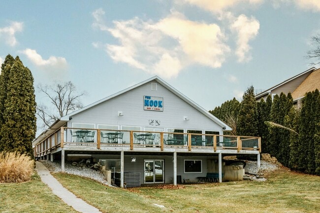

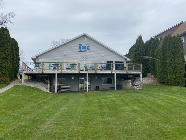
Property Detail
10170 E 600 S
44-09-26-100-020.042-013
1ST ADD TO SHADY NOOK LOT 21 & NW PT LOT 22 BIG LONG LAKE
Storebuilding
Lagrange
AE The base floodplain where base flood elevations are provided. AE Zones are now used on new format FIRMs instead of A1-A30 Zones.
Indiana
2025
21,22
2025
0.26 AC
970700
Indiana North Area
5,680 SF
Other Market Areas
NEARBY LISTINGS FOR SALE OR LEASE
-
-
View all Hudson listings for sale on LoopNet.com
DEMOGRAPHICS near 10170 E 600 S
1 mile
3 mile
5 mile
2025 Total Population
749
3,543
6,407
2030 Population
804
3,691
6,600
Pop Growth 2025-2030
+ 7.34%
+ 4.18%
+ 3.01%
Average Age
47
44
44
2025 Total Households
317
1,421
2,581
HH Growth 2025-2030
+ 6.94%
+ 3.94%
+ 2.75%
Median Household Inc
$69,033
$81,747
$82,610
Avg Household Size
2.40
2.50
2.50
2025 Avg HH Vehicles
2.00
2.00
2.00
Median Home Value
$340,697
$259,599
$240,421
Median Year Built
1964
1975
1974
Nearby Places
Map Layers
Map Styles
 Street
 Aerial
Layers
 Traffic
 Biking
Places
Listings with unknown addresses are not visible on the map
- Restaurants
- Banks
- Shops
- Fitness
- Groceries
SALE & LEASE HISTORY
LISTING DATE
SALE/LEASE

Mar 31, 2022
For Sale
Nearby Properties
Address
Land Use
TOTAL SIZE
Lot Size
Zoning
Address
Land Use
TOTAL SIZE
Lot Size
Zoning
21,035 SF
10 AC
Address
Land Use
TOTAL SIZE
Lot Size
Zoning
12.70 AC
Address
Land Use
TOTAL SIZE
Lot Size
Zoning
11,500 SF
17 AC
Address
Land Use
TOTAL SIZE
Lot Size
Zoning
6,000 SF
32.62 AC
Address
Land Use
TOTAL SIZE
Lot Size
Zoning
15,651 SF
4.29 AC
Address
Land Use
TOTAL SIZE
Lot Size
Zoning
2,688 SF
10.84 AC
Address
Land Use
TOTAL SIZE
Lot Size
Zoning
19.79 AC
Address
Land Use
TOTAL SIZE
Lot Size
Zoning
9,100 SF
1.46 AC
Address
Land Use
TOTAL SIZE
Lot Size
Zoning
2,112 SF
48.50 AC
Address
Land Use
TOTAL SIZE
Lot Size
Zoning
10,998 SF
1.84 AC
Address
Land Use
TOTAL SIZE
Lot Size
Zoning
25,680 SF
5.35 AC
Address
Land Use
TOTAL SIZE
Lot Size
Zoning
Address
Land Use
TOTAL SIZE
Lot Size
Zoning
980 SF
5.71 AC
Address
Land Use
TOTAL SIZE
Lot Size
Zoning
6,000 SF
5.33 AC
Address
Land Use
TOTAL SIZE
Lot Size
Zoning
5,140 SF
0.77 AC
Address
Land Use
TOTAL SIZE
Lot Size
Zoning
Address
Land Use
TOTAL SIZE
Lot Size
Zoning
2.74 AC
Address
Land Use
TOTAL SIZE
Lot Size
Zoning
1,920 SF
22.12 AC
Address
Land Use
TOTAL SIZE
Lot Size
Zoning
15,960 SF
5 AC
Address
Land Use
TOTAL SIZE
Lot Size
Zoning
52,740 SF
8.16 AC
Address
Land Use
TOTAL SIZE
Lot Size
Zoning
3,824 SF
1.29 AC
Address
Land Use
TOTAL SIZE
Lot Size
Zoning
147.81 AC
Address
Land Use
TOTAL SIZE
Lot Size
Zoning
4,800 SF
5.17 AC
Address
Land Use
TOTAL SIZE
Lot Size
Zoning
11.50 AC
Address
Land Use
TOTAL SIZE
Lot Size
Zoning
10.23 AC
Address
Land Use
TOTAL SIZE
Lot Size
Zoning
Address
Land Use
TOTAL SIZE
Lot Size
Zoning
3,850 SF
0.49 AC
Address
Land Use
TOTAL SIZE
Lot Size
Zoning
1,448 SF
32.41 AC
Address
Land Use
TOTAL SIZE
Lot Size
Zoning
46.64 AC
The World's #1 Commercial Real Estate Marketplace
Connect with us
© 2026 CoStar Group
The information above has been obtained from sources believed reliable. While we do not doubt its accuracy we have not verified it and make no guarantee, warranty or representation about it. It is your responsibility to independently confirm its accuracy and completeness. Any projections, opinions, assumptions, or estimates used are for example only and do not represent the current or future performance of the property. The value of this transaction to you depends on tax and other factors which should be evaluated by your tax, financial, and legal advisors. You and your advisors should conduct a careful, independent investigation of the property to determine to your satisfaction the suitability of the property for your needs.