Property Record
10170 Road 5 1/2, Firebaugh, CA 93622

Save to a Folder
{{folder.Name}}
{{folder.ListingIds.length}} Properties
{{folder.ListingIds.length}} Property
Create a New Folder
Property Detail
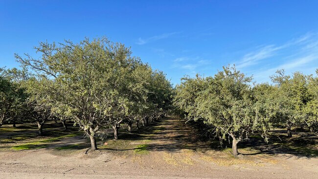
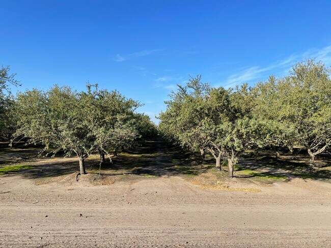
10170 Road 5 1/2
041-070-006
SECS 8 AND 9 T12S R14E
Farms
MADERA
ARE-40
California
A Areas with a 1% annual chance of flooding and a 26% chance of flooding over the life of a 30-year mortgage.
150.05 AC
2025
Outlying Madera County
2026
Fresno
001100
Fresno, CA
NEARBY LISTINGS FOR SALE OR LEASE
-
-
View all Firebaugh listings for sale on LoopNet.com
DEMOGRAPHICS near 10170 Road 5 1/2
1 mile
3 mile
5 mile
2025 Total Population
42
5,931
9,354
2030 Population
45
6,076
9,569
Pop Growth 2025-2030
+ 7.14%
+ 2.44%
+ 2.30%
Average Age
34
35
35
2025 Total Households
11
1,584
2,467
HH Growth 2025-2030
+ 9.09%
+ 2.34%
+ 2.23%
Median Household Inc
$37,500
$45,829
$45,598
Avg Household Size
3.80
3.70
3.80
2025 Avg HH Vehicles
2.00
2.00
2.00
Median Home Value
$450,000
$249,038
$265,751
Median Year Built
1972
1995
1992
Nearby Places
Map Layers
Map Styles
 Street
 Aerial
Layers
 Traffic
 Biking
Places
Listings with unknown addresses are not visible on the map
- Restaurants
- Banks
- Shops
- Fitness
- Groceries
SALE & LEASE HISTORY
LISTING DATE
SALE/LEASE

Nov 19, 2024
For Sale
Nearby Properties
Address
Land Use
TOTAL SIZE
Lot Size
Zoning
Address
Land Use
TOTAL SIZE
Lot Size
Zoning
76,048 SF
3.51 AC
Address
Land Use
TOTAL SIZE
Lot Size
Zoning
105,096 SF
6.57 AC
R3
Address
Land Use
TOTAL SIZE
Lot Size
Zoning
23,160 SF
0.86 AC
R2
Address
Land Use
TOTAL SIZE
Lot Size
Zoning
58,080 SF
3.85 AC
R3
Address
Land Use
TOTAL SIZE
Lot Size
Zoning
308.10 AC
ARE-40
Address
Land Use
TOTAL SIZE
Lot Size
Zoning
11,657 SF
0.60 AC
C1
Address
Land Use
TOTAL SIZE
Lot Size
Zoning
40,504 SF
11.52 AC
A1
Address
Land Use
TOTAL SIZE
Lot Size
Zoning
34,944 SF
2.76 AC
R3
Address
Land Use
TOTAL SIZE
Lot Size
Zoning
8,240 SF
0.69 AC
C3
Address
Land Use
TOTAL SIZE
Lot Size
Zoning
864 SF
201.29 AC
ARE-40
Address
Land Use
TOTAL SIZE
Lot Size
Zoning
408 SF
333.63 AC
ARE-40
Address
Land Use
TOTAL SIZE
Lot Size
Zoning
2,793 SF
168.41 AC
ARE-40
Address
Land Use
TOTAL SIZE
Lot Size
Zoning
11,000 SF
1.03 AC
C3
Address
Land Use
TOTAL SIZE
Lot Size
Zoning
1,376 SF
0.23 AC
C3
Address
Land Use
TOTAL SIZE
Lot Size
Zoning
7,147 SF
0.69 AC
M1
Address
Land Use
TOTAL SIZE
Lot Size
Zoning
7,161 SF
0.68 AC
C3
Address
Land Use
TOTAL SIZE
Lot Size
Zoning
5,445 SF
87.93 AC
AE20
Address
Land Use
TOTAL SIZE
Lot Size
Zoning
307.18 AC
ARE-40
Address
Land Use
TOTAL SIZE
Lot Size
Zoning
4,614 SF
1.29 AC
C2
Address
Land Use
TOTAL SIZE
Lot Size
Zoning
16,152 SF
0.75 AC
C3
Address
Land Use
TOTAL SIZE
Lot Size
Zoning
2,063 SF
161.03 AC
ARE-40
Address
Land Use
TOTAL SIZE
Lot Size
Zoning
560 SF
0.57 AC
C3
Address
Land Use
TOTAL SIZE
Lot Size
Zoning
231.61 AC
AE20
Address
Land Use
TOTAL SIZE
Lot Size
Zoning
112.10 AC
ARE-40
Address
Land Use
TOTAL SIZE
Lot Size
Zoning
15,986 SF
5.03 AC
AL20
Address
Land Use
TOTAL SIZE
Lot Size
Zoning
1,888 SF
142.93 AC
ARE-40
Address
Land Use
TOTAL SIZE
Lot Size
Zoning
6,120 SF
1.15 AC
M1
The World's #1 Commercial Real Estate Marketplace
Connect with us
© 2026 CoStar Group
The information above has been obtained from sources believed reliable. While we do not doubt its accuracy we have not verified it and make no guarantee, warranty or representation about it. It is your responsibility to independently confirm its accuracy and completeness. Any projections, opinions, assumptions, or estimates used are for example only and do not represent the current or future performance of the property. The value of this transaction to you depends on tax and other factors which should be evaluated by your tax, financial, and legal advisors. You and your advisors should conduct a careful, independent investigation of the property to determine to your satisfaction the suitability of the property for your needs.