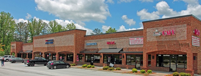
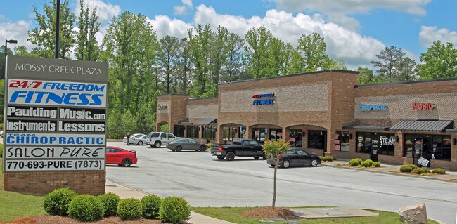
Property Record
10175 Dallas Acworth Hwy, Dallas, GA 30132

NEARBY LISTINGS FOR SALE OR LEASE
Property Detail
10175 Dallas Acworth Hwy
Atlanta-Sandy Springs-Roswell, GA
Commercial Nh County
033.3.1.031.0000
REAL PROPERTY
Stripcommercialcenter
Paulding
X
Georgia
13223C0065D
540
2025
6.65 AC
2025
Paulding Cnty/Dallas
120107
Atlanta
15,691 SF
DEMOGRAPHICS near 10175 Dallas Acworth Hwy
1 Mile
3 Mile
5 Mile
2024 Total Population
4,031
39,416
92,720
2029 Population
4,544
43,553
100,785
Pop Growth 2024-2029
+ 12.73%
+ 10.50%
+ 8.70%
Average Age
38
38
39
2024 Total Households
1,320
12,383
30,289
HH Growth 2024-2029
+ 12.65%
+ 10.40%
+ 8.50%
Median Household Inc
$98,831
$128,545
$121,210
Avg Household Size
3.00
3.10
3.00
2024 Avg HH Vehicles
2.00
2.00
2.00
Median Home Value
$310,857
$366,562
$348,240
Median Year Built
2002
2004
2000
Nearby Places
Map Layers
Map Styles
 Street
 Aerial
- Restaurants
- Banks
- Shops
- Fitness
- Groceries
PUBLIC TRANSPORTATION
AIRPORT
Hartsfield - Jackson Atlanta International
DRIVE
WALK
Distance
Hartsfield - Jackson Atlanta International
62 min
43.9 mi
SALE & LEASE HISTORY
LISTING DATE
SALE/LEASE

Feb 06, 2018
For Lease
Apr 13, 2021
For Lease
Apr 12, 2017
For Lease
Nearby Properties
Address
Land Use
TOTAL SIZE
Lot Size
Zoning
Address
Land Use
TOTAL SIZE
Lot Size
Zoning
103.29 AC
PRD-100
Address
Land Use
TOTAL SIZE
Lot Size
Zoning
Address
Land Use
TOTAL SIZE
Lot Size
Zoning
Address
Land Use
TOTAL SIZE
Lot Size
Zoning
2,584 SF
6.20 AC
RSL
Address
Land Use
TOTAL SIZE
Lot Size
Zoning
69,376 SF
8.52 AC
GC
Address
Land Use
TOTAL SIZE
Lot Size
Zoning
85,172 SF
21.79 AC
C2
Address
Land Use
TOTAL SIZE
Lot Size
Zoning
78,984 SF
17.01 AC
B1
Address
Land Use
TOTAL SIZE
Lot Size
Zoning
8.61 AC
C-2
Address
Land Use
TOTAL SIZE
Lot Size
Zoning
70,038 SF
8.67 AC
B2
Address
Land Use
TOTAL SIZE
Lot Size
Zoning
30,804 SF
2.29 AC
B2
Address
Land Use
TOTAL SIZE
Lot Size
Zoning
47,728 SF
5.45 AC
GC/WS
Address
Land Use
TOTAL SIZE
Lot Size
Zoning
38,652 SF
1.07 AC
B1
Address
Land Use
TOTAL SIZE
Lot Size
Zoning
30,600 SF
4.28 AC
B2
Address
Land Use
TOTAL SIZE
Lot Size
Zoning
58,100 SF
6.74 AC
B2
Address
Land Use
TOTAL SIZE
Lot Size
Zoning
18,376 SF
5 AC
GC
Address
Land Use
TOTAL SIZE
Lot Size
Zoning
13,546 SF
1.49 AC
NB
Address
Land Use
TOTAL SIZE
Lot Size
Zoning
33,778 SF
59.02 AC
PD
Address
Land Use
TOTAL SIZE
Lot Size
Zoning
17,426 SF
20.97 AC
Address
Land Use
TOTAL SIZE
Lot Size
Zoning
2,226 SF
10.61 AC
Address
Land Use
TOTAL SIZE
Lot Size
Zoning
11,544 SF
2.42 AC
C2
Address
Land Use
TOTAL SIZE
Lot Size
Zoning
14,490 SF
1.65 AC
GC/WS
Address
Land Use
TOTAL SIZE
Lot Size
Zoning
17,253 SF
3.45 AC
B1
Address
Land Use
TOTAL SIZE
Lot Size
Zoning
7.13 AC
C1
Address
Land Use
TOTAL SIZE
Lot Size
Zoning
16,250 SF
2.34 AC
B1
Address
Land Use
TOTAL SIZE
Lot Size
Zoning
80,550 SF
7.87 AC
B2
Address
Land Use
TOTAL SIZE
Lot Size
Zoning
32,223 SF
3.91 AC
B2
Address
Land Use
TOTAL SIZE
Lot Size
Zoning
17,610 SF
2.47 AC
B2
Address
Land Use
TOTAL SIZE
Lot Size
Zoning
766.99 AC
Address
Land Use
TOTAL SIZE
Lot Size
Zoning
20,940 SF
4.15 AC
B1
Address
Land Use
TOTAL SIZE
Lot Size
Zoning
14,438 SF
1.59 AC
B1
The World's #1 Commercial Real Estate Marketplace
Connect with us
© 2026 CoStar Group
The information above has been obtained from sources believed reliable. While we do not doubt its accuracy we have not verified it and make no guarantee, warranty or representation about it. It is your responsibility to independently confirm its accuracy and completeness. Any projections, opinions, assumptions, or estimates used are for example only and do not represent the current or future performance of the property. The value of this transaction to you depends on tax and other factors which should be evaluated by your tax, financial, and legal advisors. You and your advisors should conduct a careful, independent investigation of the property to determine to your satisfaction the suitability of the property for your needs.