Property Record
10175 S Anchor Ave, Dinuba, CA 93618
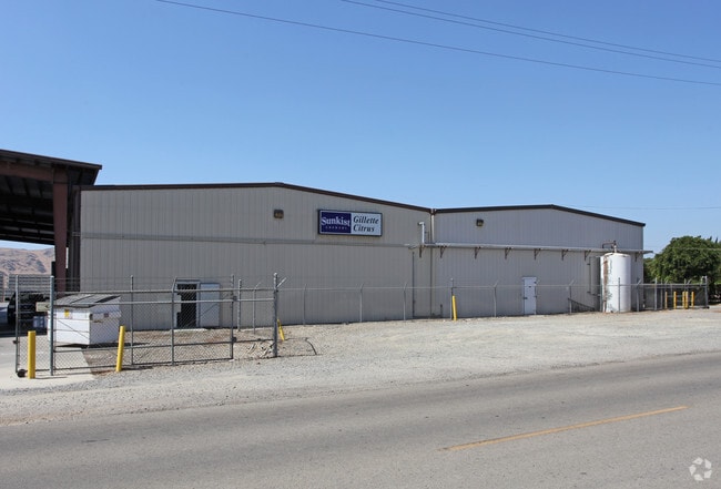


Property Detail
10175 S Anchor Ave
373-160-46
19.55 AC LOT 8 ANCHOR COLONY
Packing
FRESNO
AE20
California
B and X Area of moderate flood hazard, usually the area between the limits of the 100-year and 500-year floods.
8
2025
19.55 AC
2025
Outlying Fresno Cnty
006501
Fresno
1,040 SF
Fresno, CA
NEARBY LISTINGS FOR SALE OR LEASE
-
-
View all Dinuba listings for sale on LoopNet.com
DEMOGRAPHICS near 10175 S Anchor Ave
1 mile
3 mile
5 mile
2025 Total Population
100
9,850
45,896
2030 Population
98
9,911
46,226
Pop Growth 2025-2030
(2.00%)
+ 0.62%
+ 0.72%
Average Age
30
33
34
2025 Total Households
27
2,471
12,120
HH Growth 2025-2030
(3.70%)
+ 0.57%
+ 0.68%
Median Household Inc
$42,500
$45,321
$56,768
Avg Household Size
3.90
3.90
3.70
2025 Avg HH Vehicles
2.00
2.00
2.00
Median Home Value
$450,000
$261,160
$270,924
Median Year Built
1976
1974
1976
Nearby Places
Map Layers
Map Styles
 Street
 Aerial
Layers
 Traffic
 Biking
Places
Listings with unknown addresses are not visible on the map
- Restaurants
- Banks
- Shops
- Fitness
- Groceries
PUBLIC TRANSPORTATION
AIRPORT
Fresno Yosemite International
Drive
Walk
Distance
Fresno Yosemite International
55 min
34.3 mi
Freight Ports
Port of Stockton
Drive
Walk
Distance
Port of Stockton
197 min
158.7 mi
Nearby Properties
Address
Land Use
TOTAL SIZE
Lot Size
Zoning
Address
Land Use
TOTAL SIZE
Lot Size
Zoning
209,435 SF
11.64 AC
M1C2
Address
Land Use
TOTAL SIZE
Lot Size
Zoning
110,663 SF
10.32 AC
M1
Address
Land Use
TOTAL SIZE
Lot Size
Zoning
83,914 SF
7.07 AC
R3
Address
Land Use
TOTAL SIZE
Lot Size
Zoning
88,243 SF
5.22 AC
R1
Address
Land Use
TOTAL SIZE
Lot Size
Zoning
79,874 SF
5.38 AC
R3
Address
Land Use
TOTAL SIZE
Lot Size
Zoning
40,104 SF
4.71 AC
R3
Address
Land Use
TOTAL SIZE
Lot Size
Zoning
86,979 SF
6.82 AC
R3
Address
Land Use
TOTAL SIZE
Lot Size
Zoning
42.15 AC
AE20
Address
Land Use
TOTAL SIZE
Lot Size
Zoning
174,840 SF
12.95 AC
AE20
Address
Land Use
TOTAL SIZE
Lot Size
Zoning
16.44 AC
AE-20
Address
Land Use
TOTAL SIZE
Lot Size
Zoning
104,763 SF
9.55 AC
AE-20
Address
Land Use
TOTAL SIZE
Lot Size
Zoning
155.20 AC
AE20
Address
Land Use
TOTAL SIZE
Lot Size
Zoning
2,812 SF
0.96 AC
C2
Address
Land Use
TOTAL SIZE
Lot Size
Zoning
14,623 SF
2.18 AC
M1
Address
Land Use
TOTAL SIZE
Lot Size
Zoning
50,094 SF
2.91 AC
R3
Address
Land Use
TOTAL SIZE
Lot Size
Zoning
55,564 SF
3.91 AC
Address
Land Use
TOTAL SIZE
Lot Size
Zoning
37,238 SF
40 AC
AE20
Address
Land Use
TOTAL SIZE
Lot Size
Zoning
3,040 SF
160 AC
AE20
Address
Land Use
TOTAL SIZE
Lot Size
Zoning
2,364 SF
41.37 AC
AE20
Address
Land Use
TOTAL SIZE
Lot Size
Zoning
10,000 SF
1.28 AC
C2
Address
Land Use
TOTAL SIZE
Lot Size
Zoning
4,975 SF
1.75 AC
M-1
Address
Land Use
TOTAL SIZE
Lot Size
Zoning
1,144 SF
40 AC
AE20
Address
Land Use
TOTAL SIZE
Lot Size
Zoning
54.25 AC
Address
Land Use
TOTAL SIZE
Lot Size
Zoning
23,160 SF
2.04 AC
C1
Address
Land Use
TOTAL SIZE
Lot Size
Zoning
1,464 SF
119.46 AC
AE20
Address
Land Use
TOTAL SIZE
Lot Size
Zoning
2,204 SF
157.75 AC
AE20
Address
Land Use
TOTAL SIZE
Lot Size
Zoning
9,984 SF
1 AC
C2
Address
Land Use
TOTAL SIZE
Lot Size
Zoning
33,536 SF
2.04 AC
M1
Address
Land Use
TOTAL SIZE
Lot Size
Zoning
1,387 SF
45.14 AC
AE20
Address
Land Use
TOTAL SIZE
Lot Size
Zoning
72.21 AC
AE20
The World's #1 Commercial Real Estate Marketplace
Connect with us
© 2026 CoStar Group
The information above has been obtained from sources believed reliable. While we do not doubt its accuracy we have not verified it and make no guarantee, warranty or representation about it. It is your responsibility to independently confirm its accuracy and completeness. Any projections, opinions, assumptions, or estimates used are for example only and do not represent the current or future performance of the property. The value of this transaction to you depends on tax and other factors which should be evaluated by your tax, financial, and legal advisors. You and your advisors should conduct a careful, independent investigation of the property to determine to your satisfaction the suitability of the property for your needs.